There’s another opportunity for rain in the Northland from late tonight through Tuesday evening, though, as we’ve seen this summer, some areas will receive more rain than others.
Rainfall totals are anticipated to vary through Tuesday evening, ranging from approximately 0.05 inches to as much as one inch in locations experiencing multiple periods of precipitation.
The forecast models indicate the greatest likelihood of receiving half an inch or more of rain with this system is once again in northern Minnesota, generally north of Duluth.
August 4th marked the last time Duluth received a quarter inch or more of rain, measuring 0.26 inches, making it nearly three weeks since any significant rainfall.

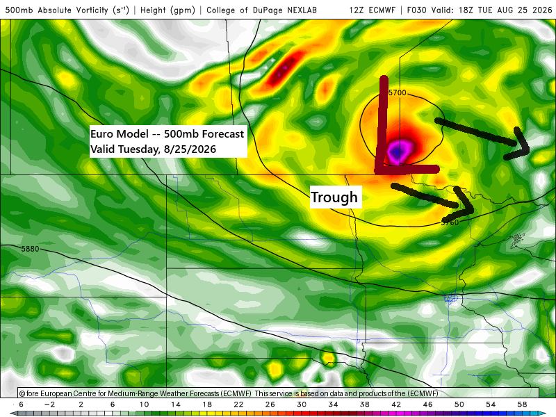
This rain is expected as a low-pressure system moves from Manitoba into Ontario on Tuesday, with a warm front advancing northeast tonight into Tuesday morning, followed by a cold front later Tuesday afternoon and evening.
Forecast models indicate adequate instability (CAPE 1000–2500 J/kg) and sufficient moisture (dew points in the low to mid-60s) to support thunderstorm development on Tuesday, with a low-end risk for strong to severe storms late Tuesday afternoon into early evening. Primary threats include hail up to 1.5 inches (ping pong ball size) and winds reaching 60 mph.
The system moves east on Wednesday, but the northwest flow aloft and a lingering upper trough over the area will likely produce a few additional showers.
…Overnight Rain Chance…
It looks like we will see a round of showers and a few thunderstorms move into northern Minnesota overnight, with this area of rain likely shifting east-southeast through mid-morning Tuesday.
Note: If we see any rain in Duluth from this first round, it will likely begin after 5 AM on Tuesday.

…Tuesday afternoon Thunderstorm Potential…
Here are a few model forecasts for Tuesday afternoon through early evening. All three suggest the development of showers and thunderstorms across the Northland, though coverage may be somewhat limited. We’ll have to wait and see how it unfolds.
As I mentioned earlier, the amount of instability and moisture appears sufficient for thunderstorms on Tuesday, although mid-level lapse rates remain quite weak, similar to last Thursday’s setup that still produced numerous reports of severe hail in the western parts of the area.
Storms forming Tuesday afternoon are forecast to track east to east-southeast across the area.


Leave a Reply