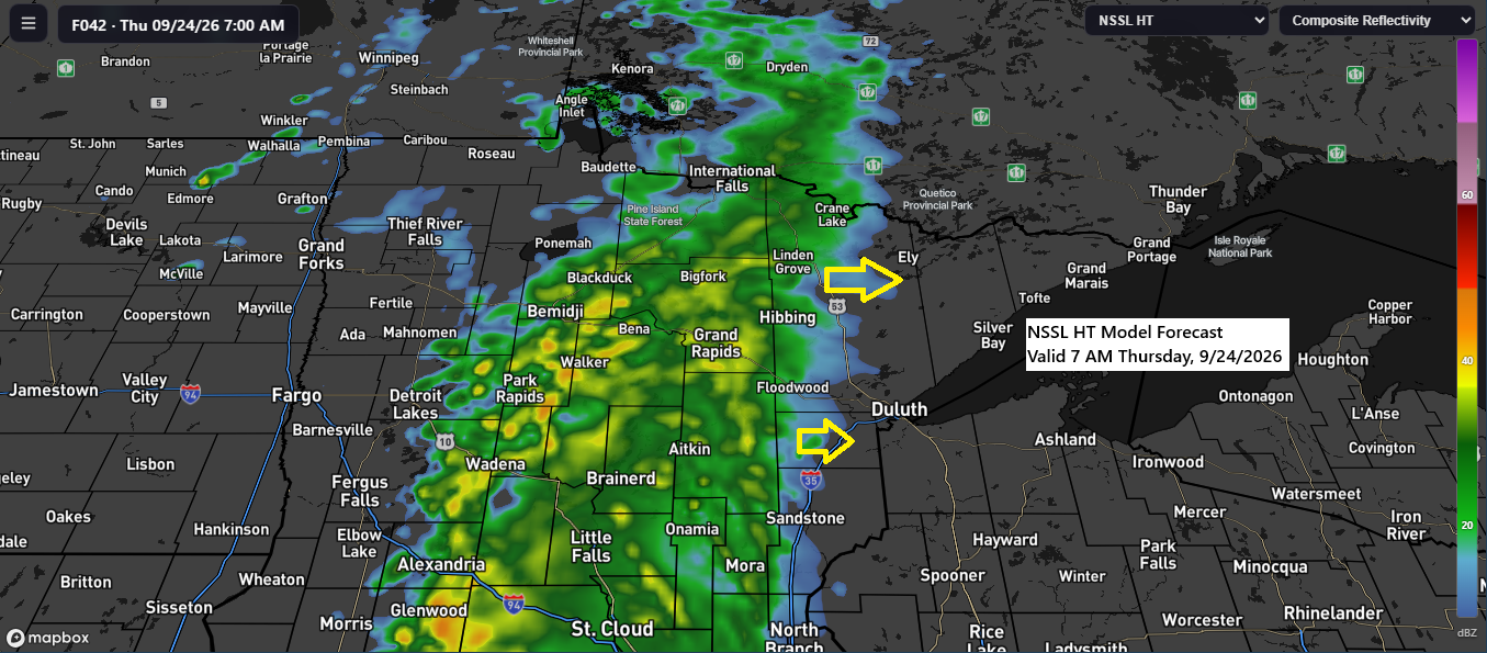
Rain might hit parts of the Northland on Thursday, but it’s unclear how far east it will go before tapering off.
Right now, it seems the rain will reach as far east as the Arrowhead, North Shore, Twin Ports, and possibly into extreme northwest Wisconsin on Thursday, before breaking up as it moves farther east.
Forecasts show that on Thursday, the western parts of the Northland could see about a quarter to half an inch of rain, while farther east, including the Twin Ports area, amounts are expected to drop to around 0.05 to less than a quarter inch.
Note: It looks like a wetter weather pattern could be setting in for our area next week, though it’s still a bit early to know for sure.
The map below displays the forecasted rainfall totals through 7 PM on Thursday, September 24, 2026.

There’s a chance of elevated CAPE (instability) spreading northeast into the upper Midwest this weekend and early next week. However, without a clear trigger for thunderstorms until possibly early next week, much of this instability may pass without producing any storm activity.

Another night brings another frost advisory, covering most of northern Minnesota and nearly all of northwest Wisconsin. With temperatures dipping as low as 34 degrees, frost is likely to form.
The best chance for frost, like we’ve seen over the past few nights, will be inland from Lake Superior.
Note: International Falls, MN, and Ashland, WI, were just 3 degrees shy of their record lows for September 22nd, while Hibbing was only 2 degrees away from its own record low for the date.

We’ll see what the models show for late next week and the weekend in the coming days, but for now, the Euro model is predicting a Fujiwhara setup across the upper Midwest. One low over western North Dakota is expected to move east-southeast, while another low over southern Illinois heads north toward western Lake Superior. The two systems then merge and rotate through Minnesota before moving east next weekend. If this plays out, it could mean a few days of rain and possibly some gusty winds late next week and into the weekend. Stay tuned.
Euro model forecast valid Thursday, October 1, 2026, to Sunday, October 4, 2026.

If you’d like to support my work, feel free to donate below—thanks a lot!
Make a one-time donation
Make a monthly donation
Make a yearly donation
Choose an amount
Or enter a custom amount
Your contribution is appreciated.
Your contribution is appreciated.
Your contribution is appreciated.
Leave a Reply