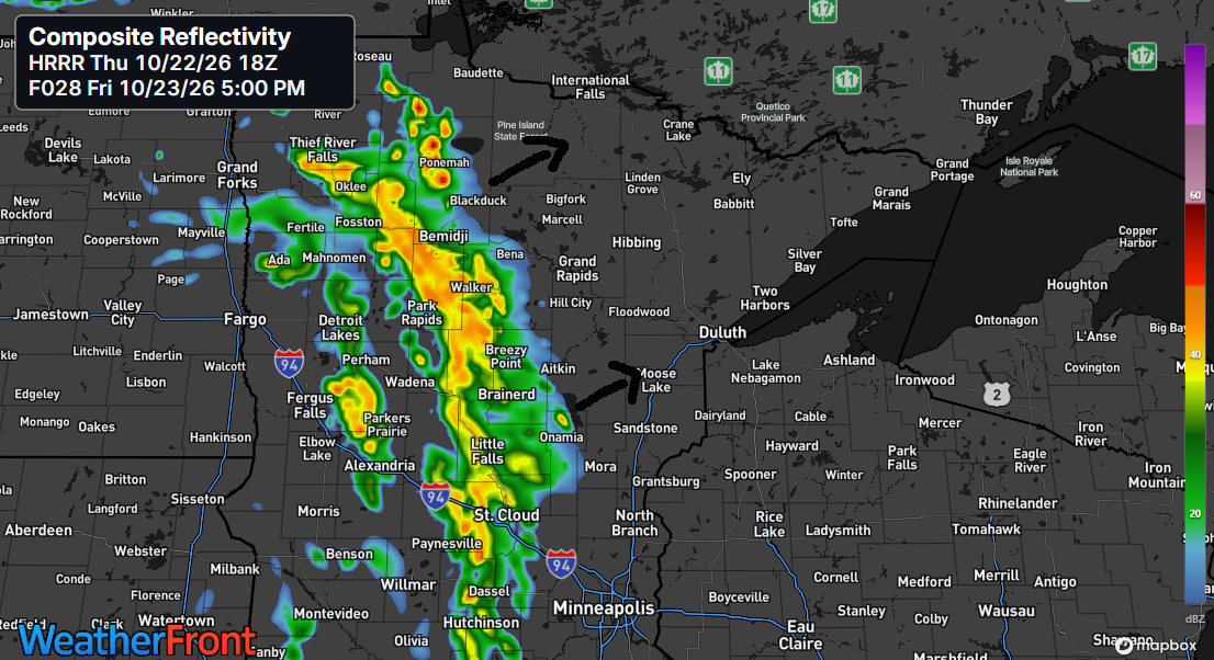
Some showers are expected in parts of northeast Minnesota and northwest Wisconsin Friday night and Saturday, though not everyone will see much rain with this cold front.
Another chance for rain arrives early to mid-next week, though uncertainty remains regarding the storm’s timing and track. That will determine how far north the precipitation reaches. At this point, temperatures look too warm for snow, meaning any precipitation would likely fall as rain. However, it’s still uncertain whether the system will track far enough north to bring rain to the area.
Here’s the HRRR model rainfall forecast through 7 AM Saturday, October 24, 2026.
North central Minnesota may get about a quarter inch of rain, with smaller amounts likely farther east, including northwest Wisconsin, eastern Minnesota, the North Shore, and the Arrowhead regions.

Today brought widespread low clouds and fog near Lake Superior, while inland areas enjoyed mostly sunny skies.
GOES-East high-resolution satellite loop ending at 4:55 PM CT on Thursday, October 22, 2026.
Visibility of a mile or less due to fog appears in the purple-like colors on the animation below.
HRRR model visibility forecast through 1 PM Friday.
Another late October afternoon brought temperatures in the upper 60s and 70s to northeast Minnesota and northwest Wisconsin, with Minong and Siren, WI nearing 80 degrees at 78 and 79 respectively.
Although these temperatures are well above average for October 22nd, they’re not quite high enough to break any records.
Closer to Lake Superior, cooler temperatures in the 50s were common today thanks to a northeast wind. Interestingly, those 50s are right where our high temperatures typically fall in late October.
Friday will likely bring a similar temperature pattern, with highs in the 50s near Lake Superior and 60s to 70s farther inland. On Saturday, most areas should see highs ranging from the 60s to lower 70s.

Leave a Reply