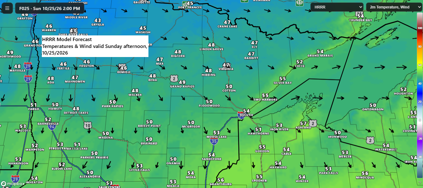
Cooler air is quickly moving into the Northland as a cold front pushes east across the region. Temperatures this afternoon were in the mid to upper 40s and lower 50s behind the front, and the cooler air mass will spread across the entire area on Sunday. Highs are expected to range from the upper 40s to mid 50s, which is actually pretty close to normal for October 25. So, while it will feel much cooler compared to the last few days, temperatures are really just returning to where they should be for late October.
Temperatures in Duluth may get close to the freezing mark at the airport Sunday morning and again Monday morning, but it’s still unclear whether we’ll actually hit 32°F. If a freeze doesn’t occur on either morning, Duluth will be on pace to record at least its fourth-latest first freeze on record, moving beyond October 30, 1877, and further up the list of the city’s latest first-freeze dates.

Showers will persist tonight across northeast and eastern Minnesota as well as northwest Wisconsin, gradually ending from west to east during the night.
In Duluth, showers are expected to wrap up around 7 PM tonight, with dry conditions returning on Sunday and lasting through most of Monday.
The MRMS radar loop wraps up at 5:32 PM CT on Saturday, October 24, 2026.
Tonight’s rainfall in northeast Minnesota and northwest Wisconsin will range from about 0.01 to 0.15 inches.

Today’s temperature in Duluth came close to the record high of 71 degrees, but peaked at 70, just one degree shy of the mark set on October 24, 1998.
Ashland, Wisconsin, matched its record high of 79 degrees today, a mark originally set back in 1963.
Today’s high of 70 degrees in Duluth on October 24, 2026, marks the fifth time this month temperatures have hit at least 70. On average, October sees only two days reaching that mark, with the record being 12 days set in 1963.
Note: The last time Duluth experienced five or more days with highs of 70 degrees or above in October was in 2011, with a total of six days.

The Northland will see a couple opportunities for rain during the upcoming week. The first system is expected to bring showers late Monday into Tuesday morning, followed by another chance Tuesday night into Wednesday. While both systems should generate some precipitation, widespread heavy rain appears unlikely, and no snow is expected across the region.

A mild southwest flow aloft is expected over Halloween weekend, bringing the chance for more showers and possibly a few thunderstorms as a system targets the upper Midwest during that period.

Leave a Reply