6:15 PM Thursday, January 9, 2025
Today’s snow is moving east at a pretty good rate, with the band of snow lasting roughly 2 hours in any given location. This short-duration snow event has dropped about half an inch to an inch of snow in northeast Minnesota and northwest Wisconsin today.
-Duluth Airport reported 0.3 inches of snow through 4 PM today, marking the highest snow total recorded so far this month. The previous highest was 0.2 inches on the 1st.
Radar loop ends 4:52 PM CT Thursday, January 9, 2025.
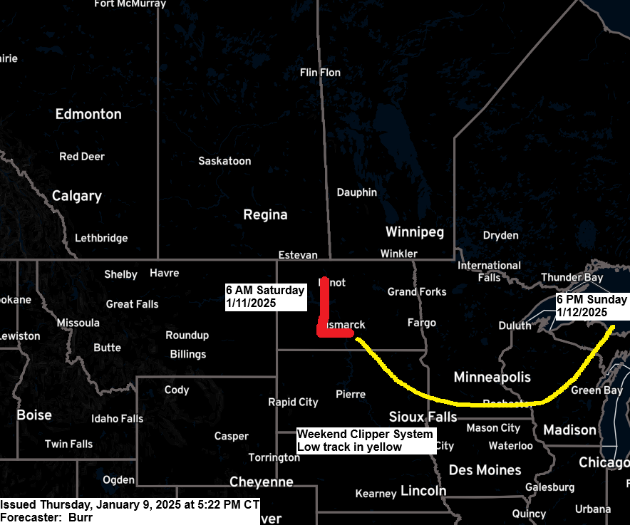
The next wave (marked in black on the map) arrives this weekend, and this snow event could stick around a little longer than today’s snow, but we’re still only looking at mostly light snow accumulations.

Duluth area: Some snow is possible mainly from Saturday evening into Sunday.
Euro model radar forecast valid 12 PM Saturday to 12 AM Monday.

A large winter storm impacting the southern Plains today will spread farther to the north and east on Friday, with multiple states under some sort of winter weather alert, either a winter storm warning or a winter weather advisory.

HRRR model total snowfall through early Saturday morning.

We’ve seen widespread snow in Oklahoma and Arkansas today, with snow, rain, and a mix affecting much of north, central, and east Texas.
Snowfall totals have ranged from around 2 to 6 inches or more in parts of Oklahoma and north Texas today through 4 PM CT.
Radar loop ends 4:38 PM CT Thursday, January 9, 2025.

Subscribe to continue reading
Become a paid subscriber to get access to the rest of this post and other exclusive content.