Category: blizzard warning
-
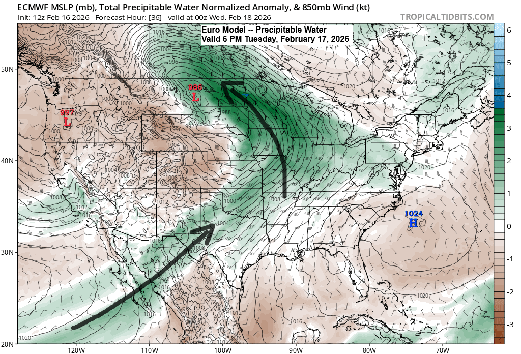
A winter storm is set to roll in Tuesday evening.
The winter storm moving in Tuesday evening will bring plenty of moisture, with a plume stretching northeast from the Baja region and additional moisture streaming up from the Gulf. PWATs of 0.5 to 0.75 inches are expected across much of the Northland Tuesday night into Wednesday morning, which is unusually…
-

Extreme Cold and Winter Storm Alerts in the U.S.
A highly active winter pattern has taken hold, with dangerously cold Arctic air settled to the north as a massive winter storm targets a vast area stretching from the southern Plains through the Ohio Valley and into the northeastern U.S. this weekend. Around here, it’s all about the dangerously cold…
-

Frigid! Light snow Sunday followed by gusty winds and some blowing snow
Another clipper will move through the upper Midwest on Sunday, bringing more snow. With temperatures in the Northland ranging from about -5 to 10 above, 850mb temperatures between -15 and -20°C, and precipitable water under 0.20 inches, conditions aren’t ideal for large snowflakes. Instead, the Northland will likely see more…
-

7 a.m. Weather Update – December 28, 2025
Today’s system is moving in this morning, but the northern reach of the accumulating snow remains uncertain, which isn’t surprising given how the computer models have struggled with this setup over the past few days. I’ll likely make some adjustments to my snowfall forecast before noon today, though it’s unclear…
-
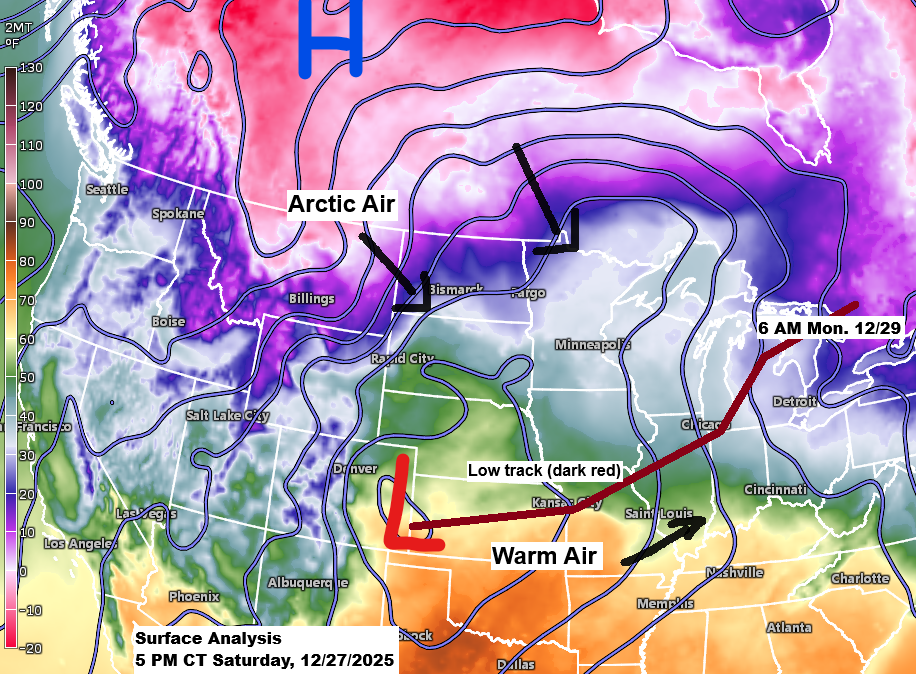
Weather update and snowfall forecast — 6 PM, Saturday, December 27, 2025.
Here’s my updated snowfall forecast as of late Saturday afternoon. I’m leaning more on the UK, ICON, and Canadian models for my forecast, which results in lower snowfall totals for northern Minnesota, including the North Shore and Duluth-Superior areas. I think those models are handling the setup the best on…
-
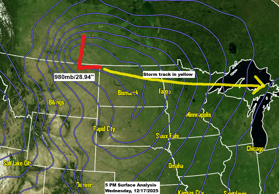
A powerful clipper is set to bring a variety of weather conditions to the Northland in the next 24 hours.
A strong low-pressure system over southern Saskatchewan this afternoon will move east-southeast, passing over far northern Minnesota Thursday morning before reaching eastern Lake Superior by around 6 PM Thursday. Over the next 24 to 36 hours, this system will bring snow, rain, wind, and a burst of arctic air to…
-
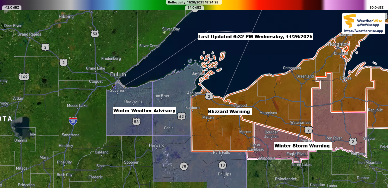
Blizzard conditions persist along the south shore of Lake Superior.
Blizzard warnings and winter weather advisories are still in place for the South Shore of Lake Superior in northwest Wisconsin, lasting through early Thursday morning. Note: As of 6:30 PM today, Gile, Wisconsin has reported a whopping 25 inches of snow. By 6 AM Thursday, another 1 to 4 inches…