Category: winter weather advisory
-

Frigid! Light snow Sunday followed by gusty winds and some blowing snow
Another clipper will move through the upper Midwest on Sunday, bringing more snow. With temperatures in the Northland ranging from about -5 to 10 above, 850mb temperatures between -15 and -20°C, and precipitable water under 0.20 inches, conditions aren’t ideal for large snowflakes. Instead, the Northland will likely see more…
-
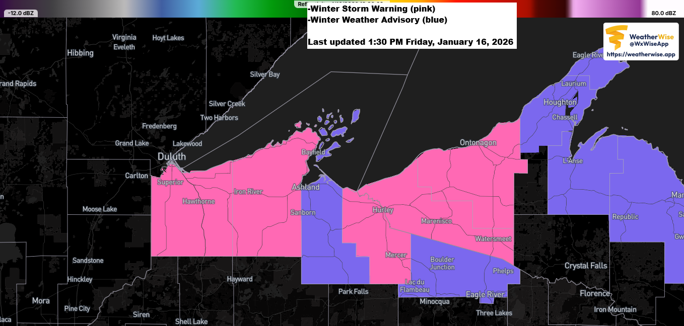
2 PM Weather Update: Snowfall Reports
Winter storm warnings and advisories are in effect for the South Shore of Lake Superior in northwest Wisconsin, with 3 to 6 more inches of snow expected by Saturday morning and over 6 inches possible in spots like Gile and Hurley. Late this morning, a report came in of 10.7…
-
The Clipper train keeps going.
The next clipper will slide southeast across the Northland late tonight into Tuesday morning, bringing in warmer air along with a mix of snow, sleet, and some patchy freezing rain. While the precipitation should be light and short-lived, even a bit of freezing rain can make roads slick, so watch…
-
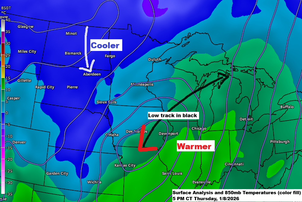
A strong system will pass to our east tonight, while temperatures trend slightly cooler over the next few days.
Tonight, a strong low-pressure system will track northeast, moving out of southern Iowa toward Green Bay, WI by late evening, and into northern lower Michigan by Friday morning. It will bring widespread precipitation from southern Minnesota through central Wisconsin to upper Michigan overnight. With little cold air around, most of…
-
4 PM Winter Weather Update – January 4, 2026
This afternoon brought a band of heavy snow mixed with sleet and ice pellets moving east-northeast across parts of northeast and east central Minnesota into northwest Wisconsin. This wintry mix formed on the eastern side of a 700mb trough over the upper Midwest, with an area of stronger lift developing…
-
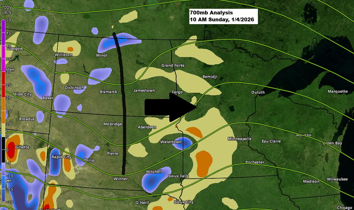
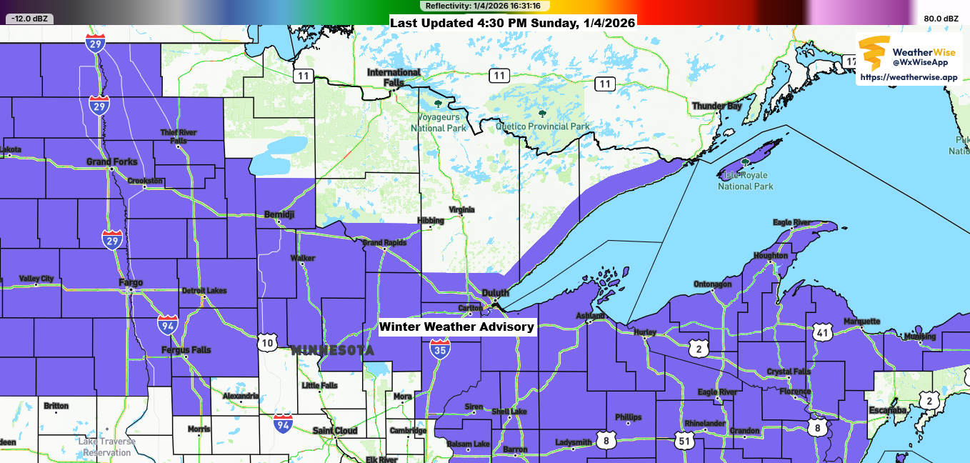
11 a.m. Weather Update – January 4, 2026
The next system is on its way, likely bringing another round of wintry precipitation to northeast Minnesota and northwest Wisconsin this afternoon and into the evening. Ahead of the trough approaching from the Dakotas this morning, we’re seeing a nice low-level jet coming up from the south at 35 to…
-

7 a.m. Weather Update – December 28, 2025
Today’s system is moving in this morning, but the northern reach of the accumulating snow remains uncertain, which isn’t surprising given how the computer models have struggled with this setup over the past few days. I’ll likely make some adjustments to my snowfall forecast before noon today, though it’s unclear…