Tag: fond du lac
-
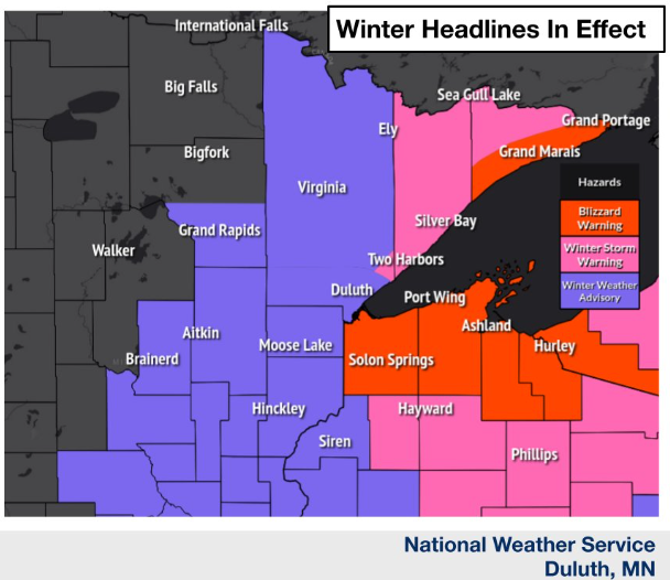
Blizzard Warning issued for the South Shore in northwest Wisconsin and for extreme northeast Minnesota; Flood Warnings continue; Strong winds and cold temperatures tonight and Monday; Snowfall Reports from Sunday
6:42 PM Sunday, April 16, 2023 Snow along with strong north winds gusting 30 to 55 mph will produce considerable blowing snow along with blizzard/near blizzard conditions along the South Shore of Lake Superior in northwest Wisconsin, and also in southern Cook County in northeast Minnesota tonight and Monday. Blizzard…
-

Chilly/Active Weather Pattern with more snow and rain chances ahead
Will get a break in precipitation on Sunday with partly sunny to mostly cloudy skies expected. There may be a few flurries around on Sunday but nothing that would accumulate. A few flurries are possible on Monday, but for the most part it looks like another dry day across the…
-
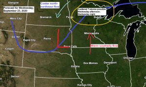
Warm temperatures continue into midweek; keeping an eye on thunderstorm chances Wednesday afternoon/night and cooler risks for next week
We’ve seen a few showers and thunderstorms develop this afternoon over far eastern Minnesota and northwest Wisconsin with brief downpours and some lightning occurring with this activity today – Radar Rainfall Estimates thru 4 PM Monday show anywhere from a trace to nearly a half inch of rain with those…
-
A few showers/thunderstorms possible Thursday PM otherwise a nice stretch of weather ahead
/Issued 7:44 PM CDT, Wednesday, July 26, 2017/ Source: https://rapidrefresh.noaa.gov 18z HRRRX model Source: http://weather.cod.edu 21z RAP model Rainfall reports from Tuesday-early Wednesday morning, July 25-26, 2017Source: http://www.weather.gov/dlh/ http://mesowest.utah.edu Bruno, MN 4 S: 0.70 inWashburn, WI: 0.64 inPhillips, WI: 0.60 inWinter, WI: 0.44 inSolon Springs, WI: 0.30 inIsle, MN 12 N:…
-
April 16, 2015 Weather Report – Unseasonably warm temperatures continue into Friday; Watching Saturday Night-Sunday rain chances; Much cooler temperatures for next week
/Issued 4:37 PM CDT, Thursday, April 16, 2015/ The entire Northland will get some rain later this weekend. The image below is from the 18z NAM-12 KM model from Today and shows widespread rainfall amounts of 0.50-0.75″ in Northeast Minnesota and Northwest Wisconsin from Saturday Evening through Sunday. Source, TropicalTidbits.com…