Tag: Lake Superior ice coverage
-
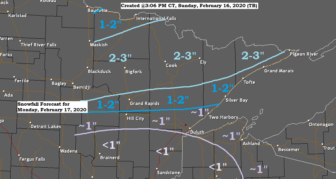
Some light snow and patchy freezing drizzle on the way for Monday
Light snow moves into north-central Minnesota later tonight and will spread farther east Monday morning. Light snow ends from west to east Monday afternoon. Here’s a look at the 18z NAM-WRF model radar forecast valid from 6 PM Sunday to 6 PM Monday. Source: https://weathermodels.com/ Here’s my updated snowfall forecast…
-

Very cold tonight, wind chill advisory in effect; some snow possible Wednesday night-Thursday (highest amounts north of Duluth)
-Wind Chill Advisory (light blue area on map) in effect from 9 PM this evening to 10 AM Wednesday for northern and northeast Minnesota including the cities of International Falls, Bigfork, Grand Rapids, Walker, Brainerd, Aitkin, Moose Lake, Cloquet, Duluth, Hibbing, Ely, Two Harbors, Silver Bay and Grand Marais. -Wind…
-
February 14, 2014 – Weather Report. Minor snow event possible Tomorrow; Bigger one Monday?
/Issued 2:37 PM CST, Friday, February 14, 2014/ *Snow depth map issued at 11 AM Today per RAP model. Most of the Northland has at least 15″ of snow on the ground with many spots in our area having a snow depth of up to 25″. More numbers below. After…
-
February 9, 2014 – Weather Report. Cold! Tracking 2 snow events this week.
/Issued 2:59 PM CST, Sunday, February 9, 2014/ -The weather maps are beginning to look a little more interesting up here in the frozen tundra. The image below is valid for Thursday Morning February 13, 2014 per 12z ECMWF ensemble model. The 2 black X’s on this map represent 2…