Tag: moderate risk
-
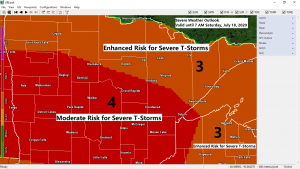
Severe Thunderstorms likely late tonight with widespread wind gusts >70 mph, isolated tornadoes and large hail also possible
A significant severe weather threat exists late tonight into early Saturday morning over much of the Northland with scattered to widespread severe thunderstorms possibly producing significant damage. There is a Moderate Risk and Enhanced Risk for Severe Thunderstorms in place across the entire Northland for tonight. Note: A moderate risk…
-
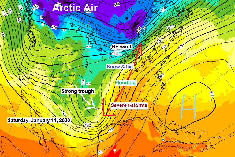
Powerful storm to hit parts of the Midwest and Great Lakes this weekend. For the Northland, turning colder, some lake effect snow this weekend, more snow chances next week
A strong storm will be impacting the Midwest and Great Lakes Friday through early Sunday morning with a flood and severe threat on the warm side of the storm and a snow/ice threat on the cold side of the storm. Winter Storm Watches in blue; Flood Watches in green. Source…
-
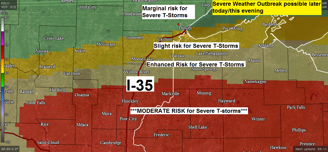
Significant risk for severe thunderstorms through this evening from east-central Minnesota into north-central Wisconsin
Today’s severe weather setup is a potent one with Moderate and Enhanced risks for severe thunderstorms in place through this evening in southern portions of the Northland. Moderate risks do happen in this area, but not very often, maybe once or twice a year. Severe weather risk is based on…
-
Light rain/drizzle this evening (Areas of fog thru Monday AM) Midweek rain/snow event south of the Northland
/Issued 4:52 PM CDT, Sunday, April 2, 2017/ Pretty good coverage albeit mostly a light rainfall passing through parts of the Northland late this afternoon/evening. Rain totals so far have generally been less than 0.05 inches. A strong storm is forecast to lift northeast out of the southern Plains during…
-
Areas of fog possible tonight; 50s Sunday with showers later in the day; Midweek storm potential south of the Northland (Rain/Snow)
/Issued 5:02 PM CDT, Saturday, April 1, 2017/ Source: https://www.weatherbell.com A strong area of low pressure is forecast to move into the southern Plains on Tuesday, this low is then expected to lift northeast toward the Ohio Valley by Thursday — This storm will be too far south to impact…
-
March 25, 2015 Weather Report – Breezy Tonight; Lake effect snow along parts of the South Shore of Lake Superior; Tracking the next rain maker for later this weekend; Snowfall report included in this post
/Issued 4:18 PM CDT, Wednesday, March 25, 2015/Wow! Radar out of Tulsa, Oklahoma from 5:21 PM CDT Today. A classic looking supercell with a confirmed tornado northwest of Tulsa with movement toward the east. A sure sign of spring! The season’s 1st moderate severe thunderstorm risk through This Evening in…