Tag: rainfall reports
-
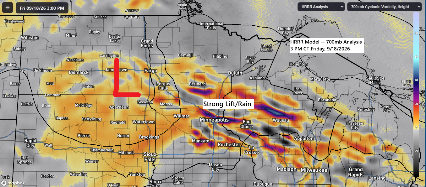
Showers End Tonight, Then a Long Dry Stretch Begins
As expected, there was a sharp gradient in rainfall across the region today, with southern parts of the Northland experiencing some rain, while northern Wisconsin, northern Minnesota, and areas near Lake Superior remained dry. The weather system responsible for today’s rain is expected to move southeast tonight, with lingering showers…
-
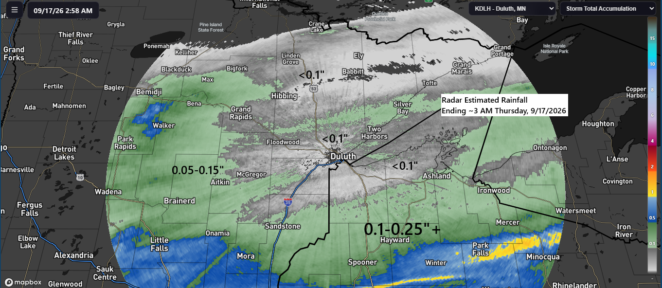
September 16, 2026 Rainfall Totals for Northern MN & WI
Parts of northwest Wisconsin received between a quarter and half an inch of rain Wednesday night, while other areas of the Northland recorded less than a quarter inch. September 16, 2026 Rainfall Summary Spooner, WI: 0.40″Siren, WI: 0.38″Shell Lake, WI: 0.38″Earl, WI: 0.36″Hayward, WI: 0.35″Winter, WI: 0.28″Glidden, WI: 0.25″Grantsburg, WI:…
-
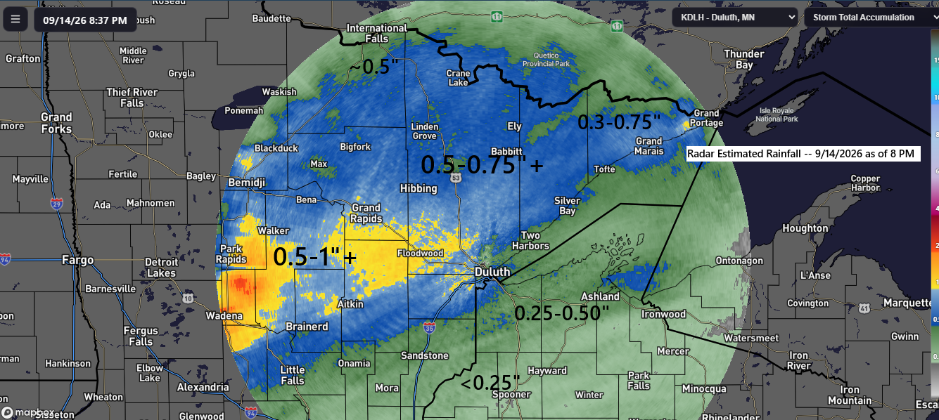
Northland Rainfall Totals for September 14, 2026
Rainfall Report for September 14, 2026, as of 8:00 PM
-
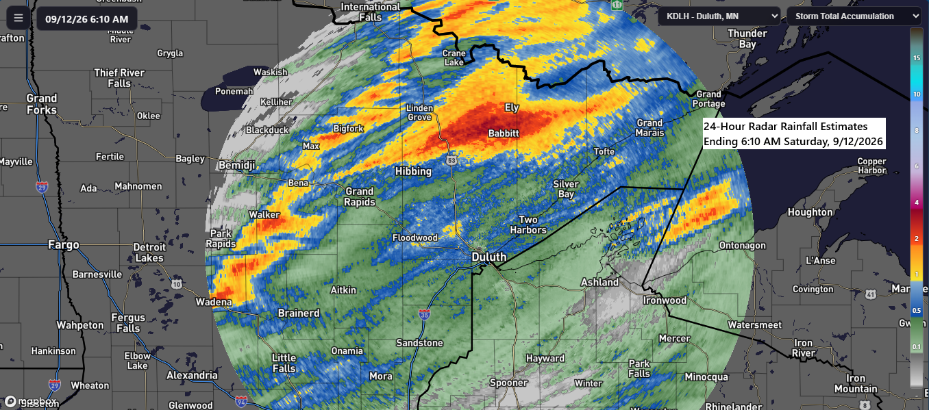
Friday Night Rainfall & Storm Reports
Parts of north-central Minnesota received the heaviest rainfall from Friday’s system, with totals ranging from 1 to 2 inches. In contrast, northwest Wisconsin and far eastern Minnesota saw lighter amounts, generally under a quarter of an inch. Overall, the event closely matched computer model predictions. Rainfall Report: Friday through Early…
-

Early Tuesday Rainfall Recap
East-central Minnesota, the Twin Ports, North Shore, and much of northwest Wisconsin experienced significant rainfall early Tuesday morning, with totals exceeding one inch reported from Brainerd to Aitkin to Palisade, decreasing to approximately half an inch in Duluth. In northwest Wisconsin, the highest precipitation was observed in the far western…
-
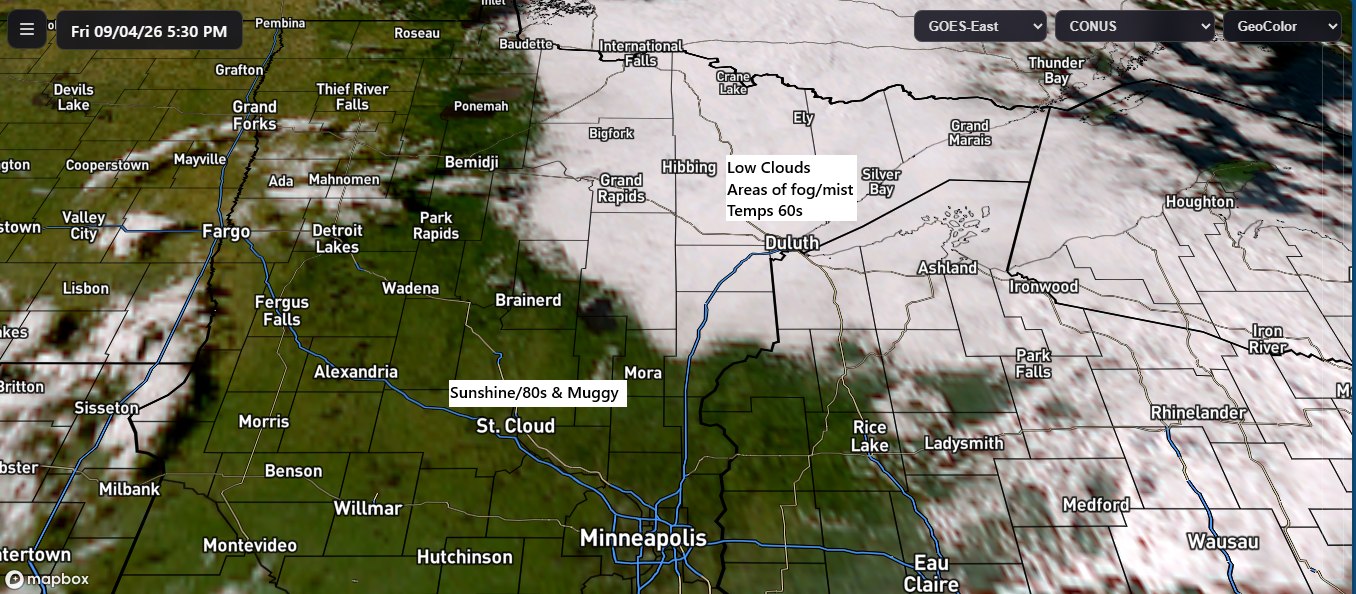
Rainfall Recap + Labor Day Outlook
Weather conditions varied widely across the region today. In northeast Minnesota and northwest Wisconsin, low clouds, fog, and mist dominated, with temperatures mostly in the 60s and cool east breezes coming off Lake Superior. Farther west and south, however, it was warmer and sunnier, with muggy conditions pushing temperatures into…
-
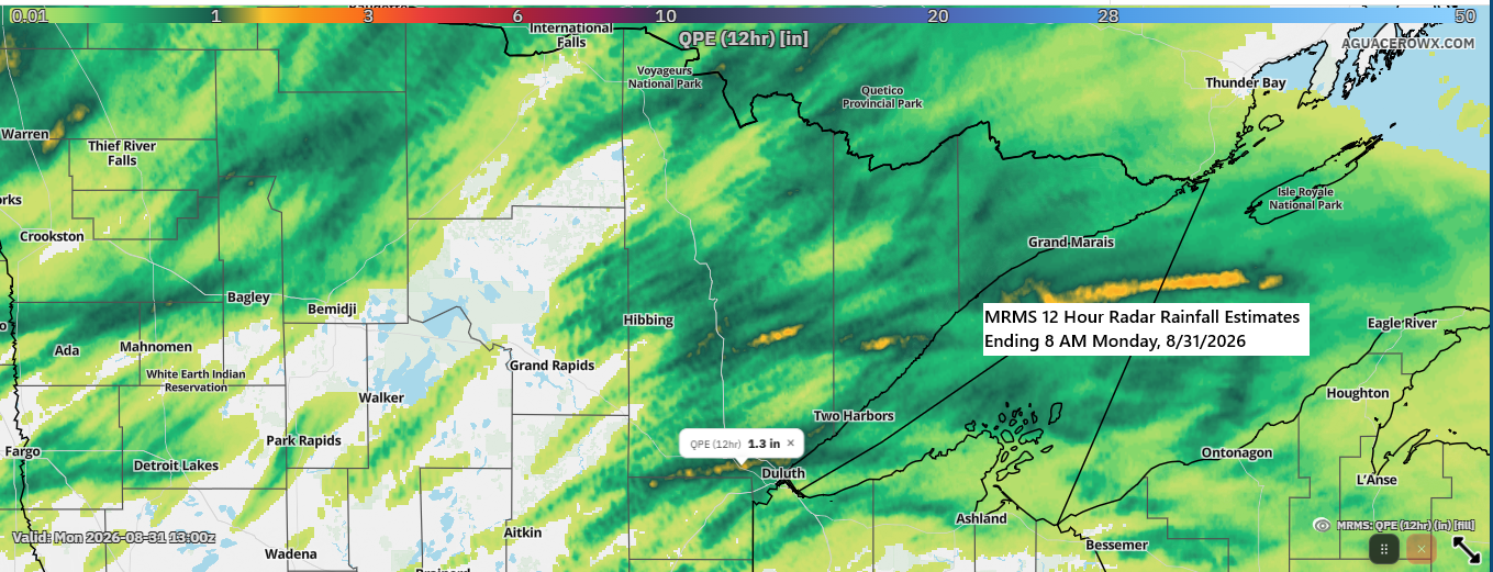
🌧️ Twin Ports Rainfall Ranged from 0.4″ to Over 1″ Overnight
There was a notable rainfall gradient across the Twin Ports last night, with several rounds of showers and thunderstorms producing brief, intense downpours in parts of Duluth. Rainfall varied across the region, with totals ranging from about 0.4 inches to over an inch at the Duluth Airport and Hermantown. Other…