Tag: water temperature
-
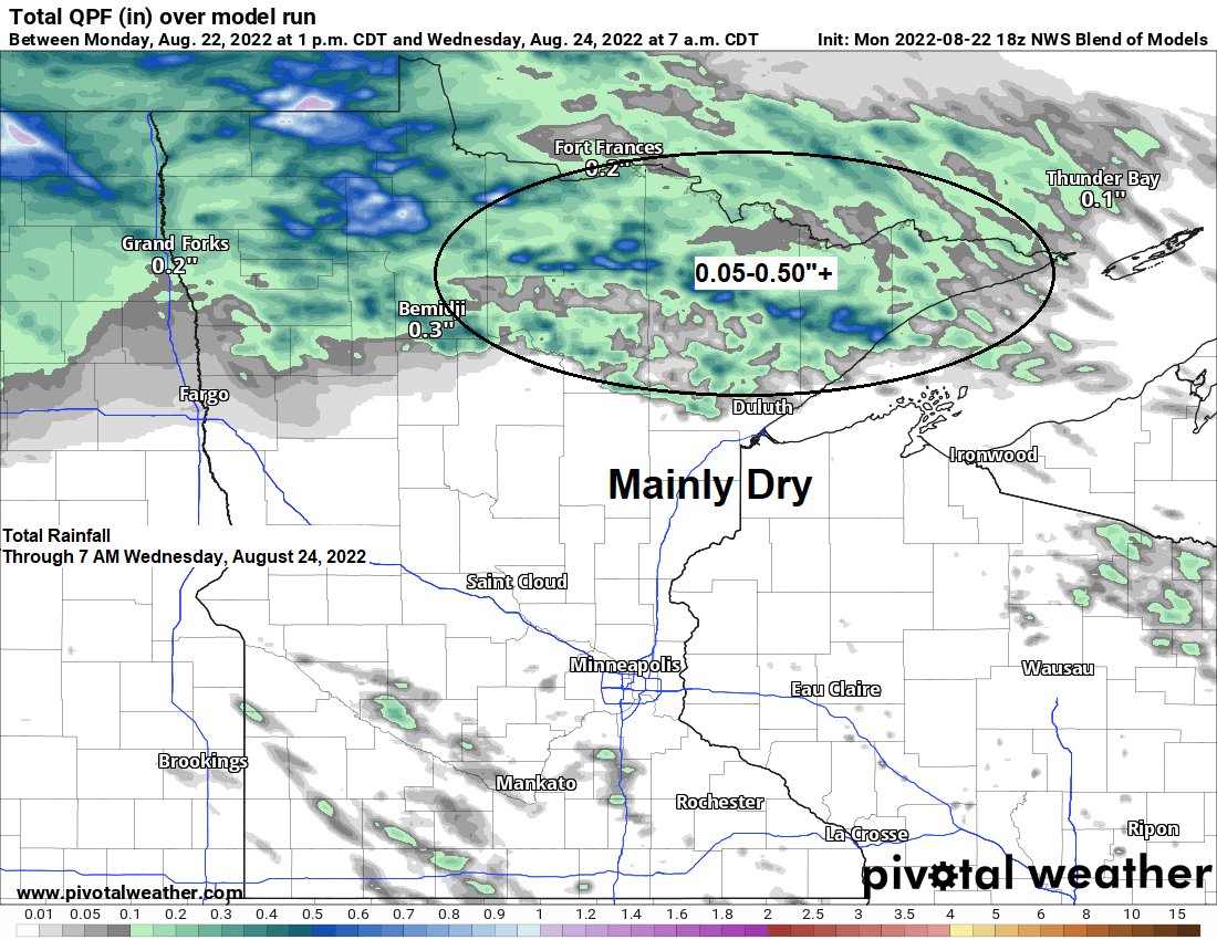
Warm temperatures continue Tuesday followed by cooler temperatures mid to late week; Showers and a few t-storms possible across northern MN through early Wednesday morning
5:24 PM Monday, August 22, 2022 A few showers or thunderstorms are possible mostly over far northern Minnesota (north of Highway 2) this evening, but more so from late Tuesday afternoon through early Wednesday morning, but it looks like east-central Minnesota and northwest Wisconsin will remain dry at least through…
-
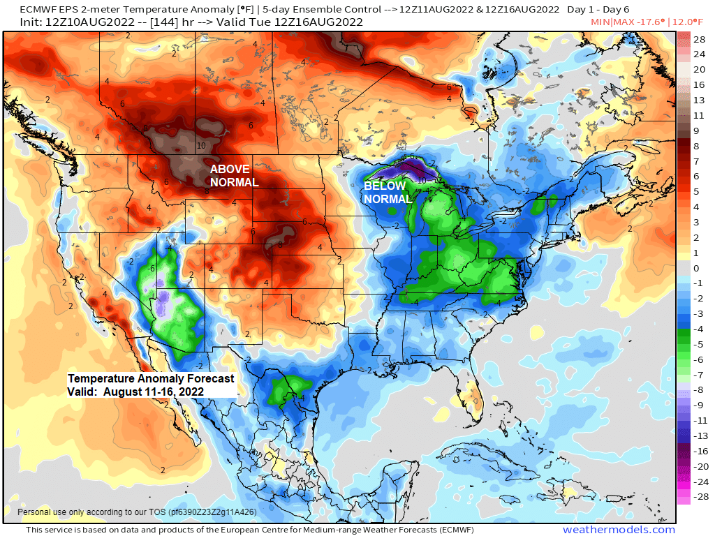
East wind returns for the next few days with cooler temperatures especially near Lake Superior; Some rain possible at times Friday-early Saturday
5:12 PM Wednesday, August 10, 2022 A cooling trend is on the way to the Northland over the next few days with the coolest temperatures likely on Friday, this is when we could see daytime highs only in the 50s and 60s in much of northeast Minnesota and northwest Wisconsin…
-
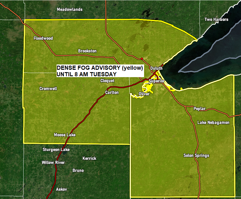
Dense Fog Advisory issued for parts of the Northland; A brief warmup near Lake Superior Tuesday but overall a cool pattern continues; Near normal temperatures to continue inland through Saturday but no heat waves in sight
6:05 PM Monday, July 4, 2022 *A Dense Fog Advisory is in effect until 8 AM Tuesday including the cities of Duluth, Cloquet, Superior, Saginaw, Arnold, French River, Oliver, South Range, Poplar, and Brule. *Visibility one quarter mile or less in dense fog. A brief warmup near Lake Superior Tuesday…
-

Some rain possible this weekend but before then pleasant late spring weather continues; 80 and 90 degree highs possible in parts of the upper Midwest next week; Lake Superior water temperature update
4:56 PM Tuesday, June 7, 2022 Isolated showers are possible across the Northland through Thursday but most of us stay dry. Pleasant temperatures to continue through Friday (daytime highs 68 to 75) Rain chances increasing this weekend (at least on some model forecasts) A look at a simulated radar forecast…
-
A little bit nicer on Wednesday; High around 60 with some sun
/Issued 4:47 PM CDT, Tuesday, September 27, 2016/ A sluggish low! Humid cyclonic flow with areas of rain along with cool temperatures continued today in most of northeast Minnesota and northwest Wisconsin on the back side of a potent low pressure system over eastern Lake Superior – This system will…