Month: May 2022
-

Long Range Forecast for June 2022
4:50 PM Tuesday, May 31, 2022 Persistent troughing may setup over the upper Midwest and Great Lakes during the month of June while a ridge is forecast to setup over the southwest/western U.S. This type of pattern would put the Northland in a NW flow aloft leading to cooler than…
-

Widespread damaging wind reports and a few hail reports in the Northland on Monday, May 30, 2022
12:56 PM Tuesday, May 31, 2022 Over 200 preliminary severe weather reports across the upper Midwest on Monday with at least 5 tornado reports thus far in far western/southwestern Minnesota. Note: Additional severe weather reports will likely come in over the next day or so, and the number of tornadoes…
-
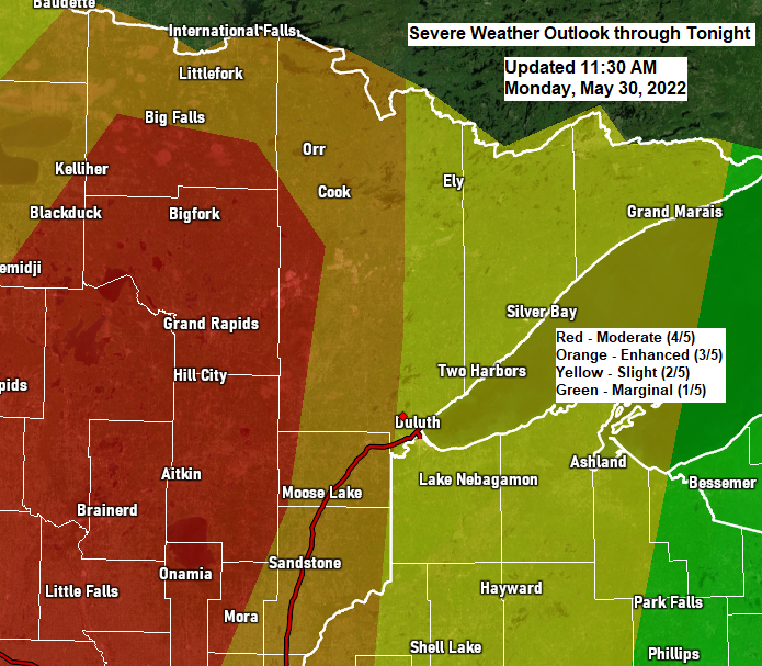
Update on the potential for severe thunderstorms for late this afternoon/this evening; Rainfall and Storm Reports from Monday morning
1:14 PM Monday, May 30, 2022 Widespread severe thunderstorms are expected in much of north-central Minnesota late this afternoon into this evening, with scattered to numerous severe thunderstorms expected in much of northeast into far eastern Minnesota with scattered severe thunderstorms in much of northwest Wisconsin. In addition to the…
-

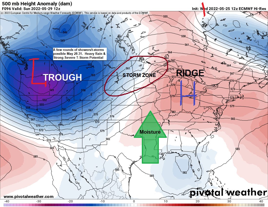
Strong to Severe Thunderstorms possible in the Northland Monday/Monday evening
7:19 PM Sunday, May 29, 2022 A severe weather outbreak is expected on Monday in parts of the Northern Plains and Upper Midwest. Significant wind gusts of 60 to 85 mph, large hail of quarter size to baseball size (1.00″ to 2.75″ diameter) and several tornadoes are possible Monday into…
-

Flood Watch issued for parts of the Northland; Rounds of showers and thunderstorms through Monday night with a threat for heavy rain (flooding) and a risk for some strong-severe storms
10:49 AM Sunday, May 29, 2022 Flood Watch in effect through Tuesday morning for parts of north-central and northeast Minnesota including the cities of Pine River, International Falls, Ely, Brainerd, Hill City, Grand Rapids, Walker, and Bigfork. Flash flooding caused by excessive rainfall possible. Several rounds of thunderstorms are expected…
-
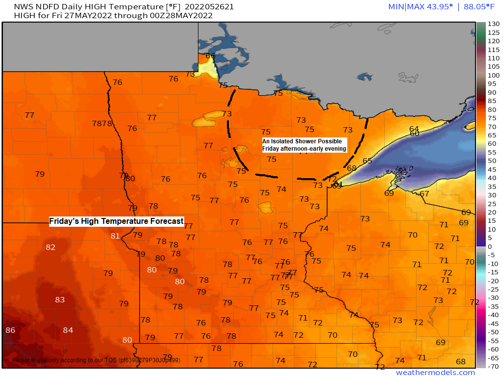
Sunshine and 70s Friday; Stormy at times this weekend-early next week with rounds of scattered showers/t-storms with heavy rain and a few strong-severe storms possible
5:53 PM Thursday, May 26, 2022 Very pleasant weather is expected on Friday with quite a bit of sunshine and mild temperatures. Several rounds of scattered showers and thunderstorms are expected from Saturday morning through next Tuesday. There is a potential for a few strong to severe thunderstorms in parts…
-
Active weather at times into early next week with warmer temperatures and more humid conditions (cooler near Lake Superior) Flood Update
5:31 PM Wednesday, May 25, 2022 Rain in parts of northeast and far eastern Minnesota and all of northwest Wisconsin will gradually end tonight. Gusty NE winds (20-35 mph) continue near Lake Superior this evening. Nicer weather returns Thursday but more so on Friday with widespread 70s for daytime highs…