5:59 PM Tuesday, February 20, 2024
We had a few new record highs set in the Northland today, February 20th.
Ashland, WI: New record high 54 degrees. Old record high 52 degrees set in 2017.
Hibbing, MN: New record high 47 degrees. Old record high 45 degrees set in 1943. Note: The low this morning was 12 degrees. A cold start to the day followed by a record high temperature.
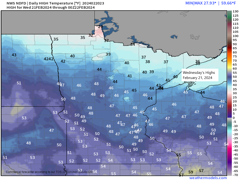
Mild temperatures will continue Wednesday and Thursday with highs in the middle 30s to middle 40s (coolest temps across far northern Minnesota).
A brief shot of colder air still looks likely on Friday with highs in the lower 20s to around 30 degrees with the coldest temperatures once again favoring far northern Minnesota.
Milder temperatures return this weekend into early next week with highs getting back into the 30s and 40s with some 50s possible next Monday.
Precipitation stats for Duluth for February 2024 (thru 4 PM on the 20th)
Total precipitation: 0.31 inches
Normal: 0.66 inches
Departure: -0.35 inches below normal
Percent of normal precipitation: 47% of normal
Snowfall stats for Duluth for February 2024 (thru 4 PM on the 20th)
Total snowfall: 0.6 inches
Normal snowfall: 10.4 inches
Departure: -9.8 inches below normal
Percent of normal snowfall: 6% of normal
Note: Seasonal snowfall total (since Oct. 1) for Duluth is at 17.7 inches which is -45.1 inches below normal to date and is just 28% of our normal snowfall to date.
Still seeing a lot of uncertainty in the computer models for next week regarding whether or not we see a system, or a few systems track east or northeast out of the western U.S, and how strong those systems would be, and whether or not they would even hit the Northland.
So, for now it’s a low confidence forecast for next week.
Here’s the NWS Blend of Models total precipitation forecast through next Wednesday.
Bulk of this would fall next Tuesday-Wednesday the way it looks now.

NWS Blend of Models total snowfall forecast through next Thursday, again most of this would come the middle of next week.

Euro ensemble model continues to be pretty weak when it comes to snowfall potential and also with the potential for a system to impact the Northland next week.
EPS model total snowfall forecast.

GEFS model continues to show a somewhat higher potential for a system to impact the Northland around the middle of next week.
GEFS model total snowfall forecast.

Thanks for reading!
Tim
Leave a Reply