6:25 PM Wednesday, May 15, 2024
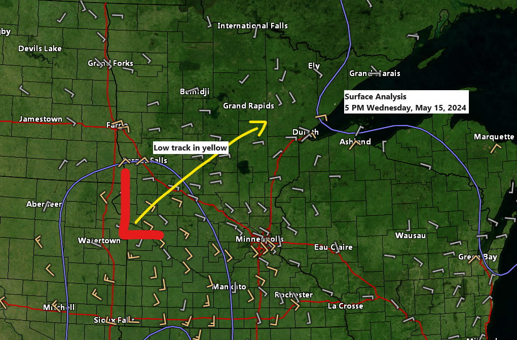
An area of low pressure near Appleton, MN, in the far western part of the state, will move northeastward through Thursday. This system, along with its occluded front, is expected to move east of the Northland by late Thursday afternoon or evening.
The system, combined with ample lift and moisture, is expected to bring rainy conditions to the Northland area from tonight through Thursday morning.

The bulk of the rainfall from this system in the Northland is expected to occur tonight through Thursday morning. Some precipitation may persist over far northern Minnesota and the Arrowhead region into Thursday afternoon, while the likelihood of rain diminishes throughout the remainder of the Northland.
Note: In Duluth, the likelihood of rain is greatest from late this evening into the early hours of Thursday morning.
NAM 3km model simulated radar forecast through 7 PM Thursday.

An area with one inch or more of precipitable water over western Minnesota this afternoon is anticipated to shift east/northeast by Thursday morning. This shift may lead to heavier downpours in parts of the Northland, especially from overnight tonight until mid-morning on Thursday.

Rainfall totals are expected to range from approximately 0.05 inches to 0.25 inches in northeast Minnesota and northwest Wisconsin by Thursday afternoon. However, certain areas in northern Minnesota and northwest Wisconsin may experience higher amounts, potentially exceeding half an inch.

A cold front, represented by the blue line on the map, is expected to move eastward across the Northland on Saturday. There is a possibility of a few showers or thunderstorms as the front passes, but the timing appears unfavorable for significant development in our area. The front is predicted to pass through most of the Northland from late Saturday morning to mid-afternoon.

The forecast indicates a likelihood of a fairly wet pattern over the region, with the potential for rain totals of 1 to 2 inches or more through May 30th according to the ensemble models.


Thursday is expected to bring a cool mid-May day to northeast Minnesota and northwest Wisconsin, with high temperatures ranging from the 50s to about 60 degrees, and even cooler conditions anticipated near Lake Superior.

Expect warmer temperatures on Friday, with highs reaching into the 70s in the Northland and climbing into the 80s in west central and southern Minnesota.
It appears that a northeast wind will persist near Lake Superior on Friday, which will maintain significantly cooler temperatures in the vicinity of the lake.
Note: This weekend, Saturday and Sunday, the Northland will experience high temperatures in the 60s and 70s. Additionally, an offshore wind is expected on one of these days, which should bring warmer temperatures, even near Lake Superior.

Thanks for reading!
Tim
Leave a Reply