7:01 PM Tuesday, December 3, 2024
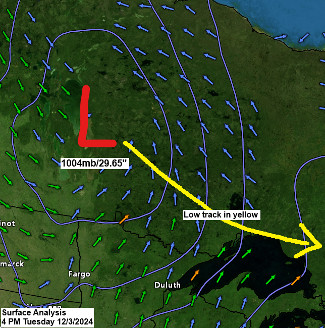
A clipper system is forecasted to move near or just north of Lake Superior on Wednesday.
Areas of snow, as well as some sleet and freezing rain are likely, ahead of this system in the Northland tonight. This will give way to strong northwest winds and falling temperatures, resulting in scattered snow showers and squalls on Wednesday. Patchy blowing snow may also occur on Wednesday, potentially reducing visibility at times. The strong winds could lead to scattered power outages on Wednesday.
I am keeping an eye on the weather models for early next week, as there is a potential system that could bring snow or mixed precipitation to the Northland area.
The Black Friday deal concludes this Friday. Get an annual subscription to my blog for just $35, reduced from $60. The link to subscribe can be found below. Thank you!
Accumulating snow tonight
- Winter Storm Warning in effect until Midnight tonight for southern Cook County in northeast Minnesota including the cities of Tofte, Lutsen and Grand Marais.

- Winter Weather Advisory until Midnight tonight for interior portions of the Minnesota Arrowhead including the city of Isabella.


Here’s my snowfall forecast through 12 PM Wednesday.
Duluth area: Expect a trace to 1 inch of snow, with higher amounts expected further north.

Strong winds expected Wednesday-early Thursday morning.
- A High Wind Warning is in effect from noon Wednesday to 6 AM Thursday for southern Cook County in northeast Minnesota, encompassing the cities of Tofte, Lutsen, and Grand Marais. Northwest winds of 20 to 30 mph with gusts up to 60 mph are anticipated. These damaging winds are likely to down trees and affect power lines, leading to power outages.
- A Wind Advisory is in effect for parts of northeast and east central Minnesota from Wednesday morning until early Thursday morning. Expect northwest winds of 15 to 25 mph, with gusts up to 45 mph. However, along the North Shore of Lake Superior, from Two Harbors to Silver Bay, wind gusts could reach up to 55 mph. This may lead to downed tree limbs and potential power outages.

Radar loop ends 6:30 PM CT Tuesday, December 3, 2024.
Scattered snow showers and potential snow squalls are expected in the Northland on Wednesday. Concurrently, lake effect snow is forecasted to develop along the South Shore of Lake Superior, predominantly east of Ashland, with the likelihood of the lake effect snow continuing into Thursday morning.
HRRR model simulated radar forecast valid 6 AM Wednesday to 6 AM Thursday.

Here’s a look at tonight’s clipper digging south/east out of central Canada.
Goes-16 water vapor loop from Tuesday, December 3, 2024. Loop time ends 6:20 PM CT.


Subscribe to continue reading
Become a paid subscriber to get access to the rest of this post and other exclusive content.