6:22 PM Wednesday, March 19, 2025
It’s been a pretty snowless month so far in Duluth, with just 3.2 inches of snow, which is 5.4 inches below normal to date. However, it looks like we may be adding to the monthly total with a system crossing the area on Sunday.
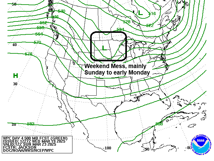
There remains quite a bit of disagreement in the computer models regarding the track of the low, as well as temperatures, which will determine how much snow we get in Duluth.
Some models predict a significant snow event affecting parts of the Northland, including Duluth, on Sunday, while others suggest warmer conditions leading to a mix of rain and light snow in the Twin Ports area.
This system is a few days away, so the computer models will keep adjusting the important details. Stay tuned.
Here are three possible tracks the low on Sunday may take when looking over the ensemble model data which includes the GEFS, Euro ensemble, UK ensemble and Canadian ensemble models.
A farther south track of the low may keep enough cold air in place for mostly snow in Duluth, while a track more to the north would probably allow enough warming to occur, which could cause more of a mix.

Three big lows showing up on satellite imagery today.
Low number one over the Atlantic Ocean
Low number two heading northeast across the Midwest
Low number three over the Pacific Ocean
Goes-16 visible satellite loop ending 4:10 PM CT Wednesday, March 19, 2025.

Here’s a closer look at the latest storm to impact parts of the upper Midwest today as a strong low-pressure system approaches the Chicago, IL, area as of 5 PM today.
Goes-16 water vapor loop from Wednesday, March 19, 2025, loop time ends 4:21 PM CT.

Today’s storm has been a big one and has produced a swath of heavy snow and blizzard conditions from parts of Kansas and Nebraska into parts of Iowa, far southern Minnesota, and up into central Wisconsin.
Snowfall totals of around 3 to 7 inches have been common in the aforementioned areas today, with pockets of higher snow totals of up to a foot in far northern Iowa and in eastern Nebraska, west and southwest of the Omaha area.
This storm also produced widespread thundersnow today, which shows just how powerful and dynamic this March storm is.
In the warmer air, we saw severe thunderstorms with high winds, hail, and a few tornadoes in parts of Illinois this afternoon.
Radar loop ends around 5:38 PM CT Wednesday, March 19, 2025.
Thanks for reading!
Leave a Reply