5:55 PM Friday, April 4, 2025
A weak system is moving through the Northland this afternoon, bringing some rain or if you’re in the far western areas then perhaps a rain/snow mix.
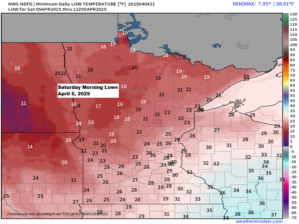
Temperatures in northeast Minnesota and northwest Wisconsin will fall into the upper teens and 20s early Saturday morning. This means that any rain this evening could lead to icy patches on the roads overnight.
Radar loop ends 5:06 PM CT Friday, April 4, 2025.
Expect some light rain or a rain/snow mix changing over to light snow tonight in northeast Minnesota and northwest Wisconsin. Precipitation will diminish early Saturday morning.
HRRR model simulated radar forecast through 7 AM Saturday.

Precipitation of a trace to about 0.10 inches is expected in the Northland tonight, with less than one inch of snow.

The pattern is quite amplified right now with a deep trough over the Rockies and southwest flow occurring ahead of that trough, with a corridor of strong winds aloft (120-150+ knots) covering the upper Midwest and upper Great Lakes once again today.

More severe weather is expected tonight, with tornado and severe thunderstorm watches in effect.
In colder areas, winter storm warnings and advisories are issued for Saturday, including the Texas Panhandle and parts of New Mexico.

Snowfall of 2 to 5 inches, with some areas receiving more, is expected by early Sunday morning in parts of New Mexico and the Texas Panhandle.

Flash flood warnings (green polygons) are in effect today for northeast Texas, eastern Oklahoma, and parts of Arkansas, Missouri, and Kentucky due to repeated showers and thunderstorms causing heavy rain and flooding.
Radar loop ends 5:36 PM CT Friday, April 4, 2025.
Impressive-looking infrared satellite imagery showing the thunderstorms (colder cloud tops) over northeast Texas, eastern Oklahoma, and Arkansas today.
Goes-16 enhanced infrared satellite loop ends 5:16 PM CT Friday, April 4, 2025.

Thanks for reading!
Leave a Reply