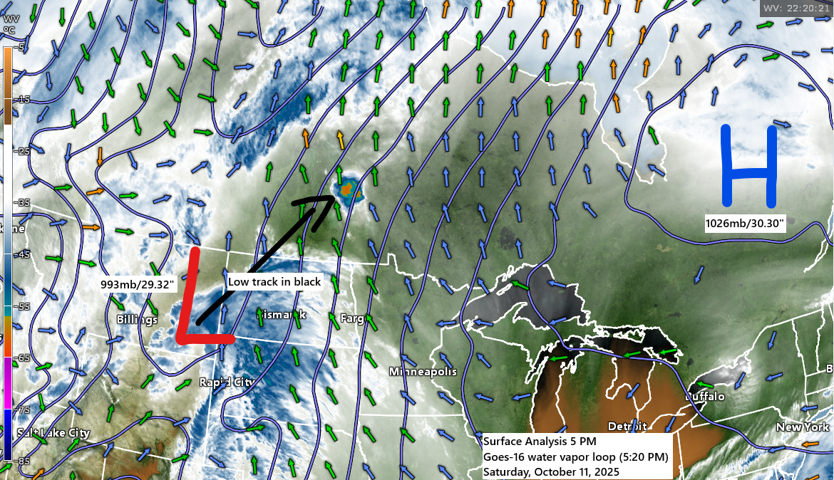
A strengthening low-pressure system is expected to move northeast from the northern Rockies tonight, likely reaching western Manitoba by Sunday. A cold front associated with this system will push through the Northland on Sunday night.
Southerly winds ahead of this system will draw moisture northward into the area, bringing a few showers tonight, mainly over western regions. Shower chances will increase across the entire Northland by Sunday afternoon and continue through Sunday night. The system will move out to the north and east, with dry weather returning on Monday.
Here’s the NAM 3 km model simulated radar forecast valid midnight tonight to 7 AM Monday.
Note: Rain chances in Duluth are expected to peak during the late afternoon and evening. They will start to decrease early Monday morning, after midnight.

Precipitation anomalies in the Northland for October 2025, as of 4 PM on October 11th.
- Ashland, WI: -1.18″ below normal
- Duluth, MN: -1.05″ below normal
- Brainerd, MN: -1.00″ below normal
- Hibbing, MN: -0.93″ below normal
- International Falls, MN: -0.86″ below normal
This probably won’t be a significant rain event for our area on Sunday, with totals generally ranging from 0.05 to 0.30 inches in northeast Minnesota and northwest Wisconsin. The heaviest rain, exceeding 0.50 inches, is expected from eastern North Dakota into northwestern Minnesota.

Strong winds with gusts up to 50 mph are expected on Sunday across the northern Plains, stretching into northwest Minnesota, where a wind advisory is in place.
Breezy conditions are also expected in northeast Minnesota and northwest Wisconsin on Sunday, with southerly winds gusting between 20 and 35 mph. A wind advisory might be issued in parts of the Northland on Sunday due to these strong gusts.

Colder air following this system is expected to bring a significant snowstorm from later tonight through Sunday night, impacting regions across the northern Rockies and the western half of Canada.
Winter weather alerts as of late Saturday afternoon.

European model total snowfall through 7 AM Monday.

NAM total snowfall through 7 AM Monday.

Leave a Reply