A large upper-level low and trough brought plenty of cool fall air to the upper Midwest and western Great Lakes today. Scattered showers, mostly cloudy skies, and gusty winds were common across the Northland. There were even a few reports of snow in some areas, which makes sense given the colder 850mb temperatures ranging from -2 to -4°C. However, surface temperatures, ranging between 37 and 45 degrees, were mostly too warm for snow. Still, stronger showers managed to pull down enough cold air to produce brief wintry precipitation in some spots.

Showers will persist across parts of the Northland tonight and Thursday, with some locations possibly experiencing snow showers.
We might see a few snowflakes on the hilltops in Duluth tonight or Thursday, but near Lake Superior, snow isn’t likely.
HRRR model simulated radar forecast through 7 PM Thursday.

Trace amounts of snow are possible through Thursday morning over parts of northeast Minnesota and downwind of Lake Superior near Hurley and Gile in northern Wisconsin, where some lake-enhanced precipitation will continue, which could result in about half an inch of snow accumulation in the higher elevations.

The fall of 2025 in Duluth has been noticeably warmer, with nearly 70% of days since September 1st being above average in temperature, while only about 23% of days have been colder than average.
The average temperature in Duluth this fall up to October 22 is 56.3 degrees, which is 3.5 degrees above normal. Interestingly, this fall is running nearly 3 degrees cooler (2.7 degrees cooler) compared to fall 2024 up to October 21.

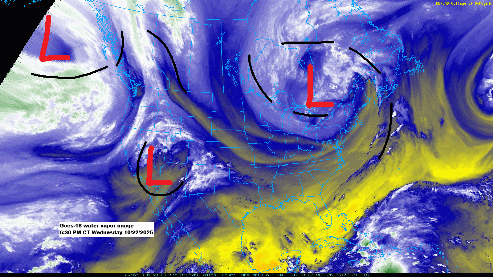
Next week’s weather outlook reveals a complex pattern, with a large trough extending from western Canada to the central and southern Plains, a ridge over the Great Lakes and eastern Canada, and another trough over the northeastern U.S.
There’s still a lot of uncertainty about how things will unfold next week, but if a system moves across the Northland, it seems temperatures will be warm enough for rain rather than snow. Stay tuned.

Take a look at the potential rain totals across the region next week, based on the ensemble models (EPS and GEFS).
Northeast Minnesota and northwest Wisconsin could see rain totals of a quarter to half an inch early to mid next week, with the GEFS model suggesting slightly higher amounts. However, due to the significant variability in computer models, there’s still a chance that much of the Northland may get little to no rain next week, so caution is advised.


Leave a Reply