A gravity wave formed over western Lake Superior on Tuesday evening and continued through the night into today, causing significant rainfall in a small area of northwest Wisconsin. The rain has mainly impacted northeast Douglas County, particularly the Poplar and Maple areas, east of the city of Superior.
Farther east along the South Shore of Lake Superior in northern Wisconsin, there have been some lake-enhanced rain showers last night and today.
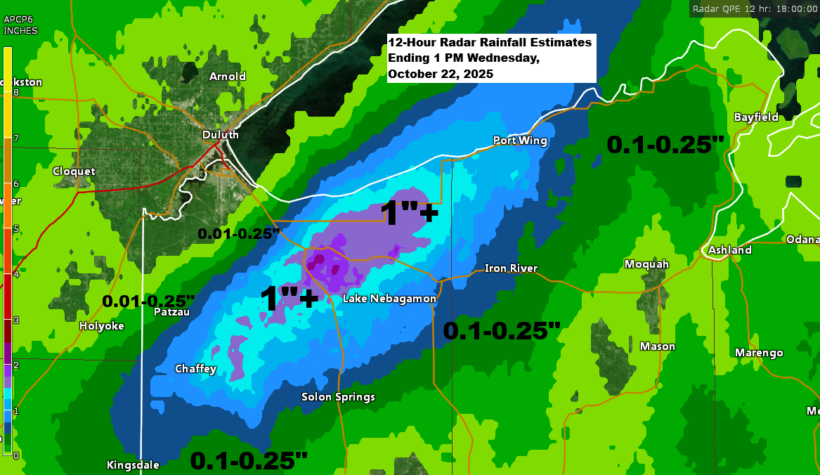
Rainfall reports for the 24-hour period ending at 12:58 PM on Wednesday, October 22, 2025.
- Poplar, WI: 1.29″
- Maple, WI: 1.06″
- Washburn, WI: 0.62″
- Odanah, WI: 0.34″
- Ashland, WI: 0.30″
- Bayfield, WI: 0.16″
- Superior Airport: 0.02″
Northwest winds in northeast Minnesota, along with a north-northwest wind over Lake Superior, are creating a gravity wave that is intensifying rainfall this afternoon. The affected areas include northern parts of Douglas County and sections of western Bayfield County, stretching from Poplar to Lake Nebagamon and eastward to Port Wing and Iron River.
Radar loop ends 1:12 PM Wednesday, October 22, 2025.
850mb temperatures ranging from -1 to -5°C over Lake Superior, paired with lake water temperatures of +8 to +10°C, create enough contrast to produce lake-enhanced rain today in the northwest wind-favored areas along the South Shore of Lake Superior.

Leave a Reply