Category: lake effect rain
-

Monday will stay dry, but rain chances increase on Tuesday, with the greatest likelihood in the western and far southern regions.
In the next few days, a strong trough will move into the northern Plains, while a ridge stays over the Great Lakes and eastern Canada. This ridge will push the trough southeast, keeping most of the rain away from northeast Minnesota and northwest Wisconsin on Tuesday. However, areas in the…
-
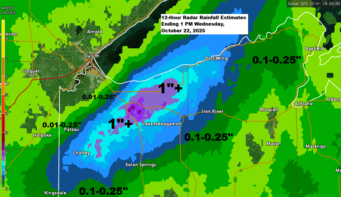
Lake-Enhanced Rainfall in Northwest Wisconsin
A gravity wave formed over western Lake Superior on Tuesday evening and continued through the night into today, causing significant rainfall in a small area of northwest Wisconsin. The rain has mainly impacted northeast Douglas County, particularly the Poplar and Maple areas, east of the city of Superior. Farther east…
-

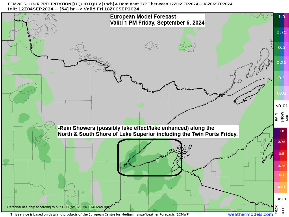
Expect scattered showers tonight and Friday, with patchy frost early Saturday morning. Warmer temperatures are forecasted for next week.
5:39 PM Thursday, September 5, 2024 In the coming days, an intensifying upper-level low and trough will move southeastward from Ontario toward the Great Lakes region. This system is anticipated to bring cooler temperatures through Saturday, with the primary phase of showers happening tonight into Friday. As colder air passes…
-
Northland Weather Forecast: Scattered Showers and Thunderstorms Tonight
6:13 PM Wednesday, September 4, 2024 Scattered showers and occasional thunderstorms are anticipated in parts of the Northland tonight into early Thursday morning due to a passing cold front. Severe thunderstorms are not expected to be widespread tonight due to a lack of significant instability, as a layer of warm…