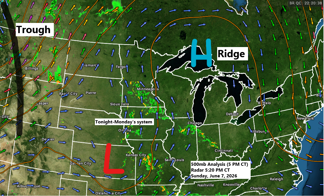
A disturbance moving north from the central Plains, along with some lift and increasing moisture—bringing precipitable water up to 1.50 to 1.90 inches—will likely bring rain to northeast Minnesota and northwest Wisconsin late tonight into Monday. With the added moisture, some downours are possible, and while an isolated thunderstorm could pop up, widespread storms aren’t expected with this system.
By late Monday afternoon, much of northeast Minnesota and northwest Wisconsin could get between 0.10 and 0.50 inches of rain, with some areas seeing over 0.50 to 1 inch or more.

Severe thunderstorms are expected tonight across central and western North Dakota, northwest South Dakota, eastern Montana, and northeast Wyoming, where a rare PDS severe thunderstorm watch is in effect through late Sunday evening. The storms could bring widespread damaging winds of 70 to 100 mph, large hail ranging from quarter to golf ball size, and the possibility of an isolated tornado in the watch area.

Tonight, a level 4 out of 5 moderate risk for severe weather is in place, impacting parts of western North Dakota and southeastern Montana, highlighted in red on the map.
No severe weather is expected tonight in northeast Minnesota or northwest Wisconsin, with just a slight chance of a non-severe thunderstorm in the light green area on the map.


So far this late spring, we haven’t had many days with high dew points in the 60 to 70-degree range. That changed today, as southerly low-level winds are bringing a much more humid air mass far to the north. This sticky air, with dew points in the 60s to low 70s, will stick around through Wednesday.
It won’t be as humid near Lake Superior because the cooler temperatures keep the dew point from exceeding the actual temperature.

Warm weather will stick around through midweek, with highs in the Northland ranging from the mid 70s to 80s Monday through Wednesday, and some spots possibly hitting near 90, especially Tuesday afternoon. While this is above average for early June, it’s likely not warm enough to break any high-temperature records in the coming days.
Near Lake Superior, including below the hill in Duluth, east winds are expected to stick around through Wednesday, keeping highs in the 50s and 60s. Some fog may also roll in at times, similar to what was seen Saturday night into Sunday morning.

…Severe Potential Tuesday (June 9, 2026)…
The risk of severe thunderstorms, including damaging winds, large hail, and isolated tornadoes, will rise on Tuesday across the Dakotas and parts of Minnesota.
Storms developing west of our area Tuesday afternoon and evening could move into parts of the Northland late Tuesday night into Wednesday morning, bringing a chance of scattered gusty winds and possibly some hail.

Leave a Reply