Category: moderate risk
-
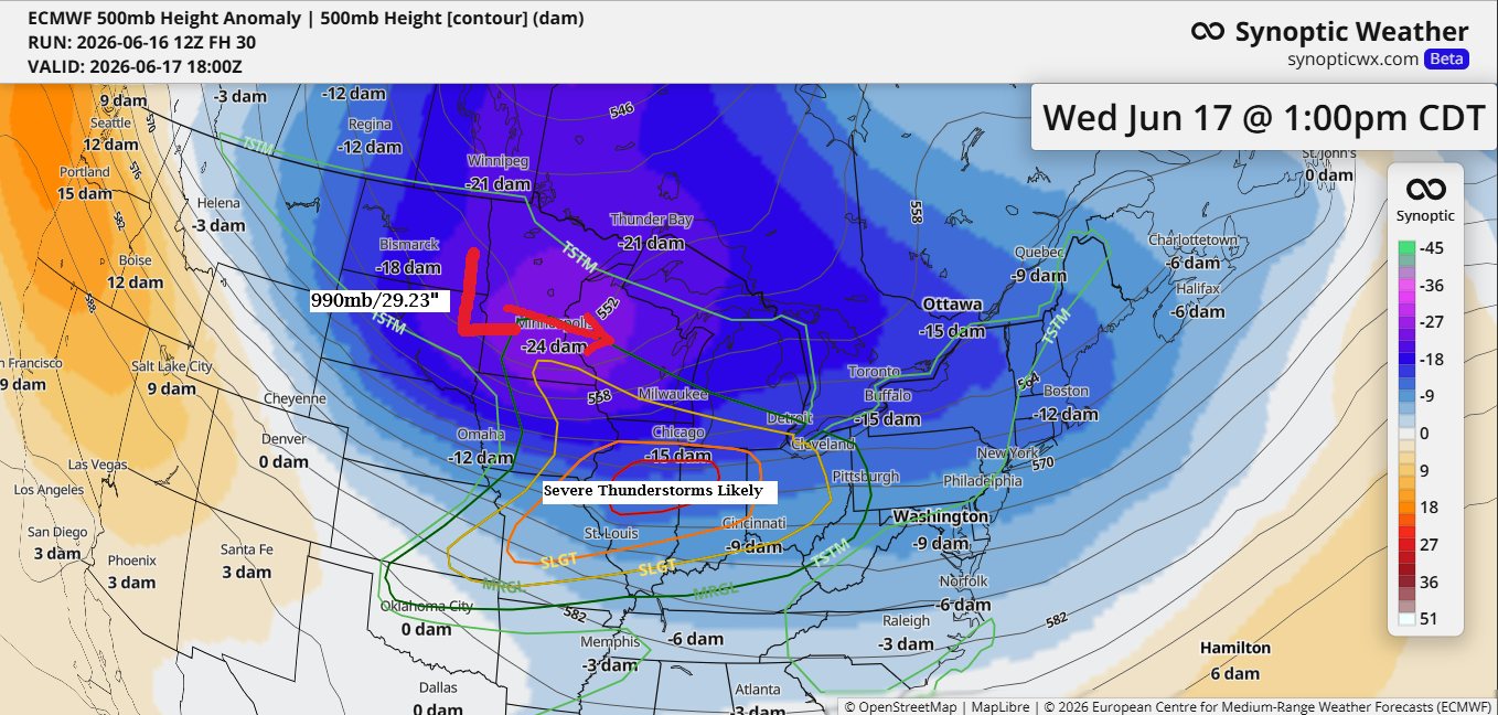
Strong Mid‑June Low Tracks Across the Upper Midwest on Wednesday
A strong low-pressure system, with readings near 987 to 990mb (29.15 to 29.23 inches), is set to move east-southeast from eastern South Dakota on Wednesday. Much like a wintertime clipper, it will bring impressive jet dynamics and strong lift as it moves across the upper Midwest. Some rain is expected…
-
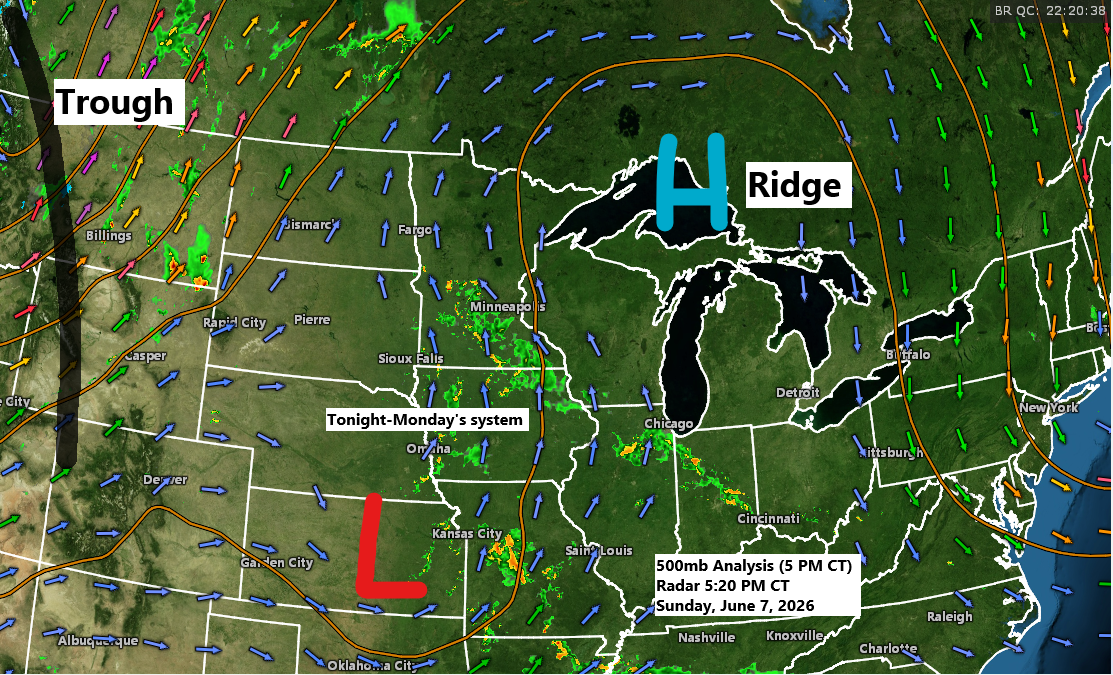
A few chances of rain this week, with warm and humid conditions inland and cooler temperatures near the lake.
A disturbance moving north from the central Plains, along with some lift and increasing moisture—bringing precipitable water up to 1.50 to 1.90 inches—will likely bring rain to northeast Minnesota and northwest Wisconsin late tonight into Monday. With the added moisture, some downours are possible, and while an isolated thunderstorm could…
-
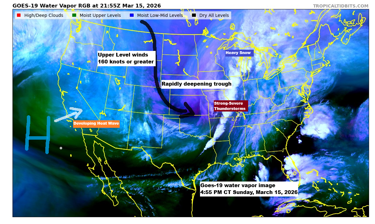
The next few days will be very cold and windy, with some snow expected tonight and another round of snow on Tuesday night.
A huge storm system is rolling through today, bringing all kinds of wild weather. Heavy snow and blizzard conditions are slamming parts of the upper Midwest and western Great Lakes, while a line of strong to severe thunderstorms—with multiple warnings and a couple of tornado alerts—stretches from southwest Illinois down…
-
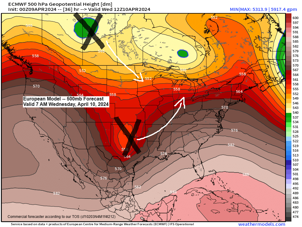
A few showers through Thursday; More rain chances next week; Rainfall Reports from April 7-8
4:56 PM Tuesday, April 9, 2024 Isolated to scattered showers are likely in the Northland this evening, Wednesday and again Thursday as a new upper-level trough digs southeast into the upper Midwest while another upper trough lifts northeast of the southern Plains. The two troughs will merge over the Midwest…
-

A few rain showers this evening and rain/snow showers early Sunday AM
-Cooler temperatures are on the way for Sunday with highs ranging from the 30s in the tip of the Arrowhead to the lower and middle 40s across the rest of the Northland, but some upper 40s are possible around the Brainerd Lakes. -A few rain showers will continue to move…
-
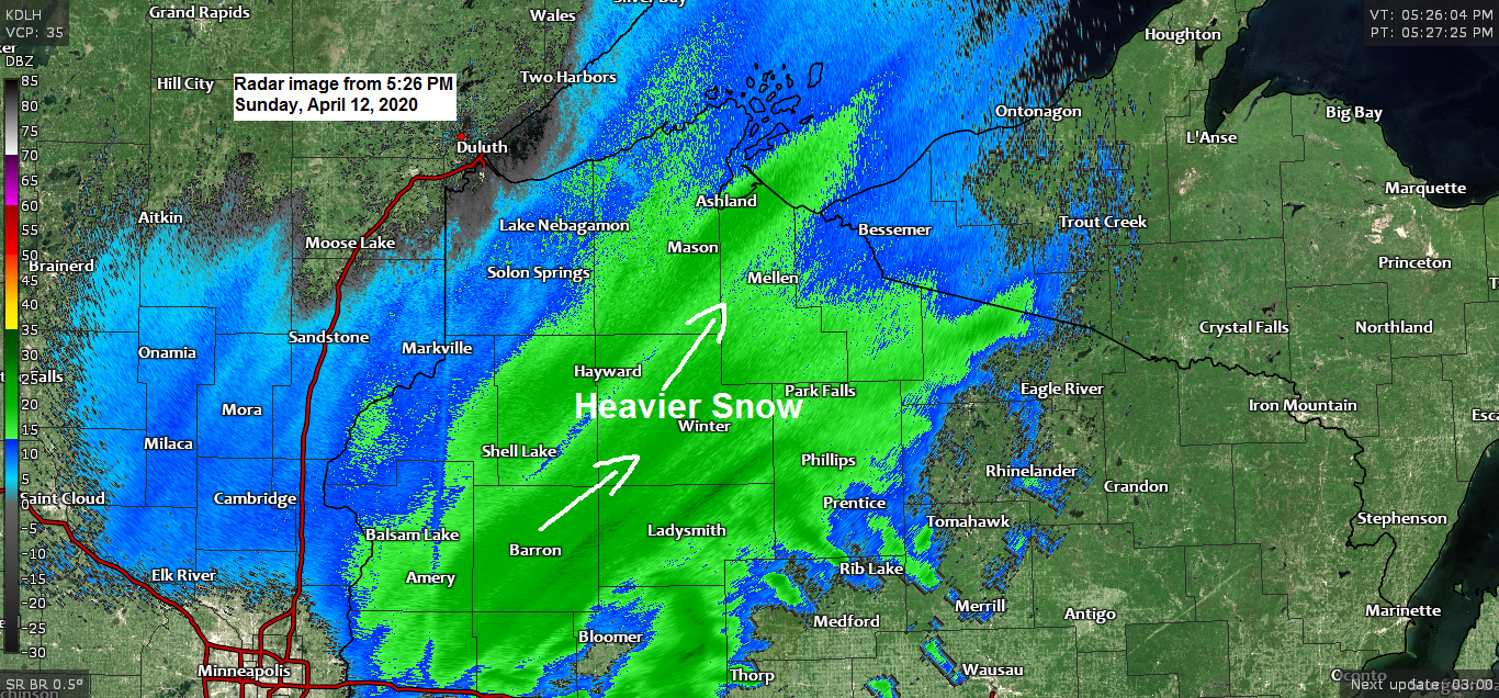
Snow continues tonight across most of northwest Wisconsin, winter storm warnings and advisories remain in effect
-Winter Storm Warning remains in effect until 1 PM Monday including the cities of Washburn, Bayfield, Ashland, Hurley and Gile. -Winter Storm Warning remains in effect until 7 AM Monday including the cities of Minong, Spooner, Shell Lake, Hayward and Winter. -Winter Weather Advisory (purple area on map) remains in…
-
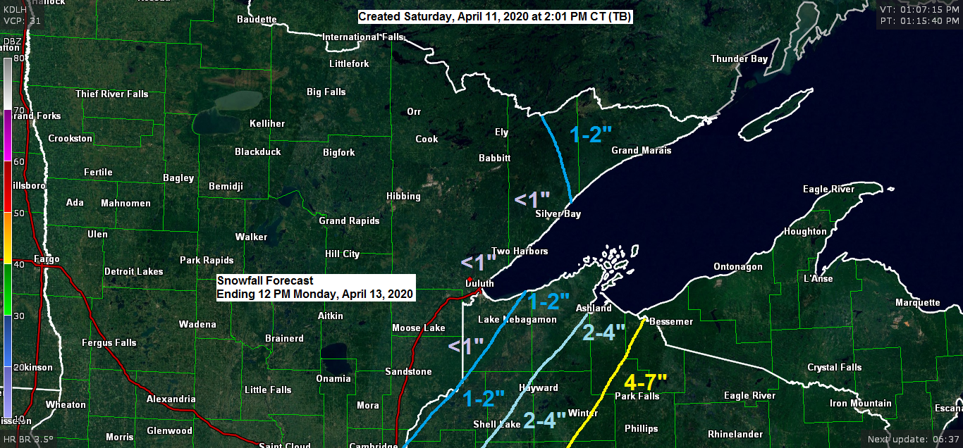
Turning colder; some snow on the way Sunday-early Monday mainly across northwest Wisconsin, winter storm warnings and advisories in effect
-Winter Storm Warning (pink area on map below) in effect from 1 PM Sunday to 1 PM Monday for most of northwest Wisconsin including the cities of Port Wing, Bayfield, Washburn, Minong, Shell Lake, Winter, Hayward, Ashland, Glidden, Hurley and Gile. -Winter Weather Advisory (purple area on map below) in…