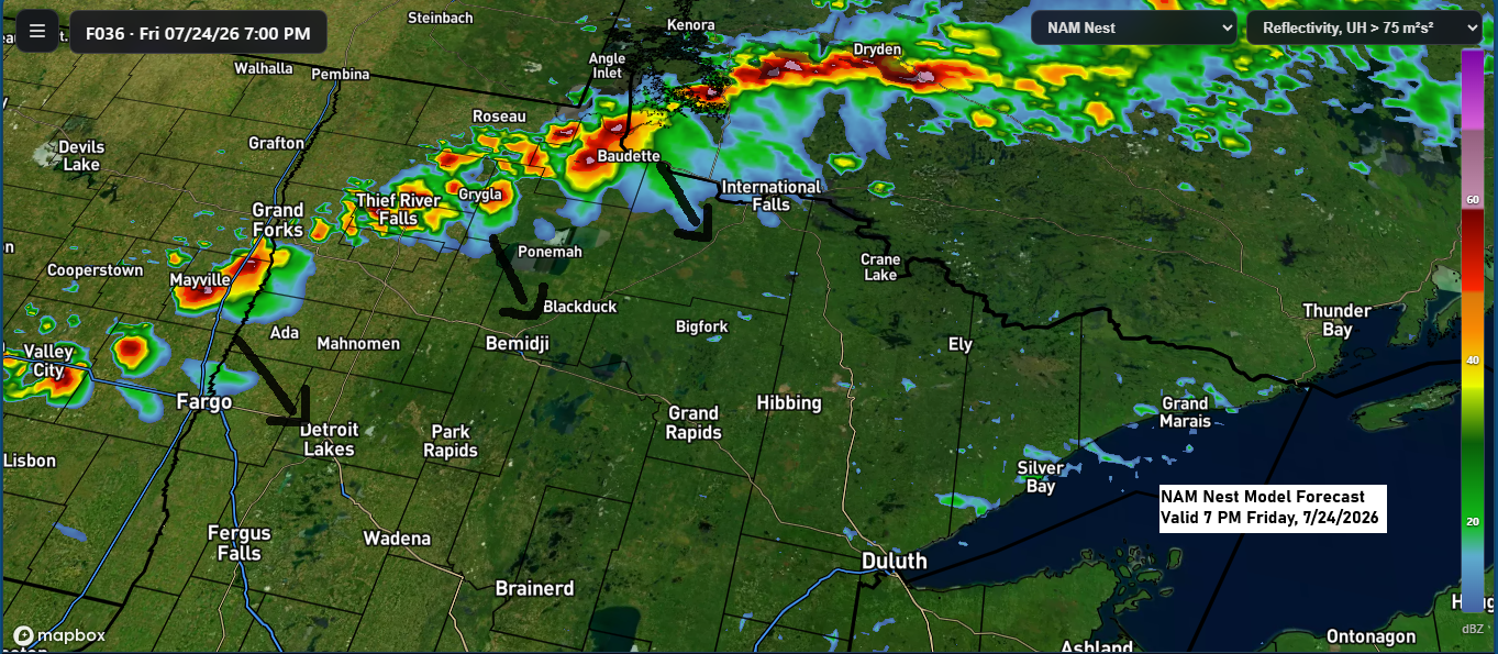
A few strong to severe thunderstorms could develop from late Friday afternoon into the evening, mainly across parts of the eastern Dakotas into west-central and northern Minnesota. This is where conditions may come together to support the risk for some severe storms.
Late Friday afternoon and evening, the main severe weather threats will be damaging winds of 60-70 mph and large hail up to 1.5 inches in diameter (about the size of a ping pong ball), with a chance of one or two tornadoes, especially from eastern North Dakota to northwest Minnesota.
Any storms that form late Friday afternoon and evening are expected to weaken as they move farther southeast into central and northeast Minnesota and northwest Wisconsin later Friday night.

Northern Minnesota, including the Arrowhead, could get between a quarter and half an inch or more of rain on Friday, while areas farther south are expected to see less, tapering off to just a trace to 0.2 inches, according to the NWS blend of model forecasts.
Note: Some models suggest a few showers could move northeast from central Minnesota and reach the Twin Ports on Friday, though any rain would likely be light, if it happens at all. Storms forming in northern Minnesota will probably weaken before arriving in the Twin Ports area late Friday night.

July 2026 in Duluth has been warm, with 17 warmer-than-average days and only 4 cooler days, including a brief 3-day stretch of below average temperatures.

After several days of improved air quality in the Northland, conditions might shift from Friday into Saturday as more wildfire smoke drifts east-southeast across the region. Most of this smoke is expected to remain high in the atmosphere, creating hazy skies but with little to no impact at ground level.
HRRR model vertically integrated smoke forecast valid 7 AM Friday to 1 PM Saturday.
After a stretch of cooler days in the Northland, temperatures bounced back to typical late-July levels this afternoon, with highs in the upper 70s to low 80s across northeast Minnesota and northwest Wisconsin.
The next few days in the Northland will bring highs in the 70s and 80s, with some areas possibly hitting the 90s this weekend. It’s also going to feel more humid as dew points climb into the 60s, and maybe even the 70s for some spots on Saturday and Sunday.

Leave a Reply