Category: Dry Pattern
-

Upcoming Cold Fronts and Weather Trends in Northland
5:00 PM Sunday, September 29, 2024 As anticipated, the temperatures in the vicinity of Lake Superior are approximately 10 to 15 degrees cooler this afternoon than they were on Saturday afternoon. This change is primarily attributed to the stronger northeast winds that have been affecting the area near Lake Superior…
-
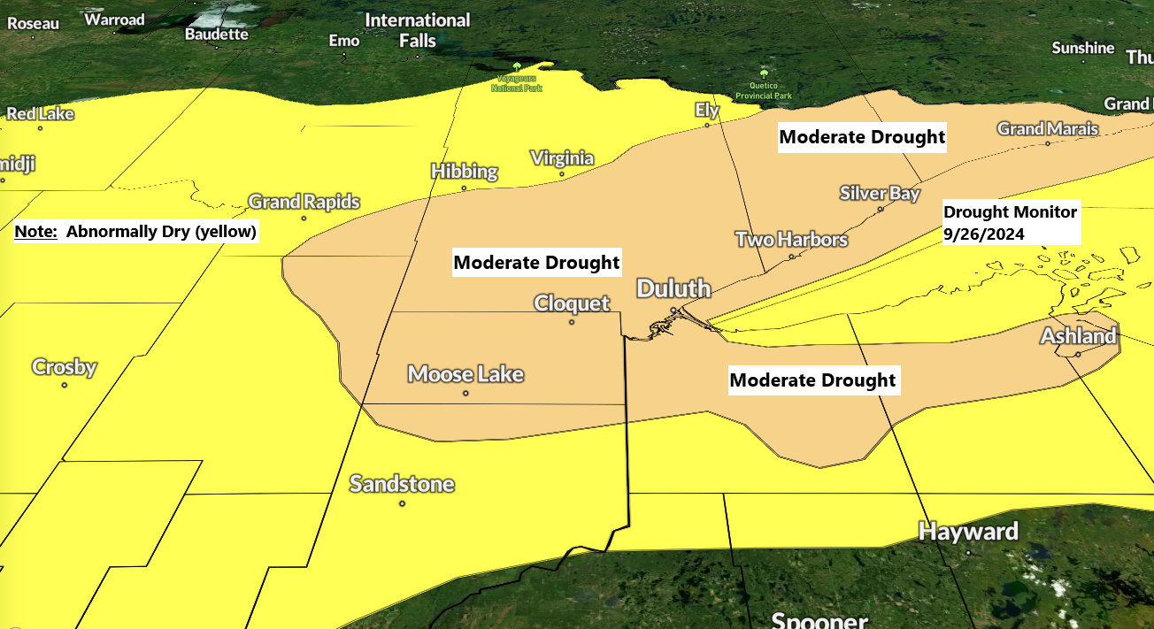
Drought Update: Minnesota’s Conditions Worsen, Wisconsin Remains Steady
5:32 PM Friday, September 27, 2024 Drought conditions have worsened in Minnesota this week, while they have stayed consistent in Wisconsin. Precipitation anomalies for September up to 4 PM on the 27th. The most recent drought monitor was released on Thursday, September 26, 2024. Minnesota Wisconsin The current forecast for…
-
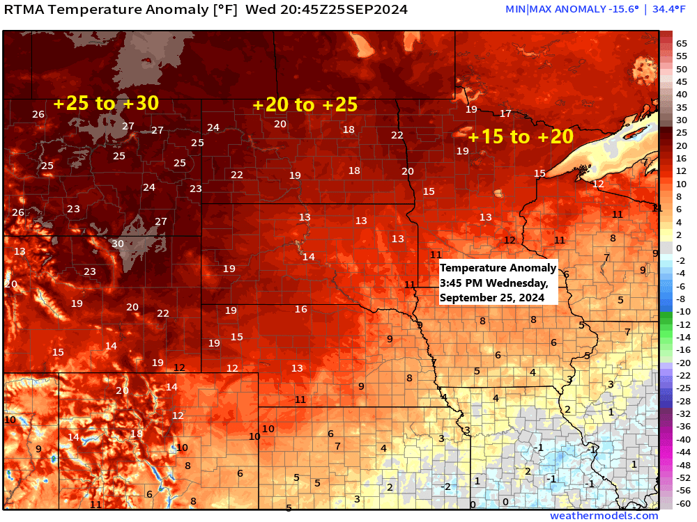
Unusually Warm September in Northeast Minnesota
4:55 PM Wednesday, September 25, 2024 This afternoon, temperatures in northeast Minnesota and northwest Wisconsin were approximately 15 to 20 degrees above average, and this warm trend is anticipated to persist for the next several days as we experience an unusually warm September.
-
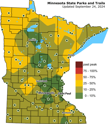
Northland Weather Update: Mild Temperatures & Fall Colors
4:30 PM Tuesday, September 24, 2024 Autumn hues are emerging across the Northland, yet the peak conditions might experience a slight delay this year compared to previous years. In Duluth and the nearby Jay Cooke State Park area, the peak fall colors typically appear from late September to early October.…
-
Warm and Dry Tuesday and Wednesday with highs in the 80s to around 90 degrees, cooler along the North Shore
Clouds and some light rain showers helped keep temperatures from getting out of the 60s or lower 70s in northeast Minnesota and northwest Wisconsin today, but temperatures should warm up quite a bit Tuesday and Wednesday, you have the TB guarantee on that! On second thought, maybe I shouldn’t guarantee…
-
A warm week ahead (cooler lakeside through Wednesday) A few showers Monday and again late this week
A few showers or thunderstorms are possible over parts of the Northland late tonight into Monday with the potential for a few more showers or storms Monday night into Tuesday morning, but overall the pattern continues to look dry through mid-week, but if you happen to get underneath a thunderstorm…
-

Shower/t-storm chances Saturday night into the middle of next week
Showers and thunderstorms are possible across the Northland beginning Saturday night, and these storm chances will continue into the middle of next week, so some much needed rain could be on the way. Note: Precipitation deficits across the Northland since January 1st range from 2 to 4 inches below normal!…