Tag: 90 degree days
-
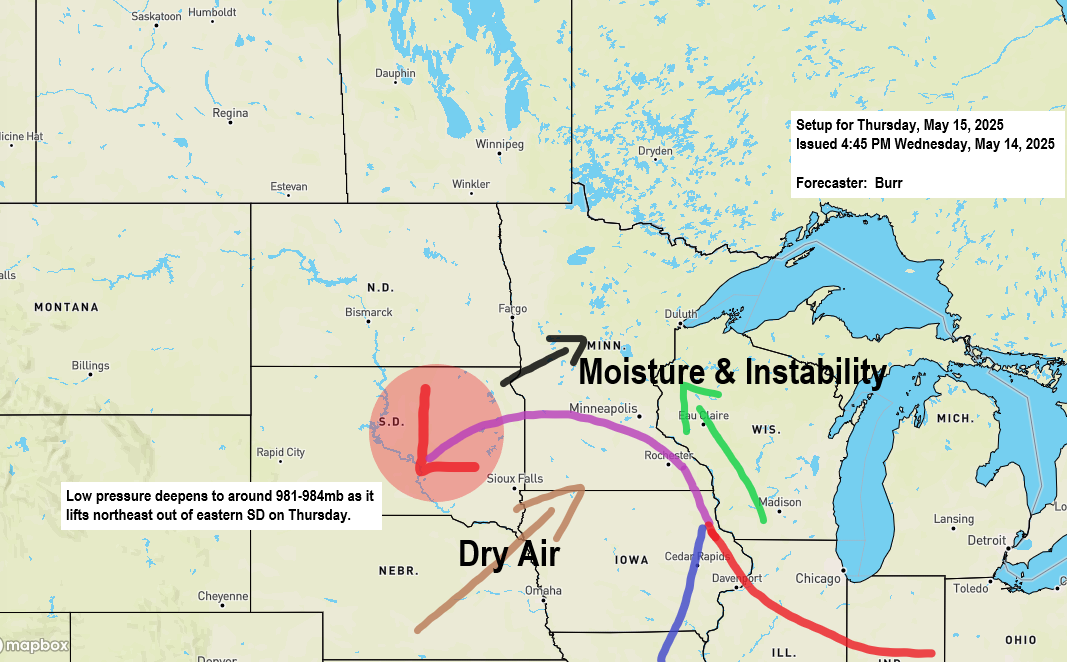
Periods of showers and thunderstorms are expected on Thursday, followed by additional rainfall on Friday.
6:20 PM Wednesday, May 14, 2025 -A strengthening low-pressure system, accompanied by a potent negatively tilted trough, will move northeast into the Upper Midwest on Thursday. This system is anticipated to bring showers and thunderstorms to northeast Minnesota and northwest Wisconsin on Thursday, with additional rainfall expected from Friday into…
-
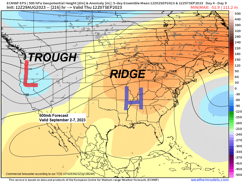
90-degree temperatures and record warmth possible in the Northland this weekend-early next week; Cool tonight with patchy frost possible in northern Wisconsin well inland from Lake Superior; Mainly dry through early next week
6:23 PM Tuesday, August 29, 2023 The big weather story around here will be the upcoming warm up which could be pretty significant in that we could even see some record-breaking warmth this weekend into early next week. The basic pattern this weekend into the middle of next week will…
-

Mild and less windy Friday; East wind returns Saturday (Cooler near Lake Superior) Heat Wave Sunday-Monday, and possibly again late next week/next weekend; First half of June 2022 climate stats; Rainfall reports from Wednesday
5:44 PM Thursday, June 16, 2022 Last time it was 90 degrees or warmer in the Northland International Falls: August 20, 2021Hibbing: August 19, 2021Duluth: July 5, 2021 Note: Brainerd and Ashland have already recorded their first 90 degree or warmer temperature this year on June 14, 2022. Note: Last…
-
Rain and much cooler temperatures on the way for Tuesday; Dry pattern returns after Tuesday with milder temps late this week
A big drop in temperatures is coming on Tuesday – Check out the temperature forecast from the 18z NAM 3km model valid from Midnight tonight to 7 PM Tuesday. Overnight temps in the 60s to lower 70s tonight, and then will see falling temperatures during the day Tuesday, in fact…
-
More record warmth in Duluth, MN today. 3rd day in a row with a record high temp! Scattered t-storms possible late tonight. Warm through midweek with cooler temps near Lake Superior, scattered t-storms Mon night-Wed
/Issued 6:01 PM CDT, Sunday, May 27, 2018/ Source: http://weather.cod.edu 18z NAM-Nest model Source: https://www.tropicaltidbits.com 18z RGEM model Source: http://www.pivotalweather.com/ Heat advisories remain in effect through Monday for southern Minnesota, meanwhile to our west a risk of flooding for parts of the northern Rockies and western High Plains. Source: https://hprcc.unl.edu Temperature departure map for…