Tag: hail
-
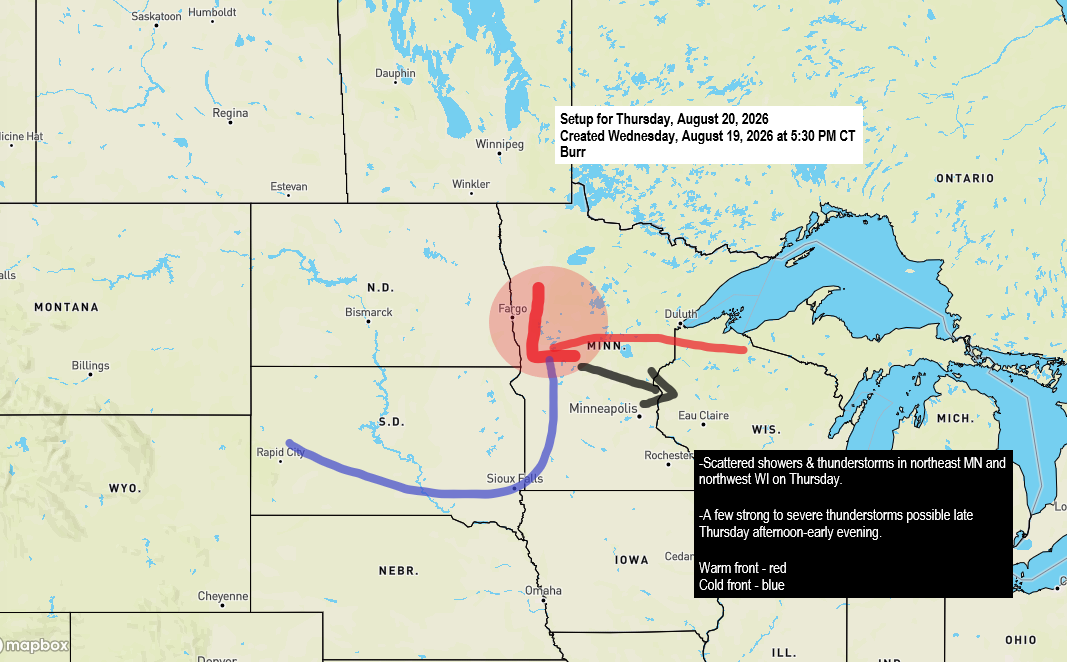
⚡ Morning Showers Then a Conditional Severe Threat Thursday Afternoon and Evening
There’s a chance of rain in the Northland on Thursday as a low-pressure system moves east-southeast from northern North Dakota, resembling a mid-August clipper. This system is expected to bring two rounds of precipitation. The first will occur during the morning and early afternoon, with scattered showers and isolated thunderstorms…
-
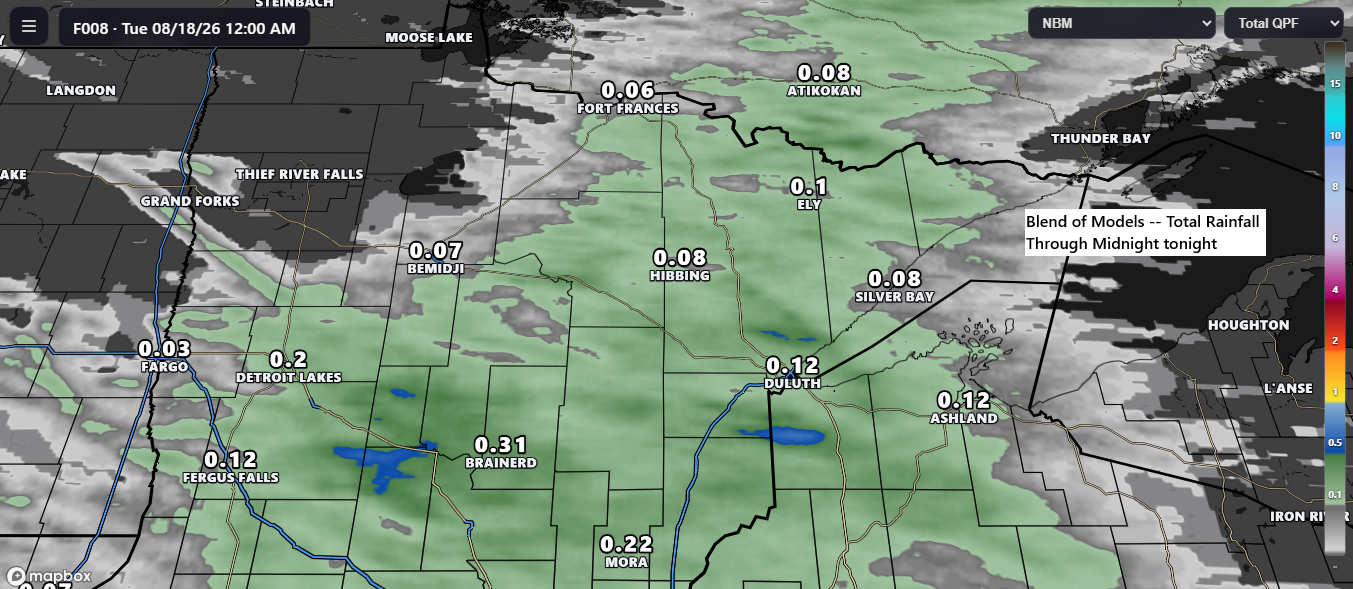
🌩️ Scattered Showers and Occasional Thunder Expected with Tonight’s Front
Another cold front is set to move through the Northland tonight. Ahead of it, warm southwesterly breezes prevail, while behind the front, winds shift to a cooler northwesterly direction. Expect scattered showers and occasional thunderstorms with tonight’s front, with rain generally moving east to east-southeast. Widespread heavy rain is unlikely;…
-
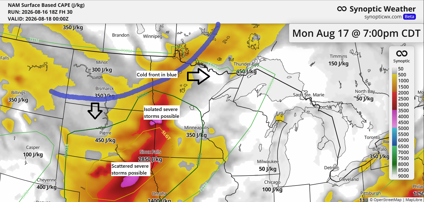
🌬️ Cold Front Arrives Monday Evening; Scattered Showers Here, Stronger Storms Farther Southwest
A cold front will move through the Northland Monday evening. Ahead of it, dew points will mostly be in the 50s to around 60, with the highest instability from western to southwestern Minnesota and areas farther south. In our area, expect scattered showers and isolated, non-severe thunderstorms late Monday afternoon…
-

🌦️ Wet North, Dry South Over the Past Three Weeks; Saturday Brings Only Modest Rain
Over the past three weeks, far northern Minnesota has experienced a shift to a wetter pattern, with several rain events resulting in precipitation ranging from 100% to nearly 200% of normal since July 21. In contrast, southern areas have remained much drier during the same period, receiving only 2% to…
-

⚡🌩️ Strong Storms Stay South Tonight; 🌫️ Hazy Skies Continue; 🌧️ Saturday Shows Rain Potential
Strong to severe thunderstorms could pop up tonight well south of the Northland, impacting parts of South Dakota, Iowa, and possibly southern Minnesota. The main threat is damaging winds between 60 and 75 mph, with hail up to 2 inches in diameter possible, especially in parts of South Dakota. Any…
-

⛈️ Cold Front Sparks Scattered Showers and Storms Tonight Into Friday
Note: On Thursday, August 6th, Duluth marked its 24th day this summer with temperatures hitting 80 degrees or higher. Typically, the city averages around 23 such days between June and August. Remarkably, July 2026 alone saw 21 days reach 80 degrees or more, nearly matching the usual total for an…
-

⛈️ Duluth Sees 1–5 AM Storm Window as Cold Front Approaches
A cold front will move east from western Minnesota across the Northland tonight, heading out by mid-morning Tuesday. Ahead of it, southerly winds will pull warm, humid air north, while cooler, drier air follows behind on northwest winds. This shift in wind direction along the boundary will create strong convergence,…