Tag: heavy rain
-
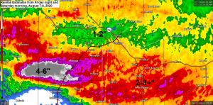
Rainfall and Storm Reports from around the Northland
Strong thunderstorms producing vivid lightning and torrential rainfall impacted much of northeast and east-central Minnesota into northwest Wisconsin early Saturday morning with as much as 6 inches of rain reported in a corridor from Kettle River to Barnum south to Moose Lake. Over 600 Lake Country Power members are without…
-
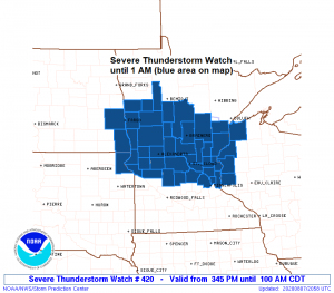
Update on Tonight’s severe weather and heavy rain potential
4:08 PM Friday – A Severe Thunderstorm Watch has been issued for portions of central Minnesota, southeast North Dakota, northeast South Dakota and northwest Wisconsin effective this Friday afternoon and Saturday morning from 3:45 PM until 1 AM. Primary threats include Scattered damaging wind gusts to 70 mph likely Scattered…
-
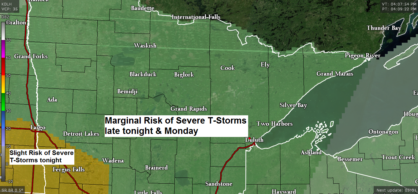
Thunderstorms late tonight and Monday (heavy rain possible) more rain chances midweek
A wet week ahead – Rain chances tonight and Monday, Wednesday-Thursday and on Saturday. Foggy as well, especially tonight and Monday. Warm front (red line on map below) will lift north out of Iowa tonight into Monday. A strong low level jet will transport warm and humid air north into…
-
Rainfall and Storm reports from around the Northland from Thursday, July 4, 2019. Showers ending this evening, patchy fog overnight; warm Friday; cooler lake wind Saturday
/Issued 6:29 PM CDT, Thursday, July 4, 2019/ Note: Another 80 degree day in Duluth today which makes it 9 days in a row with a high temperature of at least 80 degrees. Will probably hit 80 again Friday which would extend the streak to 10 consecutive days with a…
-
Mild temps continue Tuesday with a risk of afternoon-evening showers/t-storms. Potentially active/wet pattern ~May 17-22
/Issued 4:40 PM CDT, Monday, May 13, 2019 Moisture and instability isn’t the greatest Tuesday with dew points generally in the 40s (possibly up around 50 degrees) CAPE of 100-500 J/kg, this combined with stronger NW flow aloft and an approaching cold front should be enough to cause scattered showers…