Tag: hurricane Dorian
-
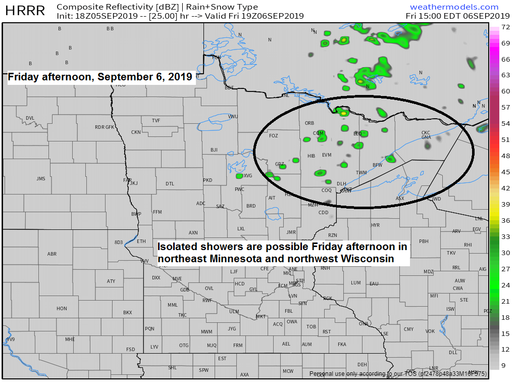
Storm reports from Thursday (numerous reports of hail in southern portions of the Northland today) Spotty showers Friday PM; mainly dry this weekend
Local Storm Reports for September 5, 2019 Source: https://www.weather.gov/dlh/ 2:08 PM — HAIL. 1.00 inch. 3 N Winter, WI (Sawyer County) Mostly pea-sized with a few larger stones to quarter-sized. 1:47 PM — HAIL. 1.00 inch. 1 NW Northwoods Beach, WI (Sawyer County) Mostly pea-sized hail with some larger to…
-
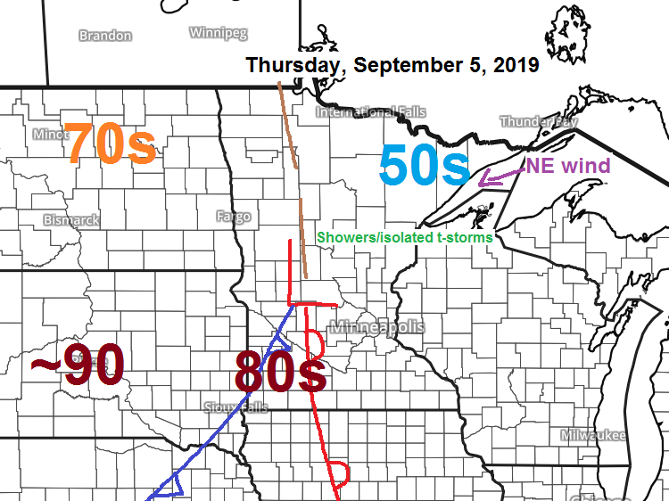
Some rain Thursday; spotty showers Friday PM
Some more rain is on the way for Thursday. Source: 18z NAM-WRF model; https://weathermodels.com Here’s a look at Thursday’s radar forecast per 18z NAM-WRF model — Occasional showers through the day with some dry hours mixed in. If you like warm weather, head to southern Minnesota or South Dakota Thursday…
-
Few showers this evening; risk of strong to severe t-storms Monday night; frost potential Wed AM; Dorian update
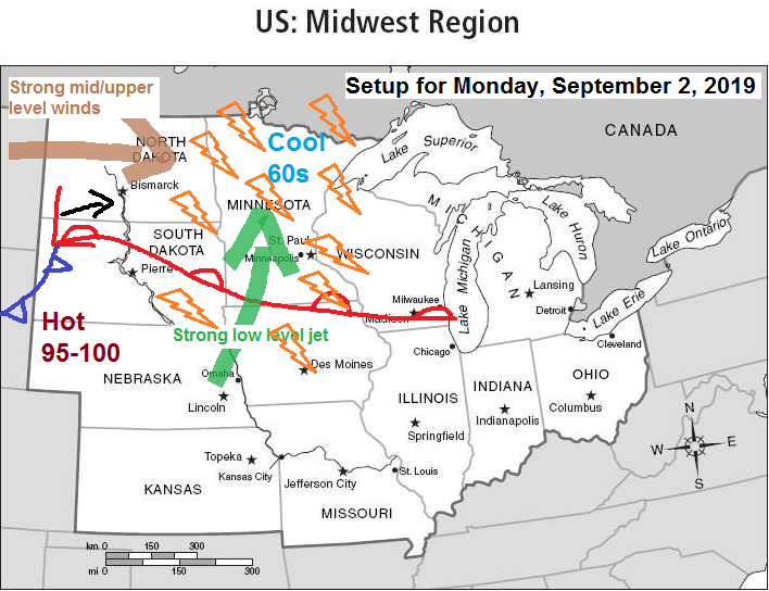
Strong to severe thunderstorms remain a possibility across the Northland from Monday evening through early Tuesday morning. Hazards include large hail, damaging wind gusts, lightning and heavy rain. Stay Weather Aware Monday night! Low pressure is forecast to deepen while moving E/NE out of the western Dakotas from Monday into…
-
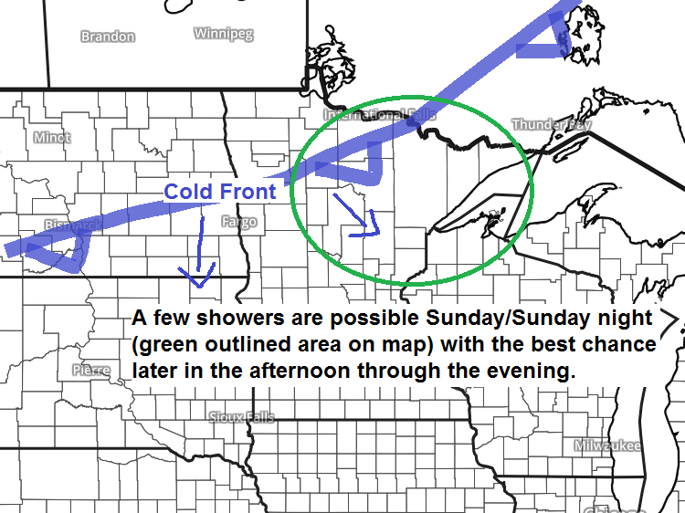
A few showers possible Sunday; strong to severe t-storms possible Monday night
A cold front will move southeast across the Northland Sunday afternoon into Sunday night with a chance of a few showers as that front moves through. A risk of strong to severe thunderstorms returns to the Northland Monday night. An elevated mixed layer will be in place Monday over the…
-
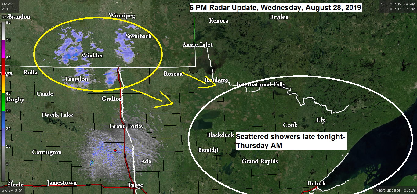
Gusty winds Thursday with scattered morning showers (isolated t-storms) Hurricane Dorian update
A cold front will move quickly southeast and through the Northland Thursday morning bringing scattered showers and isolated thunderstorms to northeast Minnesota and northwest Wisconsin. Note: Greatest chance for some rain in Duluth is from around 3 to 8 AM Thursday. Source: 18z NAM-WRF model; https://weathermodels.com Note: Radar forecast below…