Tag: record snowfall
-

Snowfall Reports from Friday morning (a new daily snowfall record set at Duluth, MN today) Another round of snow/rain Saturday morning followed by scattered rain/snow showers Saturday afternoon through Sunday; Significant Lake effect snow event possible along the South Shore of Lake Superior Sunday evening-early Tuesday
6:16 PM Friday, October 14, 2022 Nothing like going from temps of around 80-degrees earlier this week (Tuesday), to thunderstorms Tuesday night, to a 1-to-3-inch snowfall just a few days later, all in the same week! This morning’s snowfall was just a friendly reminder from Mother Nature that winter is…
-
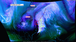
Blustery and cool with lingering snow showers and drizzle tonight; Some sun returns Thursday; Warmer Friday (highs in the 40s!)
5:35 PM Wednesday, March 30, 2022 Some nicer weather is on the way after today’s early spring winter storm which produced up to a quarter inch of ice accumulation in parts of the Northland, and around a half-foot of wet snow in other parts of the Northland, and we even…
-
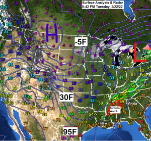
Blustery and very cold; snow ends tonight; some sun returns the next few days
5:57 PM Tuesday, February 22, 2022 The long duration snow event which has been affecting much of the Northland since early Monday morning will finally come to an end by later tonight. 62.1″ of snow so far this winter (since Dec. 1) at Duluth, Minnesota, normal snowfall to date is…
-
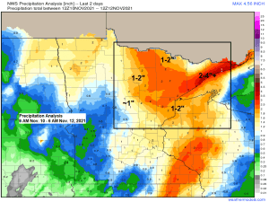
Northland Snowfall and Precipitation Totals from Wednesday night-Friday morning, November 10-12, 2021
A powerful fall storm brought heavy rain and snow to northeast Minnesota and northwest Wisconsin from Wednesday evening into early Friday morning. Snowfall totals of >6″ were reported in parts of north-central Minnesota, while precipitation totals of >3″ were reported along the North Shore of Lake Superior in northeastern Minnesota.…
-
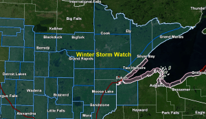
Winter Storm Watch issued for parts of the Northland for Thursday-Thursday night; Snowfall totals from 10/20/2020
12:49 PM 10/21/2020 – We’ve seen quite a change in the forecast models (except for the GFS model) regarding Thursday’s system as they have pushed the system further south which has shifted the main axis of snow further south compared to how it looked 24 hours ago. The GFS model…
-
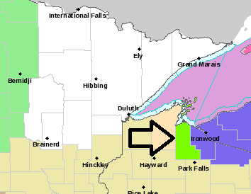
Chilly tonight, snow and blowing snow lingers along the South Shore; much warmer this weekend; turning colder late Sunday with some light wintry precip possible
-Lakeshore Flood Advisory in effect until Midnight tonight for the South Shore of Lake Superior including Ashland and Iron Counties in northwest Wisconsin (light green area on map) Waves of 9 to 12 feet will cause lakeshore flooding from Saxon Harbor to the Mouth of the Bad River to Chequamegon…