Tag: wind
-
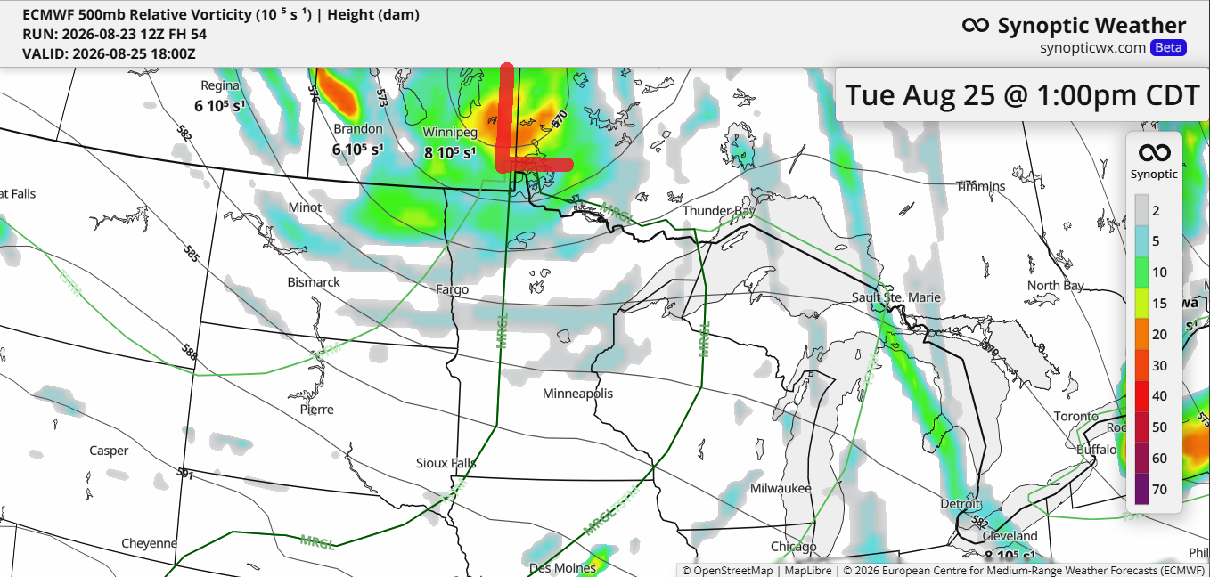
🌦️ Tuesday Brings Hit‑or‑Miss Rain and Thunderstorms
Rain chances return to the Northland on Tuesday, though coverage will be scattered, meaning some areas will see rain while others remain dry. This system is driven by a cold front and a low-pressure area tracking from Manitoba into Ontario, along with a mid- to upper-level low and trough moving…
-
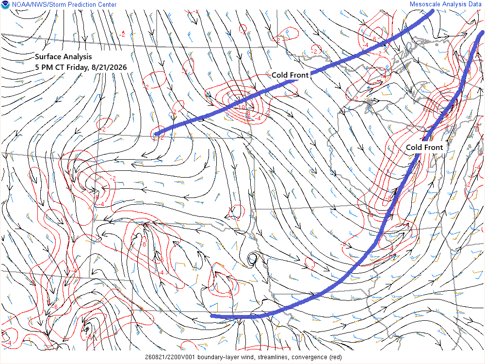
🌦️ A Few Gusty Showers and Isolated Thunder Tonight; Thursday’s Storms Delivered Large Hail
Thursday’s cold front has moved well southeast of the Northland, but a secondary front is closely following from northern Minnesota this afternoon. It will continue moving southeast across the region this evening, bringing a few gusty showers and isolated thunderstorms. While severe weather is not expected, wind gusts could reach…
-
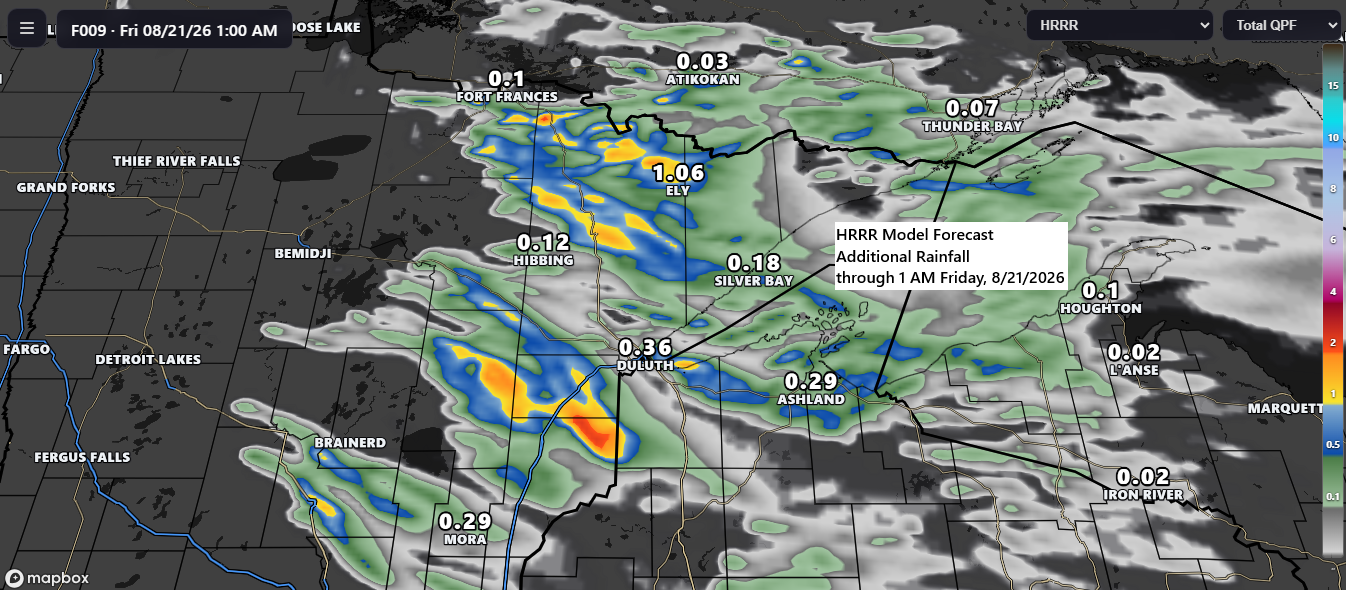
🌧️🌩️ Scattered Storms Continue This Evening; ⚡🧊 Isolated Severe Threats with Quarter-Size Hail and Winds Up to 60 mph
Scattered showers and thunderstorms are forecast to continue across the Northland through this evening, progressing southeastward. These storms may produce brief periods of heavy rainfall, with isolated strong to severe thunderstorms possible. The primary hazards include hail up to half-dollar size (1.25″ in diameter) and wind gusts approaching 60 mph.…
-
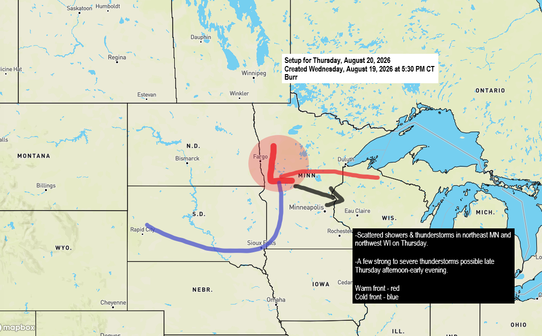
⚡ Morning Showers Then a Conditional Severe Threat Thursday Afternoon and Evening
There’s a chance of rain in the Northland on Thursday as a low-pressure system moves east-southeast from northern North Dakota, resembling a mid-August clipper. This system is expected to bring two rounds of precipitation. The first will occur during the morning and early afternoon, with scattered showers and isolated thunderstorms…
-

🌧️ Heavy Downpours Hit NE Minnesota Monday; Chisholm Tops the Region With 1.99″
On Monday, scattered showers and thunderstorms moved east-southeast across the region, bringing heavy downpours to parts of northeast Minnesota. Areas north of Duluth received half an inch or more of rain, while a separate corridor of heavier rain developed from west-central to central Minnesota. It was a close call for…
-
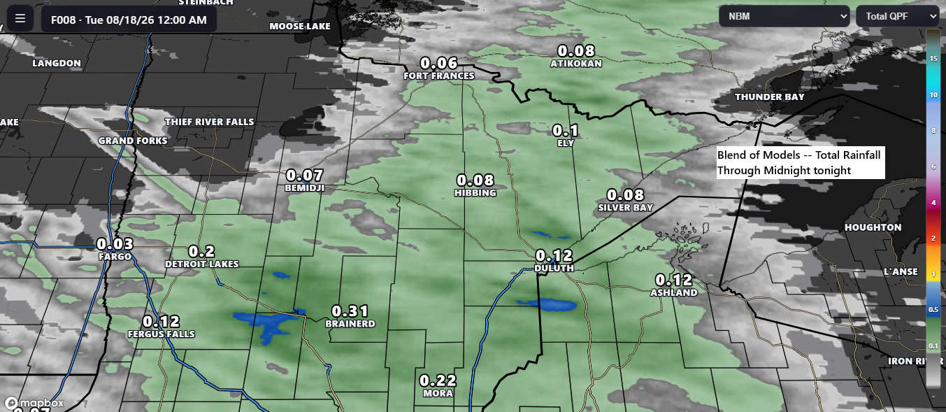
🌩️ Scattered Showers and Occasional Thunder Expected with Tonight’s Front
Another cold front is set to move through the Northland tonight. Ahead of it, warm southwesterly breezes prevail, while behind the front, winds shift to a cooler northwesterly direction. Expect scattered showers and occasional thunderstorms with tonight’s front, with rain generally moving east to east-southeast. Widespread heavy rain is unlikely;…
-
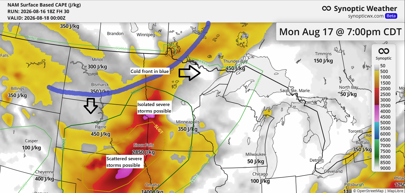
🌬️ Cold Front Arrives Monday Evening; Scattered Showers Here, Stronger Storms Farther Southwest
A cold front will move through the Northland Monday evening. Ahead of it, dew points will mostly be in the 50s to around 60, with the highest instability from western to southwestern Minnesota and areas farther south. In our area, expect scattered showers and isolated, non-severe thunderstorms late Monday afternoon…