5:31 PM Thursday, June 27, 2024
Rain is set to return to the Northland late this evening and will persist into Friday night. The heaviest rainfall is anticipated on Friday morning, followed by more intermittent showers in the afternoon and evening.
Sunday is expected to remain largely dry in the Northland, while Saturday may experience a few showers, though a continuous or heavy downpour is not anticipated.
For the Duluth area: Rain begins late this evening/overnight (around 11 PM to 2 AM) Rain through about mid-morning Friday followed by a chance for scattered showers Friday afternoon/evening.
HRRR model simulated radar forecast valid 7 PM Thursday to 7 AM Saturday.

A significant portion of northeast Minnesota and northwest Wisconsin is forecasted to receive approximately half an inch to an inch of rain by Friday evening, with some areas potentially seeing amounts surpassing an inch.

The HREF model forecast generally predicts the upper potential for rainfall amounts with this system to be around 2 to 2.5 inches.

Significant moisture, with precipitable water values exceeding 1.50 inches, is expected to move northeastward into the Northland later tonight into Friday morning, heightening the likelihood of heavier downpours.

The upcoming rainy system is set to move northeast from the northern Rockies and western High Plains, with several low-pressure areas passing over the upper Midwest on Friday and departing eastward on Saturday. The low-pressure system is notably intense for late June, exhibiting a central pressure of approximately 29.32 inches late this afternoon.

A significant mid/upper-level trough is expected to move east-southeast from southwest Canada by Friday night. The trough will enhance lift over the Northland area late tonight and into Friday, aiding in rain production.

Goes-16 water vapor loop from Thursday, June 27, 2024, loop time ends 4:40 PM CT.

There is a possibility of experiencing some thunderstorms in northeast Minnesota and northwest Wisconsin on Friday and into the evening, though the likelihood of severe thunderstorms remains low.
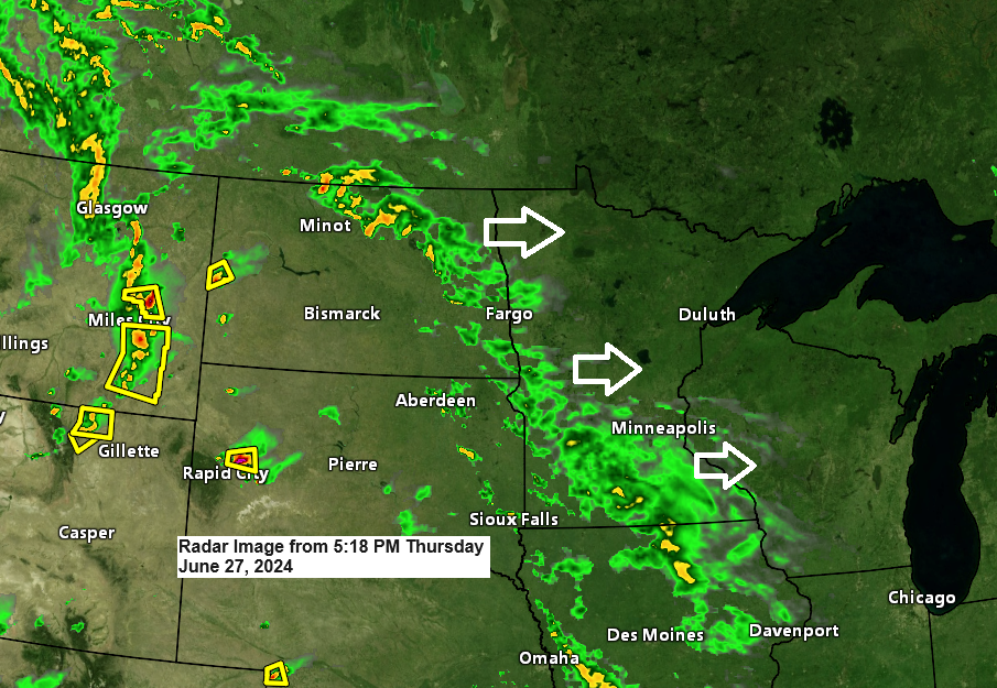
Numerous severe thunderstorm watches and a tornado watch will remain in effect throughout the evening across regions of the Rockies, northern Plains, and western High Plains.

Early next week, we’re anticipating another large-scale low-pressure system, which appears to be quite similar to the one that will impact us in the coming 24 hours.

Rain is expected to move from west to east across the Northland area on Monday evening and overnight.
The forecast for rain in the Duluth area indicates that rain is expected to arrive in the Twin Ports on Monday evening, likely between 8-10 PM. Note: The timing of the rainfall may shift in the coming days.
European computer model simulated radar forecast valid 1 PM Monday to 1 AM Tuesday.

Thanks for reading!
Tim
Leave a Reply