Tag: mix
-
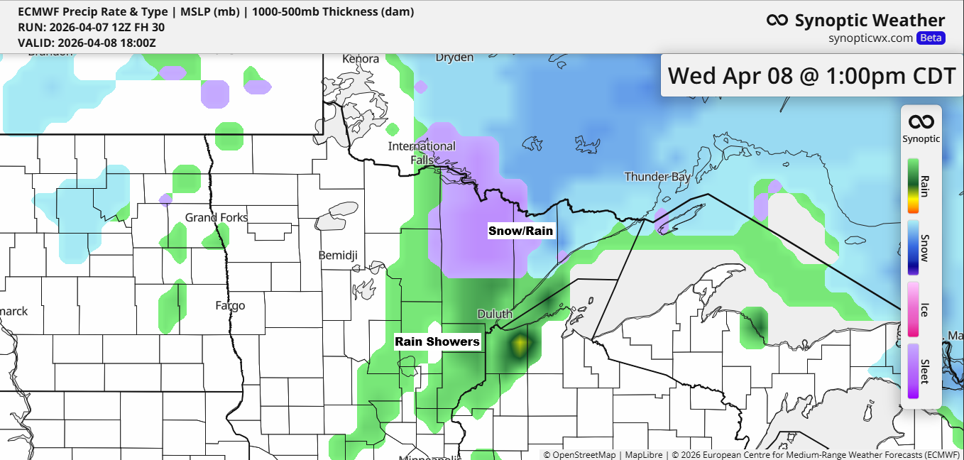
Wednesday Brings Precipitation; Weekend Brings Thunderstorms
The high pressure that brought bitter cold to the Northland this morning has moved east, making way for milder air as southerly winds pick up ahead of a low-pressure system moving in from the west. This system is set to bring precipitation on Wednesday, with a wintry mix in the…
-
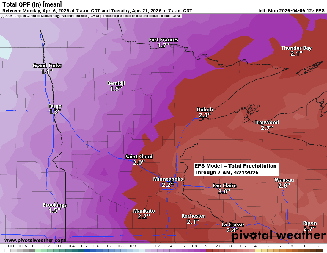
Quiet but Chilly Tonight; Active Days Coming Up
After a short break from the active weather pattern, it appears set to return over the next two weeks, with multiple systems potentially impacting the Northland and bringing a chance for significant precipitation. Ensemble models are predicting over 2 inches of precipitation in northeast Minnesota and northwest Wisconsin through April…
-
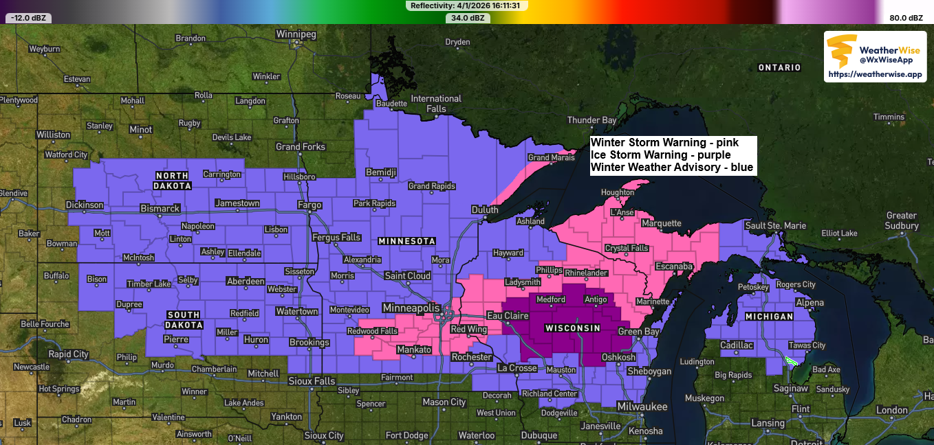
Winter Storm Update: Revised Snowfall Forecast as of 5 PM, Wednesday, April 1, 2026.
A messy winter storm will hit the Northland tonight and last through Thursday evening, with the heaviest precipitation expected from Thursday afternoon until around mid-evening Thursday. Duluth area: Snow will start to develop tonight, with up to an inch of accumulation possible by 8 AM Thursday. Snow will continue through…
-
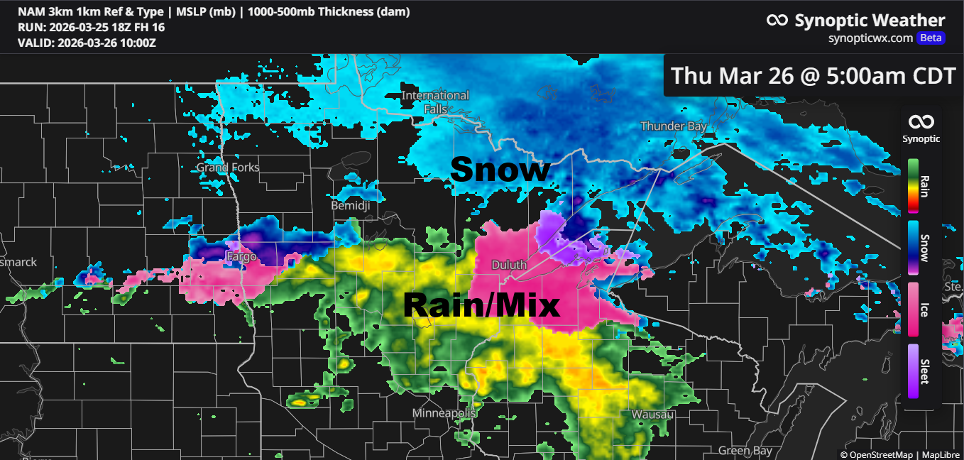
Late‑night mix tonight; snow chances Friday and an active pattern next week
Confidence is fairly low about how things will unfold late tonight into Thursday morning, but there’s a chance we could see some rain and a wintry mix in parts of northeast and east-central Minnesota, stretching into northwest Wisconsin. This would happen as a frontal boundary slowly drifts south, with warm…
-
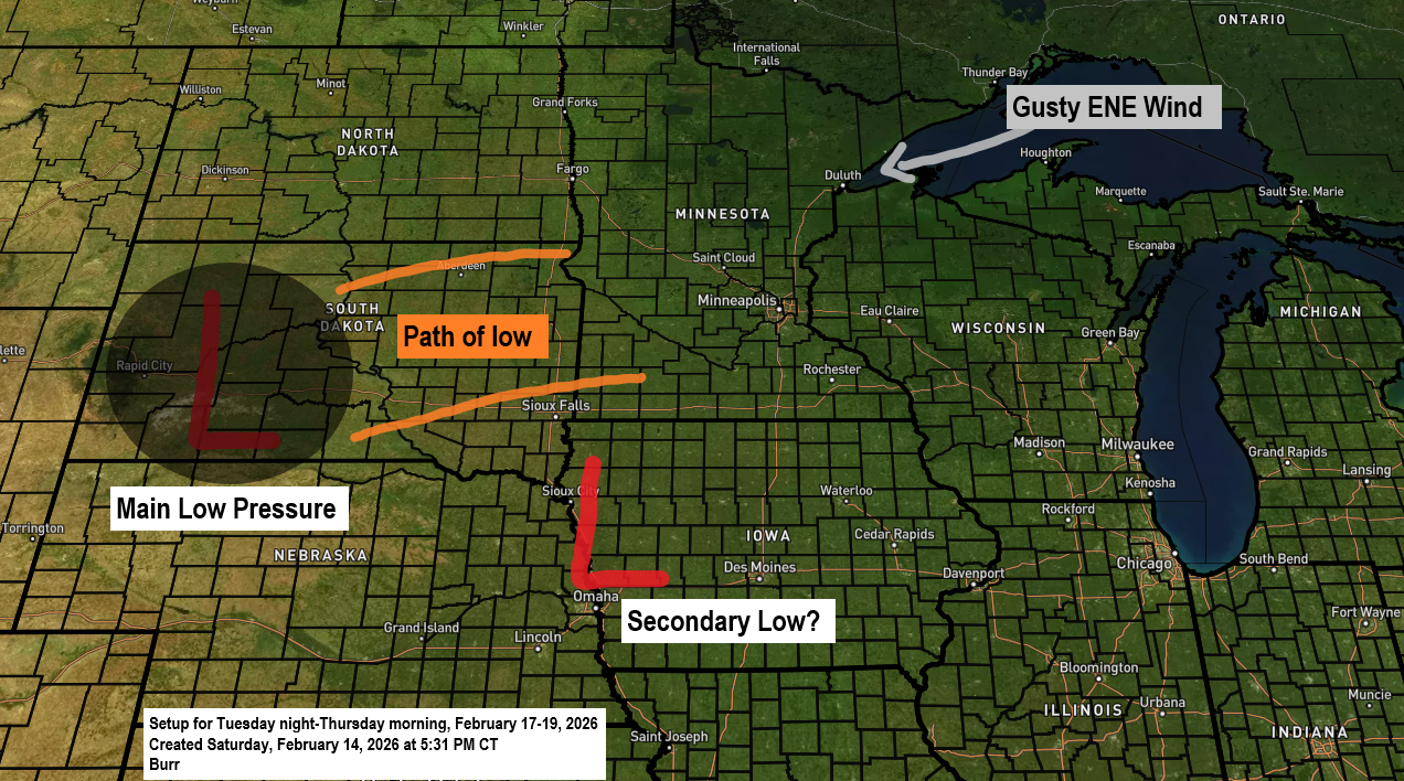
Potential Midweek Winter Storm for the Northland
The main story is still the potential winter storm expected to roll in around midweek, but it’s worth noting today’s record-breaking warmth in the Northland. Ashland, Brainerd and Hibbing all set new daily high temperature records for February 14th, with more details on that coming later in this post. Here’s…
-
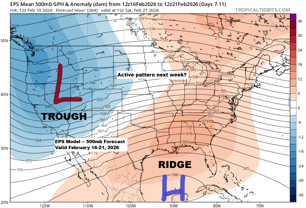
Upcoming Active Weather Pattern in Upper Midwest
It looks like there’s potential for an active weather pattern to develop across the upper Midwest next week, especially from the middle to the end of the week based on current trends. A general pattern of troughing in the West and a ridge over the Southeast U.S. appears to be…
-

A few chances of light snow or a wintry mix are expected this week, with temperatures fluctuating up and down.
Southerly winds will bring milder air into northeast Minnesota and northwest Wisconsin tonight and Monday, along with a bit of moisture. Combined with a frontal boundary lingering across northern Minnesota, this could lead to some light wintry precipitation—snow, sleet, or freezing rain—at times through Monday night. The chance of precipitation…