Category: hail reports
-
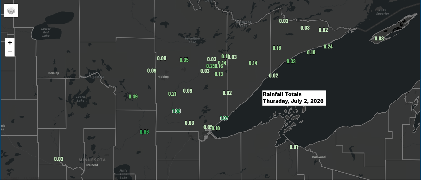
Northern MN Rainfall Totals and Local Storm Reports, July 2, 2026
Rainfall reports from the evening of Thursday, July 2, 2026 Meadowlands, MN: 1.08″Palmers, MN: 1.07″Grand Rapids, MN: 0.49″Hermantown, MN: 0.23″Beaver Bay, MN: 0.23″Toivola, MN: 0.21″Grand Marais, MN: 0.20″Hog Creek, MN: 0.16″Isabella, MN: 0.14″Keewatin, MN: 0.11″Floodwood, MN: 0.09″Nashwauk, MN: 0.09″Eveleth, MN: 0.09″Duluth Airport: 0.05″Aurora, MN: 0.03″French River, MN: 0.02″Esko, MN: 0.01″…
-
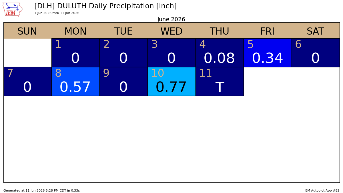
Rainfall Totals and Storm Reports for June 10, 2026
June has kicked off on a soggy note in Duluth, with three rainfall events adding up to over a quarter inch so far, and two of those topping half an inch. Following Wednesday’s thunderstorms in Duluth, here’s an update on the latest rainfall statistics. Month to dateTotal: 1.76″Departure: +0.33″ Year…
-
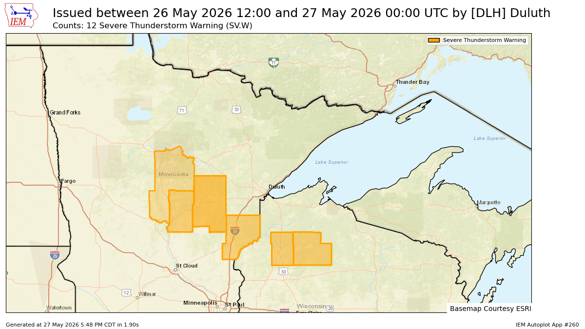
Severe Storm Reports: Hail & Wind Damage – May 26, 2026
On Tuesday afternoon, May 26, 2026, the National Weather Service in Duluth, MN issued 12 severe thunderstorm warnings, all concentrated in the southern part of their forecast area. Local storm reports for May 26, 2026 6:35 PM: Hail 0.50 inch. 7 NE Sarona, WI (Washburn County) 6:06 PM: Hail 1.25…
-
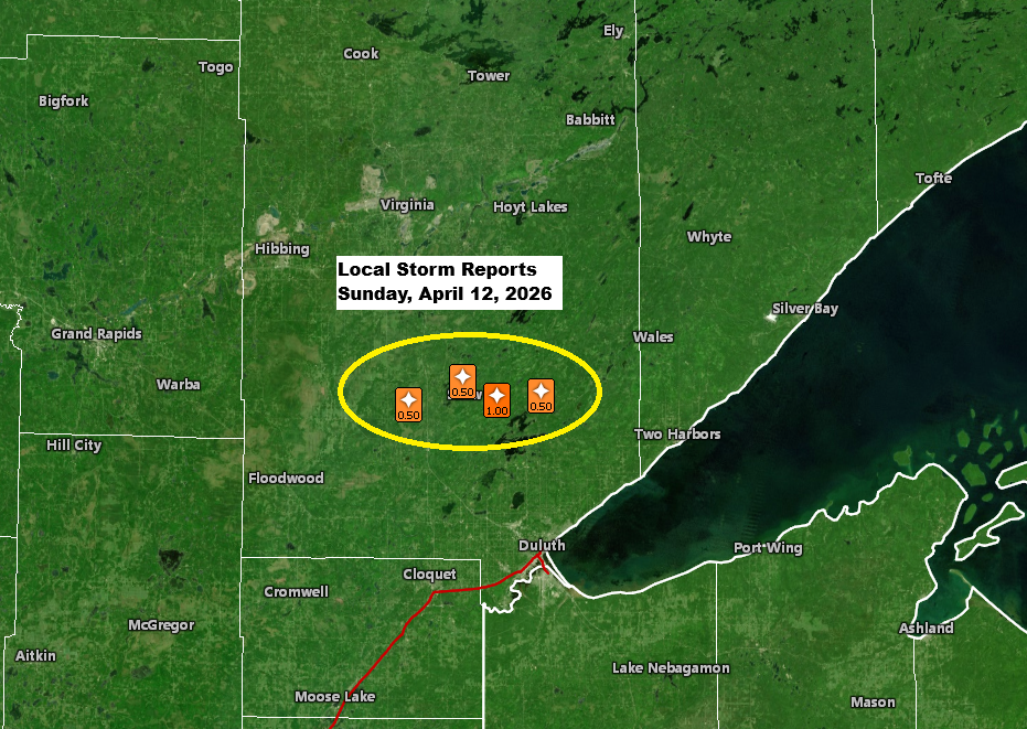
Local storm, rainfall, and temperature reports.
Late this afternoon, a single strong thunderstorm popped up near the warm front stretched across northeast Minnesota. This cell first appeared around 4:30 PM today near Hill City, Minnesota, before moving east-northeast. The storm hit peak intensity between about 6:00 and 6:45 PM, with cloud tops reaching around 40,000 feet…
-
Northland Weather: Changes Ahead This Week
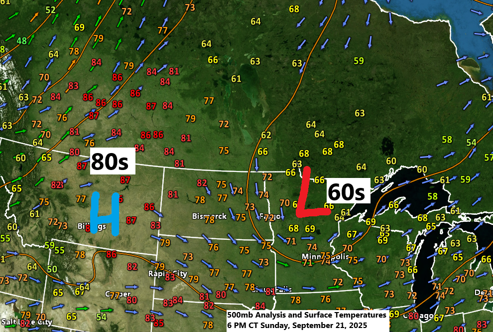
The weather pattern today remained consistent, with an upper trough/low over the upper Midwest and an upper-level ridge across the northern Rockies. Temperatures this afternoon ranged from the 60s to around 70 under the trough in northeast Minnesota and northwest Wisconsin, while the northern Rockies enjoyed warmer 80s under the…
-
Heavy Rainfall and Hail Reports for Northland: September 12, 2025
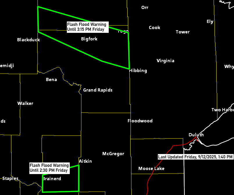
Friday brought plenty of action to the western parts of the Northland as showers and thunderstorms rolled in. Some storms escalated to severe levels, unleashing large hail and heavy downpours, which raised concerns about flash flooding. The affected areas include a stretch from Northome to Effie and Bigfork, as well…
-
Local Storm Highlights: Hail and Rainfall Reports from April 17
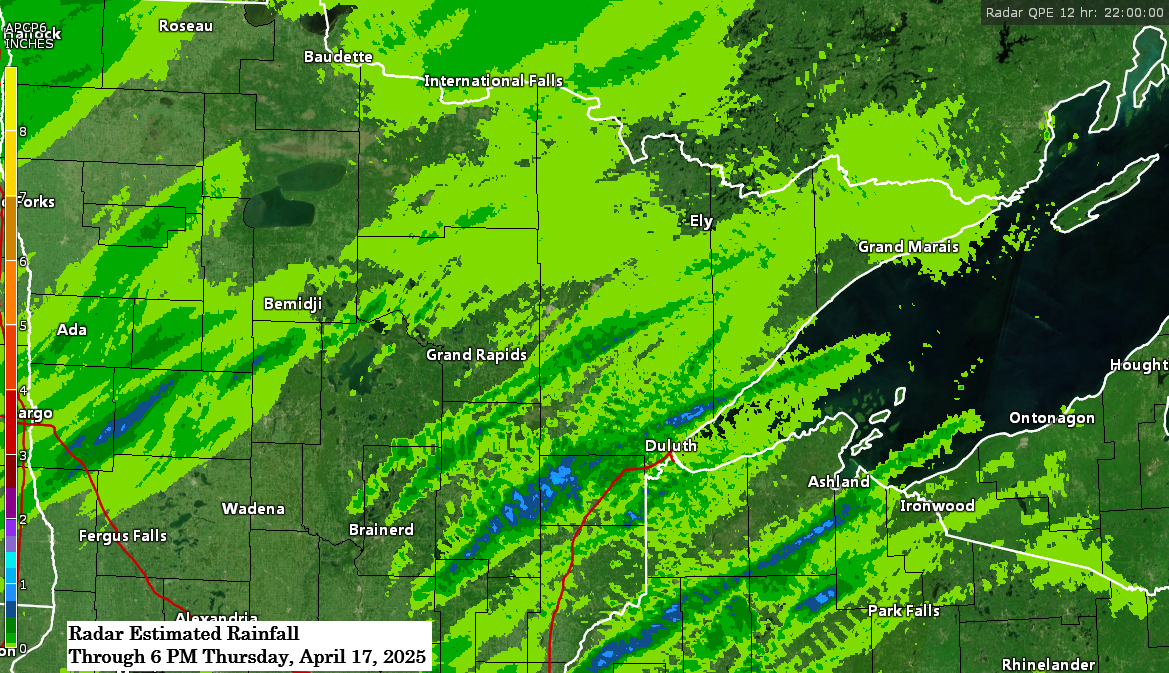
6:20 PM Thursday, April 17, 2025 Showers and thunderstorms moved northeast through parts of the Northland this afternoon. These storms developed along the leading edge of increased instability that advanced northeastward from southern Minnesota earlier today. This instability was primarily elevated, and in combination with a plume of very steep…