Category: heat
-

Northern Minnesota Severe Thunderstorm Watch, More Rain Possible Midweek
A severe thunderstorm watch is in effect until 9 PM tonight for northern Minnesota and eastern North Dakota. The main threats include scattered damaging wind gusts between 60 and 75 mph, large hail measuring 1 to 2 inches in diameter (about the size of a quarter to a hen’s egg),…
-
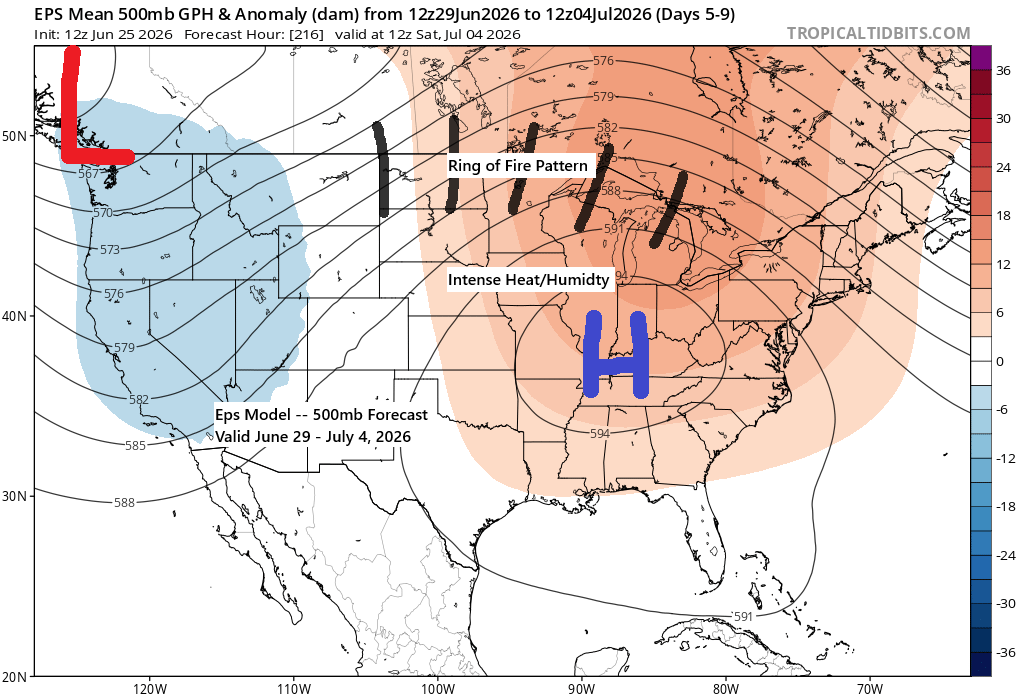
Heads-Up: Severe Threat Taking Shape Across the Upper Midwest
Northeast Minnesota and northwest Wisconsin are at risk for severe thunderstorms on Monday, June 29. This outlook serves as a heads-up since there are still questions about the timing of the storms and the primary threats. Given the forecasted setup, it’s no surprise that a severe weather risk area has…
-
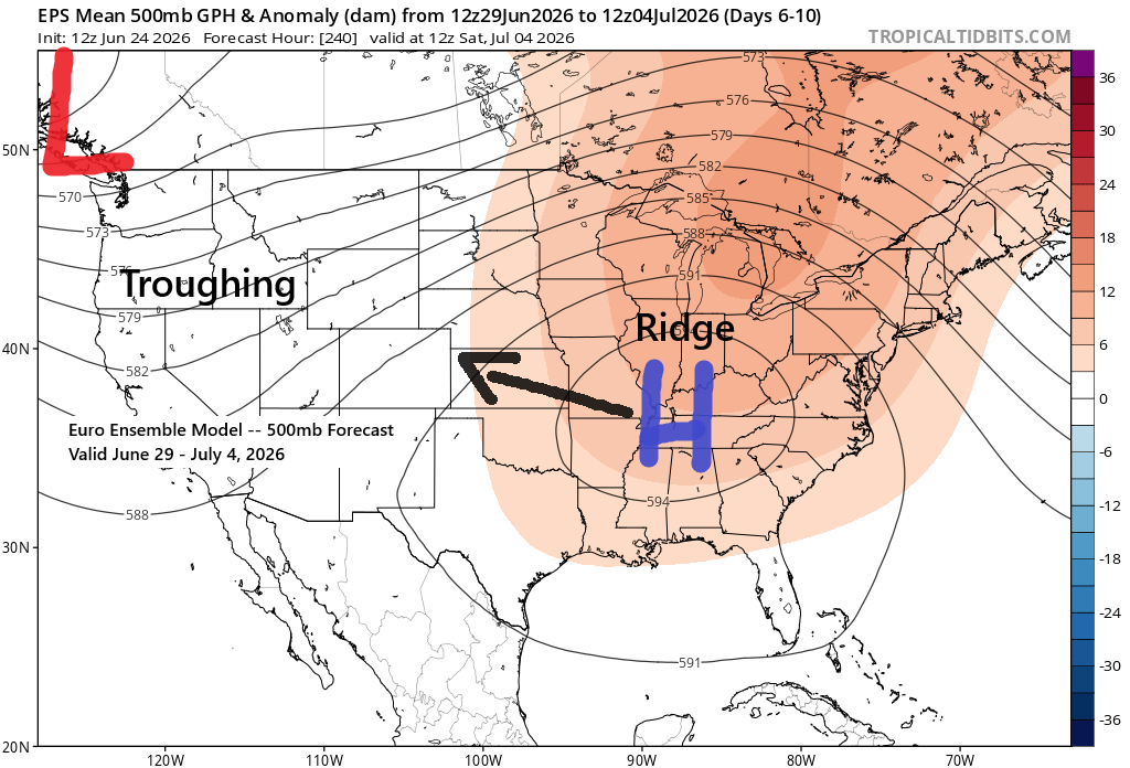
Heat Pushes North as Midwest Ridge Strengthens Ahead of the Holiday
Heading into next week, computer models continue to show signs of a pattern shift, with an upper-level ridge developing across the Midwest and South and troughing out West. This setup will push much warmer air northward into the Upper Midwest, with 500mb heights likely topping 582 decameters and possibly exceeding…
-
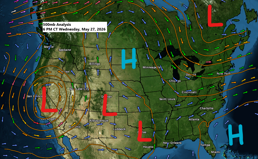
Northern Plains Heat Dome: Ridge Keeps Most of the Northland Warm and Mostly Dry
The weather pattern remains highly amplified and isn’t expected to change through at least this weekend. The Northland will stay under an upper-level ridge, keeping conditions dry, though a backdoor cold front moving south and west could trigger a few isolated showers or thunderstorms Friday afternoon and evening, mainly along…
-
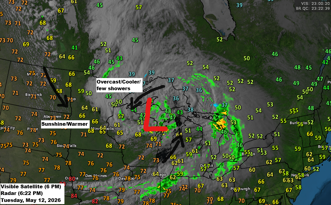
Expect more temperature swings ahead, along with the possibility of an active long-range pattern.
A few showers will linger over parts of the Northland this evening as today’s system heads east. We’ll enjoy a dry Wednesday and most of Thursday before another cold front moves in Thursday night, bringing a chance for scattered showers again, though rainfall totals with this front aren’t expected to…
-
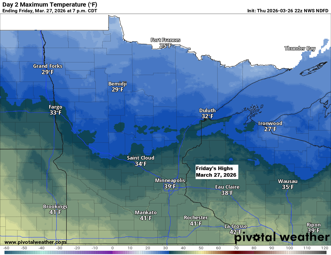
Scattered snow showers and a chilly Friday ahead
It’ll be chilly tonight and Friday, but things will start to warm up over the weekend. By Sunday, east winds will bring cooler air back to areas near Lake Superior, while inland spots will see highs in the 40s and 50s, with a few places possibly hitting the 60s. Tonight…
-
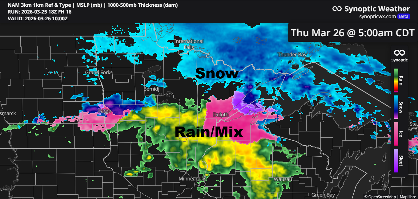
Late‑night mix tonight; snow chances Friday and an active pattern next week
Confidence is fairly low about how things will unfold late tonight into Thursday morning, but there’s a chance we could see some rain and a wintry mix in parts of northeast and east-central Minnesota, stretching into northwest Wisconsin. This would happen as a frontal boundary slowly drifts south, with warm…