Category: long range forecast
-
Mild weather this weekend, with the possibility of wind and snow by the middle of next week.
An active weather pattern is expected next week, with a key period of interest from late Tuesday night through early Thursday morning. During this time, a broad low-pressure system is forecast to move out of the northern Rockies and western High Plains region. Colder air brought in by northeast winds…
-

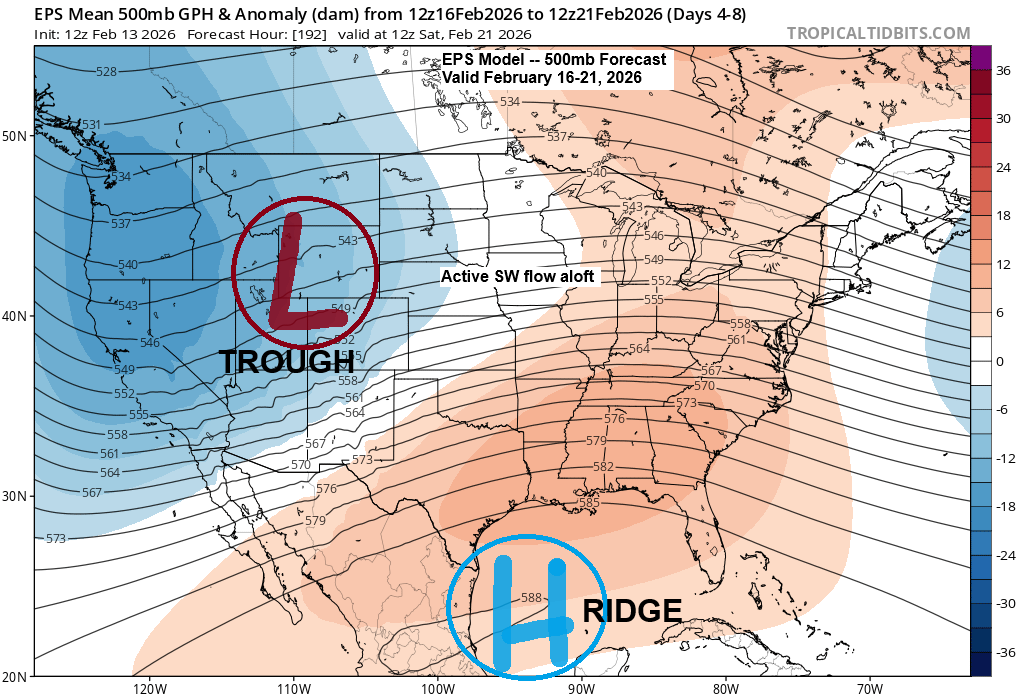
Update on the potential active pattern for next week
Computer models are still showing an active weather pattern for next week, with one period starting to come into focus—likely around the middle of the week, in the February 17–19 range. It looks like a broad low-pressure system will develop, stretching from the northern Rockies to the central Plains early…
-
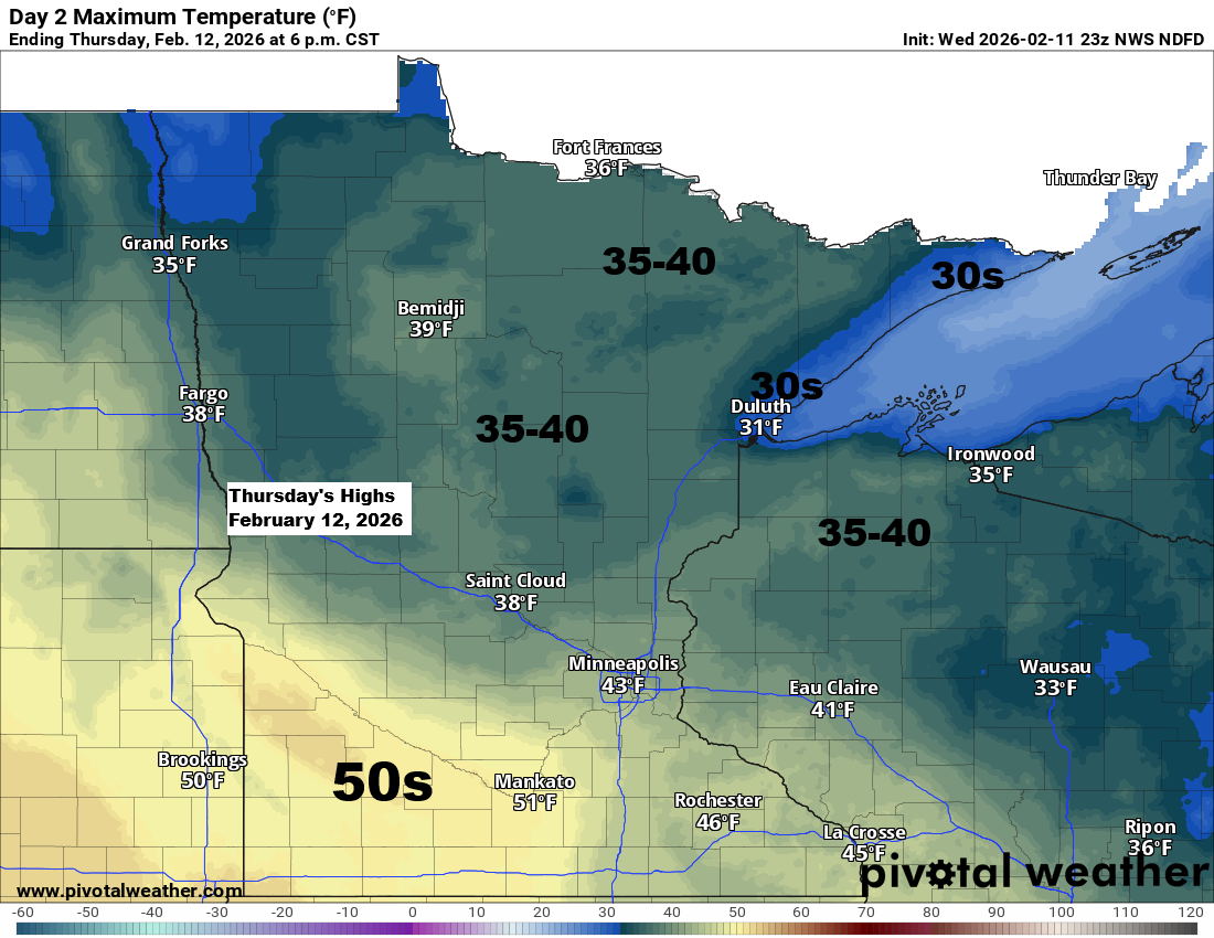
Northland Weather Update: Mild Days Ahead
The next few days will bring mild weather across the Northland, with temperatures in the 30s and 40s, while southern Minnesota can expect warmer conditions in the 50s, and possibly even hitting the 60s this weekend and early next week. The only notable weather issue around here in the next…
-
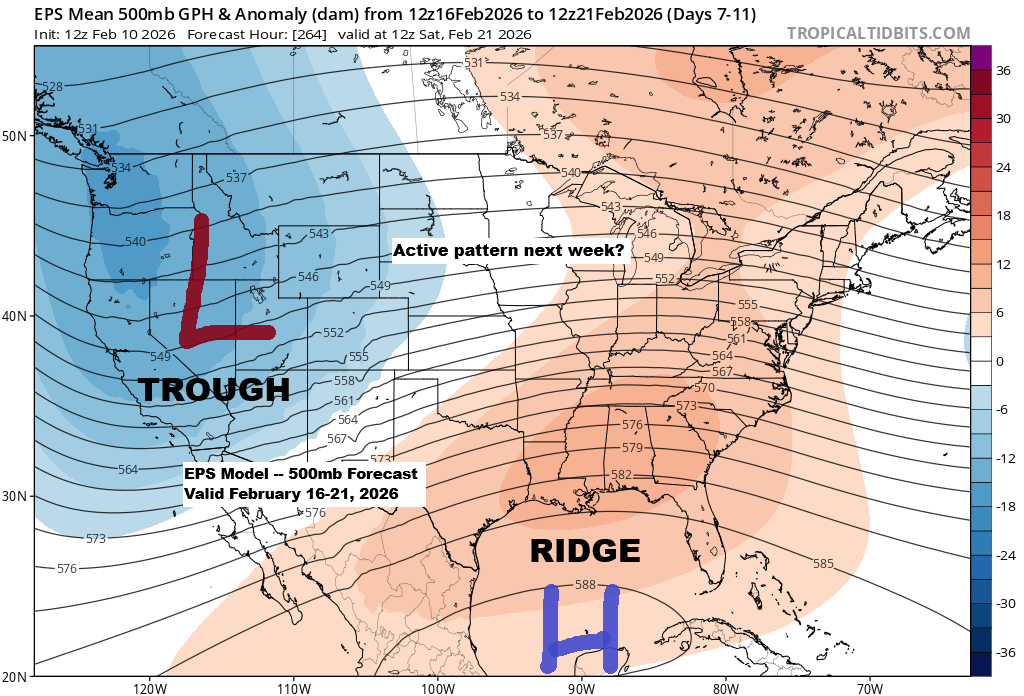
Upcoming Active Weather Pattern in Upper Midwest
It looks like there’s potential for an active weather pattern to develop across the upper Midwest next week, especially from the middle to the end of the week based on current trends. A general pattern of troughing in the West and a ridge over the Southeast U.S. appears to be…
-
It’ll stay mostly dry through early next week, with slightly cooler temperatures over the next few days before a warming trend sets in.
This afternoon, temperatures warmed into the 70s as far north as Nebraska and western Iowa, while the 50s reached into southwestern Minnesota, including towns like Luverne, Jackson, and Worthington. Temperatures were cooler in northeast Minnesota and northwest Wisconsin today compared to areas farther south, but even here we reached the…
-
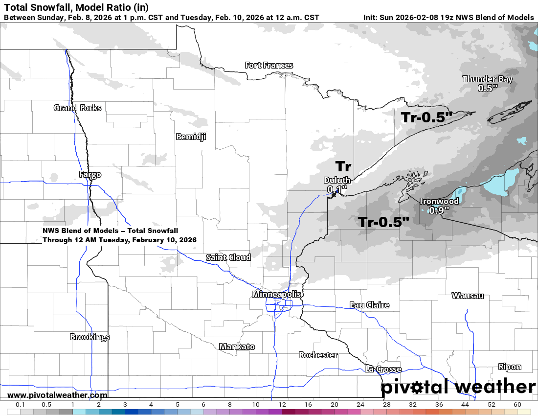
Northland Weather Update: Expect a bit of light rain and snow on Monday.
A weak system with minimal lift will pass through the Northland Monday afternoon and evening, bringing a chance of light rain or wet snow, with a few isolated pockets of sleet possible. It’s not expected to be a major system and should have little to no impact on travel. It…
-
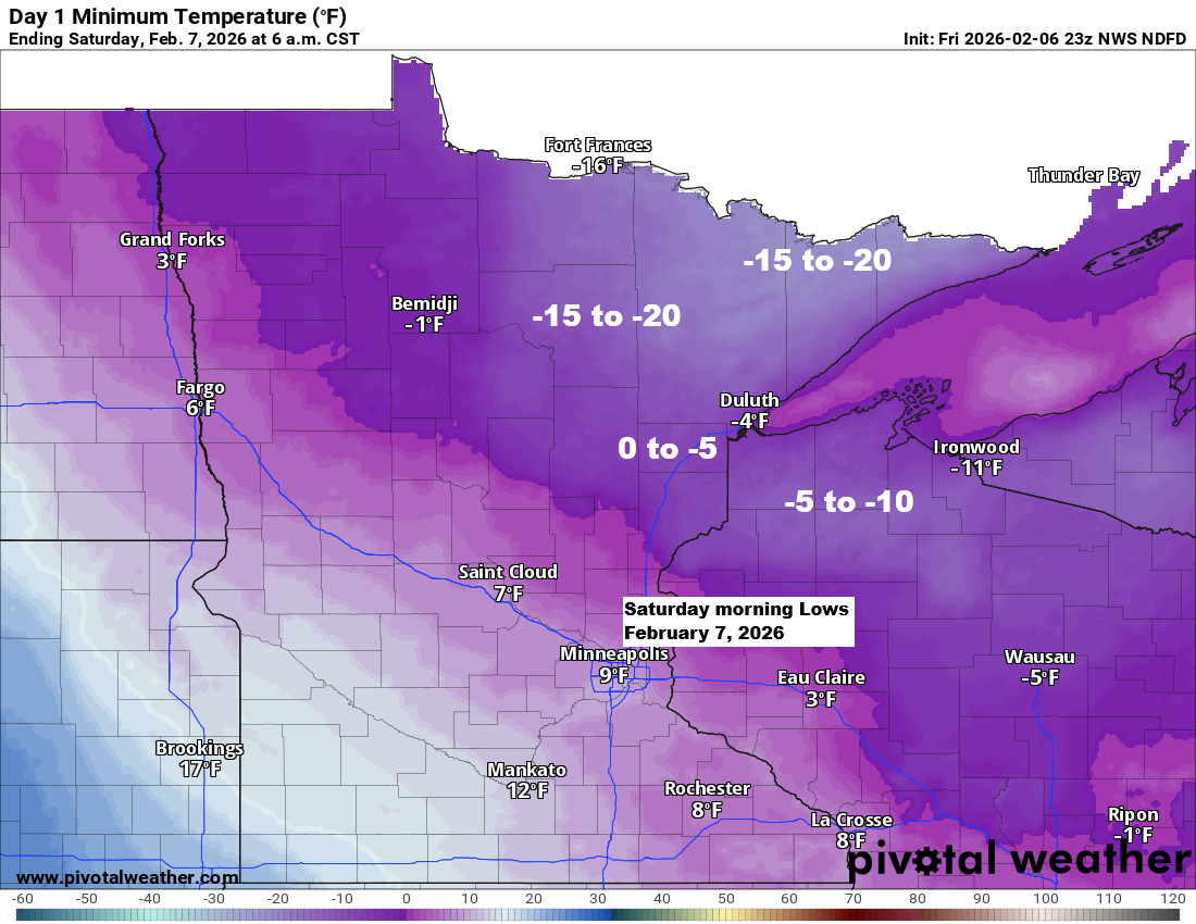
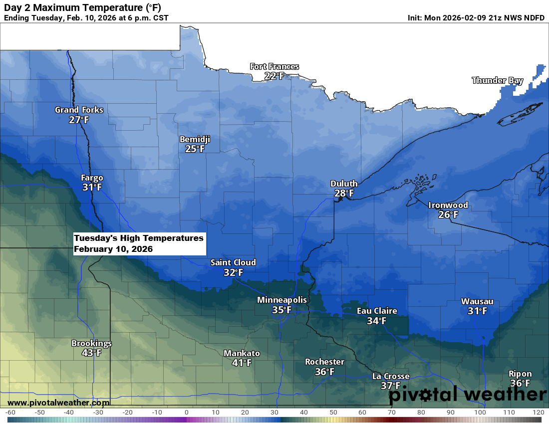
Subzero temperatures return tonight, followed by a gradual warming trend.
Chilly weather made its way back to the Northland today. Today’s highest temperatures hit just after midnight, when it was in the 30s, but they’ve been dropping ever since. By 5 PM, it was about 15 to nearly 30 degrees colder than the same time on Thursday. Subzero temperatures, ranging…