Category: long range forecast
-
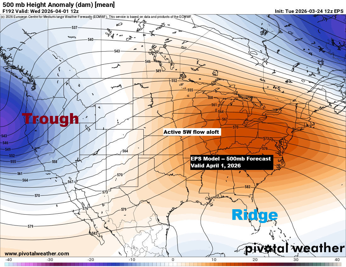
Upcoming Active Weather Pattern in the Upper Midwest
Next week’s weather could turn more active, with a trough developing over the western U.S., sending southwest winds aloft across the Plains and creating ridging in the southeast. This setup might mean a busy period for the upper Midwest, including the Northland, as a few systems could track northeast from…
-
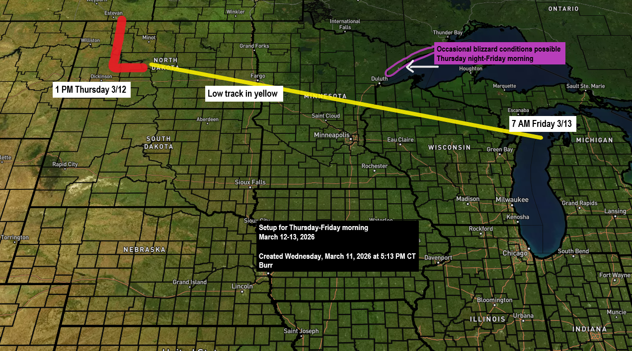
More snow is expected to roll in by mid to late Thursday afternoon.
Latest snowfall numbers for Duluth following the past two snow events. The seasonal total for 2025-2026 has reached 61.2 inches, which is 11.8 inches below to date. We’re just 29 inches short of our average of 90.2 inches and have definitely made some progress lately. So far, Duluth has seen…
-

An active weather pattern
The weather’s been pretty active lately, and it doesn’t look like it’s calming down anytime soon. Today, a pair of low-pressure systems stretch from eastern Colorado to northern Missouri, with a strong warm front cutting across north-central Illinois, creating a sharp temperature contrast—from the upper 30s in Chicago to around…
-
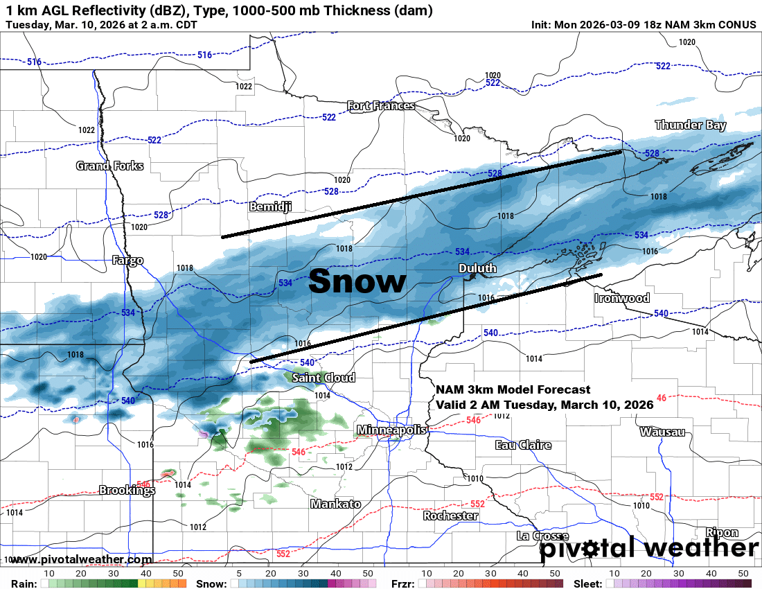
A narrow band of snow is expected late tonight, with more chances for snow continuing through the rest of the week.
A fast-moving, narrow band of snow is expected to sweep across parts of the Northland late tonight and linger into early Tuesday morning. It will follow a sharp temperature gradient, with northwest Minnesota seeing temps in the teens, while central and southern Wisconsin enjoyed highs in the 60s to near…
-

Turning colder and breezy tonight, with some rain, snow, and mixed precipitation. There are also a few chances for snow next week.
From late Wednesday night to early Friday morning, persistent freezing drizzle and dense fog caused major issues in parts of Duluth. Since Thursday, numerous power outages have been reported, and the weight of ice and frost on trees has caused some damage around the city. As temperatures rose this afternoon,…
-
Cold Blast Peaks Tonight; Milder Air Moves In Monday
That was quite a cold front that blasted through the region on Friday. In its wake, temperatures early this afternoon were running about 30 to 35 degrees colder than they were early Friday afternoon. Low temperatures this morning dropped as low as the teens below zero in far northern Minnesota,…
-

Milder the next few days; A little snow Thursday morning; Strong winds Friday; Arctic air returns this weekend
A High Wind Watch has been issued for the North Shore of Lake Superior in northeast Minnesota due to the potential for strong winds on Friday. Northwest winds could gust up to 60 mph from mid‑afternoon Friday into Friday evening. These damaging winds may bring down trees and power lines,…