Category: Record warmth
-
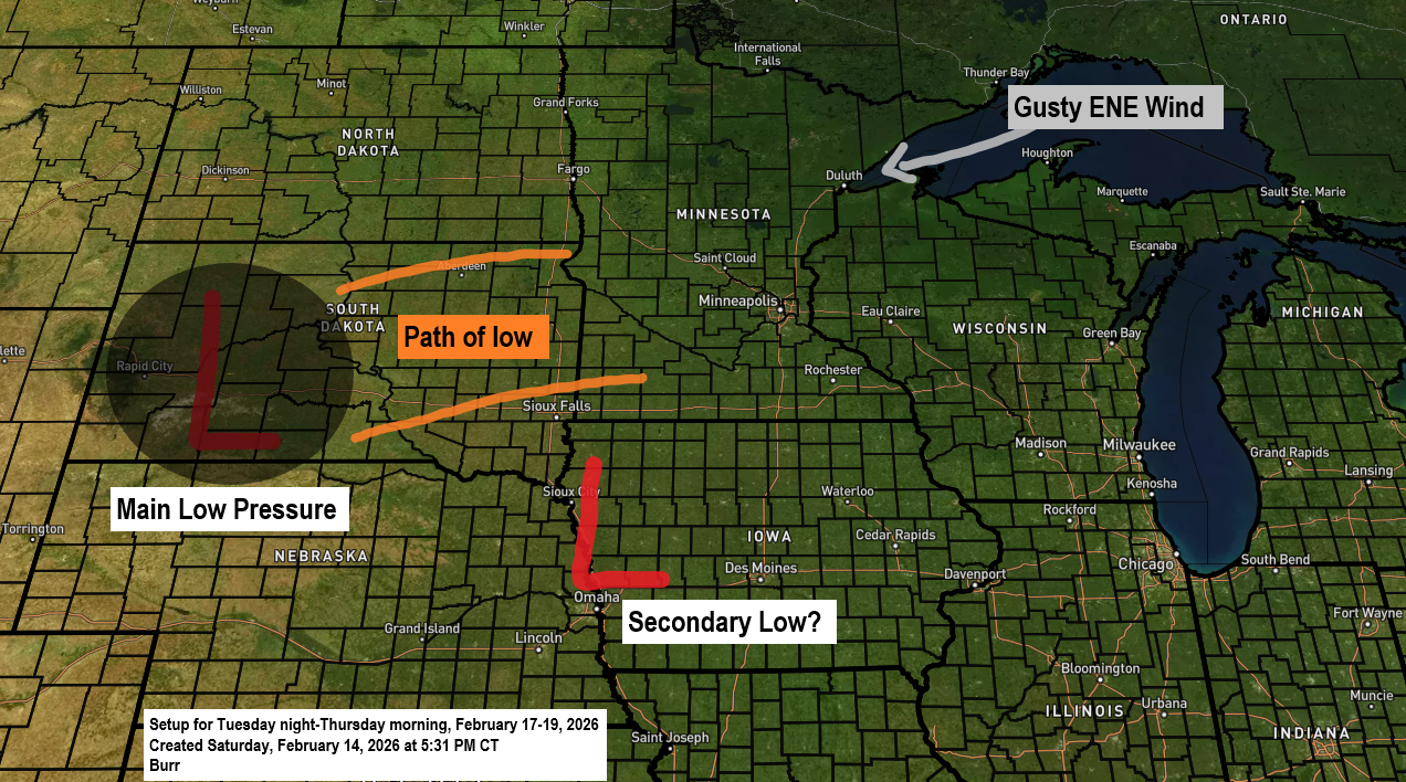
Potential Midweek Winter Storm for the Northland
The main story is still the potential winter storm expected to roll in around midweek, but it’s worth noting today’s record-breaking warmth in the Northland. Ashland, Brainerd and Hibbing all set new daily high temperature records for February 14th, with more details on that coming later in this post. Here’s…
-
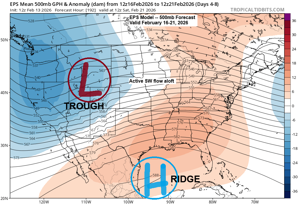
Mild weather this weekend, with the possibility of wind and snow by the middle of next week.
An active weather pattern is expected next week, with a key period of interest from late Tuesday night through early Thursday morning. During this time, a broad low-pressure system is forecast to move out of the northern Rockies and western High Plains region. Colder air brought in by northeast winds…
-

Update on the potential active pattern for next week
Computer models are still showing an active weather pattern for next week, with one period starting to come into focus—likely around the middle of the week, in the February 17–19 range. It looks like a broad low-pressure system will develop, stretching from the northern Rockies to the central Plains early…
-
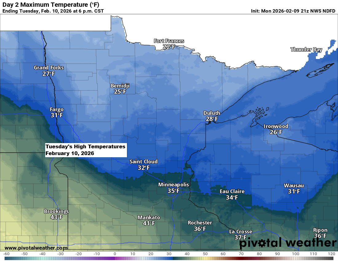
It’ll stay mostly dry through early next week, with slightly cooler temperatures over the next few days before a warming trend sets in.
This afternoon, temperatures warmed into the 70s as far north as Nebraska and western Iowa, while the 50s reached into southwestern Minnesota, including towns like Luverne, Jackson, and Worthington. Temperatures were cooler in northeast Minnesota and northwest Wisconsin today compared to areas farther south, but even here we reached the…
-

Gusty winds and turning colder; Scattered showers of snow, ice pellets and rain tonight
An arctic front will move south across the Northland tonight, bringing scattered showers of snow, rain, and ice pellets to northeast Minnesota and northwest Wisconsin. The precipitation should be fairly brief, though a few heavier snow showers could drop a quick 0.5 to 1 inch of accumulation in some areas,…
-
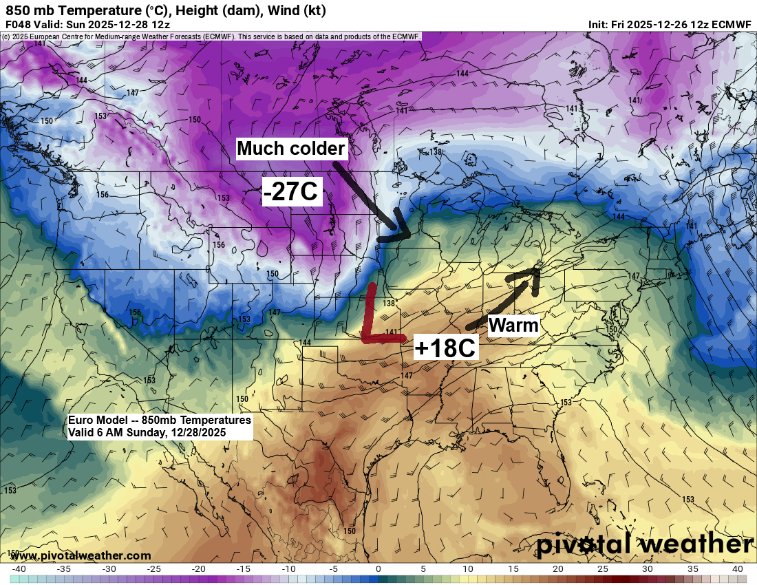
Foggy and mild conditions will give way to strong winds and colder temperatures on Sunday, with rain and a wintry mix turning to snow.
Arctic air and strong north to northwest winds will sweep into northeast Minnesota and northwest Wisconsin from Sunday into Monday as low pressure moves northeast from eastern Kansas and western Missouri, while strong high pressure builds southeast into the northern Plains. The tight pressure gradient between these systems, along with…
-

Record highs today will give way to strong winds and colder temperatures tonight. A windy system is expected Thursday, bringing some precipitation and a return to arctic air.
Today’s warm air will give way to colder conditions tonight, with brisk northwest winds blowing at 15 to 25 mph and gusts reaching 35 to 50 mph. In Duluth, the strongest winds are expected between 7 PM tonight and 2 AM Wednesday, with gusts reaching up to 45 mph. Early…