Tag: enhanced risk
-

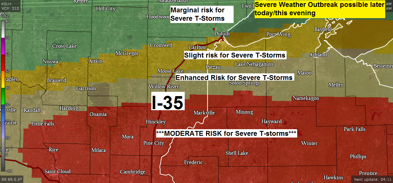
Another round of thunderstorms possible late this afternoon/this evening, a few could be strong to severe
1:32 PM CT – There is an Enhanced Risk for Severe Thunderstorms late this afternoon into this evening over eastern Minnesota and for parts of northwest Wisconsin, roughly from Aitkin to Mahtowa, east to Lake Nebagamon, then south to Cable and Winter, this includes the Hayward lakes area as well.…
-
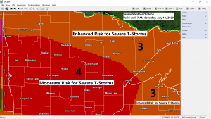
Severe Thunderstorms likely late tonight with widespread wind gusts >70 mph, isolated tornadoes and large hail also possible
A significant severe weather threat exists late tonight into early Saturday morning over much of the Northland with scattered to widespread severe thunderstorms possibly producing significant damage. There is a Moderate Risk and Enhanced Risk for Severe Thunderstorms in place across the entire Northland for tonight. Note: A moderate risk…
-

Strong to Severe Thunderstorms possible late Friday night and again Saturday afternoon-evening; Storm and Rainfall Reports from today (July 16, 2020)
Ingredients are coming together for the potential for some severe weather over parts of the Northland late Friday night. Strong instability with CAPE 2000-4500 J/kg along with dew points of 65 to 75 degrees will be in place across southern Minnesota by late Friday afternoon. A strengthening southerly low level…
-

Strong to Severe Thunderstorms possible tonight; rain chances continue Tuesday
Ingredients are coming together for possible severe weather late this afternoon and this evening across portions of western, northern and central Minnesota. A cold front approaching from the west along with stronger upper level winds will create atmospheric lift while southerly winds in the low levels of the atmosphere continue…
-
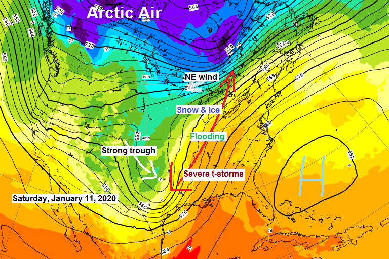
Powerful storm to hit parts of the Midwest and Great Lakes this weekend. For the Northland, turning colder, some lake effect snow this weekend, more snow chances next week
A strong storm will be impacting the Midwest and Great Lakes Friday through early Sunday morning with a flood and severe threat on the warm side of the storm and a snow/ice threat on the cold side of the storm. Winter Storm Watches in blue; Flood Watches in green. Source…
-
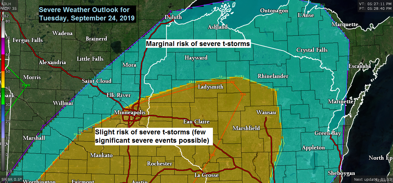
Mild temps continue Tuesday with scattered showers/t-storms (few strong-severe storms possible in northwest Wisconsin) Late week rain and frost chances
Rain chances return to the Northland on Tuesday with scattered showers possible in north-central Minnesota beginning before Noon. Scattered showers spread farther south/east Tuesday afternoon through Tuesday evening. A few thunderstorms are also possible Tuesday afternoon and evening. Scattered showers along with a few thunderstorms will move across the Northland…
-
Significant risk for severe thunderstorms through this evening from east-central Minnesota into north-central Wisconsin
Today’s severe weather setup is a potent one with Moderate and Enhanced risks for severe thunderstorms in place through this evening in southern portions of the Northland. Moderate risks do happen in this area, but not very often, maybe once or twice a year. Severe weather risk is based on…