Tag: sleet
-
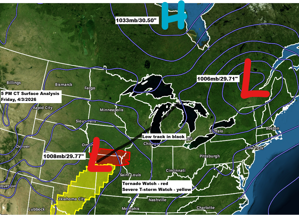
Winter Storm Update – Friday, April 3, 2026, 6:00 PM
Another winter storm is set to impact the Northland through Saturday. Much like Thursday’s storm, it will bring a mix of snow, sleet, and freezing rain. Freezing rain is most likely in northwest Wisconsin and far eastern Minnesota, with the chance for significant icing from late tonight through mid-morning Saturday.…
-
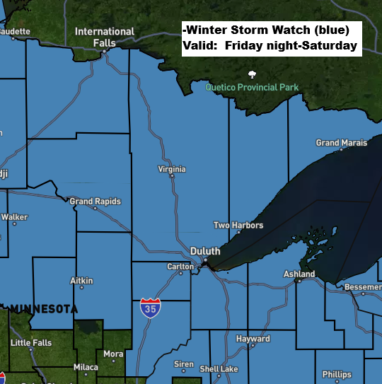
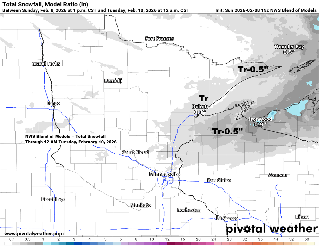
Second winter storm expected Friday night through Saturday.
A second winter storm is expected to hit northeast Minnesota and northwest Wisconsin Friday night, continuing into Saturday. A winter storm watch is in place for the entire Northland, with the potential for heavy snow, freezing rain, and mixed precipitation. Tonight’s storm will move out to the east by Friday…
-
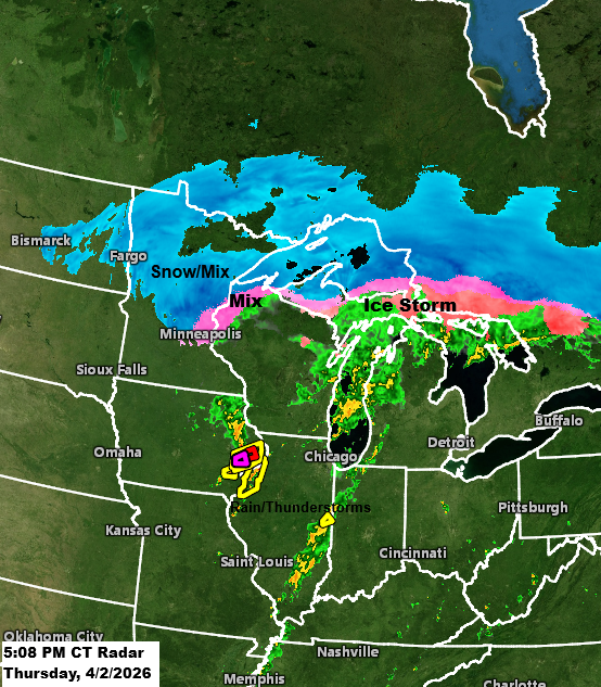
Winter Storm Update – 5:00 PM, Thursday, April 2, 2026
One winter storm is ongoing in the Northland tonight, with another expected Friday night into Saturday. Note: As of 4 PM today, the National Weather Service in Duluth, Minnesota reported 2.1 inches of snow, with an additional 2 to 4 inches expected by late tonight, which falls within my forecasted…
-
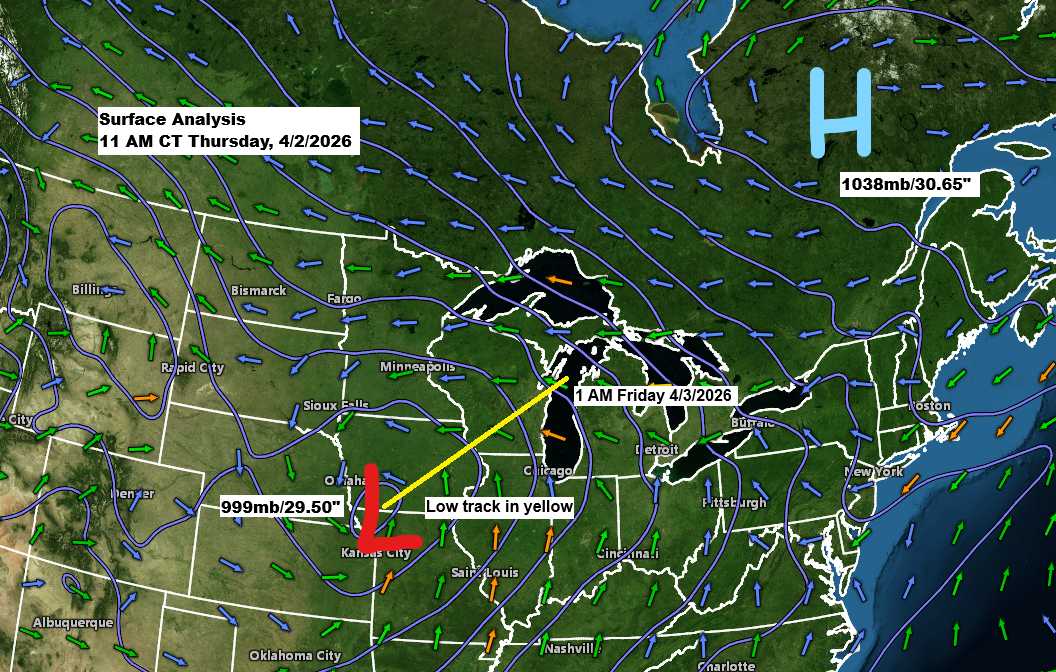
Winter Storm Update – 12:00 PM, Thursday, April 2, 2026
A low pressure system of about 999mb/29.50 inches is positioned over far southwest Iowa and will move northeast, passing near Green Bay, Wisconsin by tonight. To the northeast, there is a strong arctic high of 1038mb/30.65 inches located over Quebec, Canada, which is sending colder air into the Northland with…
-
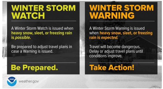
A winter storm watch is in effect for Thursday, with snow and ice expected to hit northeast Minnesota and northwest Wisconsin.
Timing for Duluth: It looks mostly dry from Wednesday into Wednesday night, though a few snow showers are possible at times, with little to no accumulation expected through Wednesday evening. Snow is likely to pick up late Wednesday night into Thursday morning, with the worst conditions expected during the day…
-
Northland Weather Update: Expect a bit of light rain and snow on Monday.
A weak system with minimal lift will pass through the Northland Monday afternoon and evening, bringing a chance of light rain or wet snow, with a few isolated pockets of sleet possible. It’s not expected to be a major system and should have little to no impact on travel. It…
-
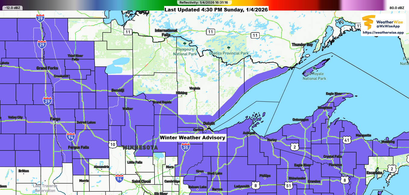
4 PM Winter Weather Update – January 4, 2026
This afternoon brought a band of heavy snow mixed with sleet and ice pellets moving east-northeast across parts of northeast and east central Minnesota into northwest Wisconsin. This wintry mix formed on the eastern side of a 700mb trough over the upper Midwest, with an area of stronger lift developing…