Tag: smoke
-

Breezy, Mild and Smoky Tuesday; much cooler mid to late week
A warm front will be moving through the Northland tonight, but this should be a dry frontal passage, with the possible exception being along the North Shore of Lake Superior where isolated showers or patchy drizzle is possible tonight. There could also be some patchy fog around Lake Superior tonight…
-

A shot at 80 degrees on Tuesday; much cooler mid to late week with frost/freeze risks
Up and Down Temperatures ahead this week, all this without a whole lot of rain! In fact it looks like will have to wait until next weekend (September 19th-20th) for our next best chance at getting some rain in northeast Minnesota and northwest Wisconsin. Areas of frost are likely early…
-

Some rain at times late tonight through Saturday evening; warming up early next week
Finally a night without any frost or freeze headlines in the Northland, but now we’ve got some rain in the forecast, and this rain is expected to begin later this evening/overnight, with some rain possible at times during the day Saturday into Saturday evening. It also looks like will be…
-
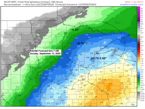
Another frosty night ahead; rain and some smoke possible Friday night and Saturday
-Freeze Warning in effect from Midnight tonight to 8 AM Thursday including the cities of Aitkin, McGregor, Hill City, Hinckley, Moose Lake, Cloquet, Duluth, Hibbing, Isabella, Superior, Solon Springs, Webster, Grantsburg and Siren. Sub-freezing temperatures as low as 30 degrees expected. Frost and freeze conditions will kill crops, other sensitive…
-

Frost and Freeze likely across much of the Northland tonight; watching rain chances for Friday night and Saturday
-Freeze Warning in effect from Midnight tonight to 8 AM Wednesday including the cities of International Falls, Bigfork, Grand Rapids, Walker, Hill City, Hibbing, Cook, Ely and Isabella. Sub-freezing temperatures in the upper 20s and lower 30s. Frost and freeze conditions will kill crops, other sensitive vegetation and possibly damage…
-

Frost/Freeze potential the next few nights; rain chances late this week; warmer temps possible next week
A ton of weather to talk about ranging from fires and record heat to snow and record cold, oh and also some frost/freeze stuff as well – I’ll break it all down the best I can. …Frost/Freeze Information… -Frost Advisory in effect from Midnight tonight to 8 AM Tuesday including…
-
Dog Days of Summer! Warm and dry with some smoke through the weekend! 90 degree highs possible in parts of the Northland on Saturday. Storm Reports from Wed, Aug 8 in this post (Golf Ball to Hen Egg sized hail reported north of Two Harbors, Minn)
/Issued 4:26 PM CDT, Thursday, August 9, 2018/ Source: https://www.spc.noaa.gov Source: https://www.pca.state.mn.us Air Quality Alert has been issued for western Minnesota until 10 AM Saturday due to wildfire smoke. More information at this link: https://www.pca.state.mn.us/featured/air-quality-alert-thursday-august-9-saturday-august-11 Source: https://fsapps.nwcg.gov U.S. wildfire map as of Thursday afternoon, August 9, 2018. Red dots on this map indicate fire…