Tag: storm surge
-
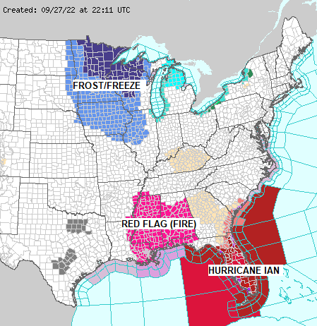
A few showers possible Thursday and Friday; Milder temps through this weekend, but a cooler lake breeze likely near Lake Superior Saturday-Sunday; Hurricane Ian update
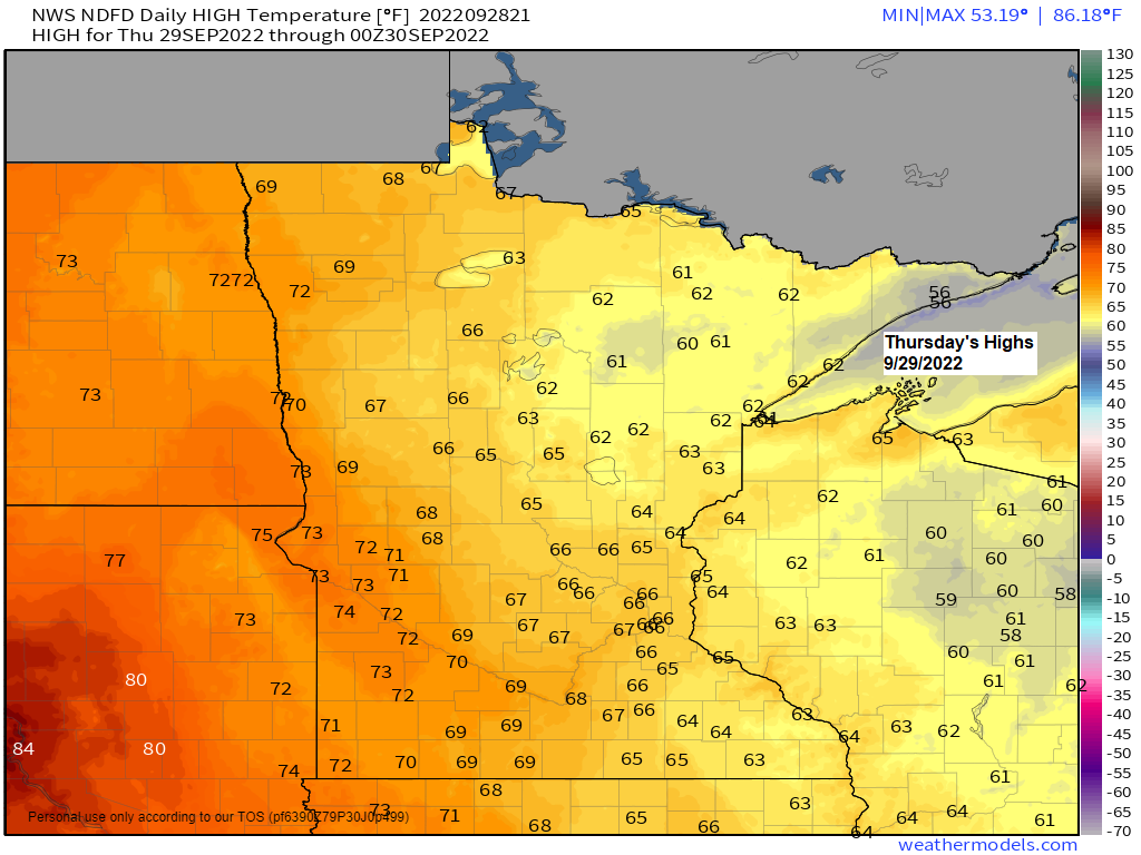
5:31 PM Wednesday, September 28, 2022 Milder temperatures will return to the Northland the next few days with afternoon temperatures mainly in the 60s to around 70 Thursday through Sunday, but winds will become easterly near Lake Superior Saturday and Sunday which will keep temperatures on the cool side compared…
-
Freeze Warning for the entire Northland tonight; Isolated showers possible late this week/weekend with milder temps; Hurricane Ian update
5:47 PM Tuesday, September 27, 2022 *Freeze Warning in effect for all of northeast Minnesota and northwest Wisconsin from Midnight tonight to 8 AM Wednesday. *Sub-freezing temperatures as low as 28 degrees expected. Frost and freeze conditions will kill crops, other sensitive vegetation and possibly damage unprotected outdoor plumbing. *Temperatures…
-
Frosty the next few nights; Warming trend later this week; Update on Hurricane Ian
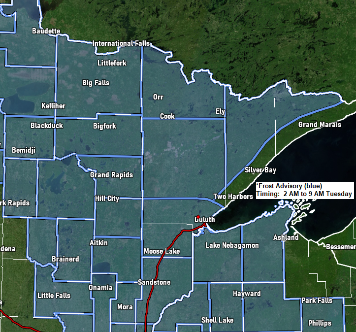
5:04 PM Monday, September 26, 2022 *Frost Advisory in effect from 2 AM to 9 AM Tuesday including the cities of International Falls, Bigfork, Grand Rapids, Cass Lake, Walker, Longville, Brainerd, Hill City, Aitkin, McGregor, Pine City, Hinckley, Moose Lake, Cloquet, Duluth, Hibbing, Virginia, Ely, Cook, Orr, Isabella, Superior, Solon…
-
A few strong to severe t-storms possible in parts of the Northland Saturday afternoon/evening; Rain chances continue into early Sunday; Dense fog near Lake Superior tonight; Rainfall reports — 2″+ totals so far in far northern MN; Frost/freeze risks late next week
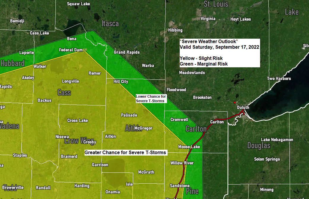
6:23 PM Friday, September 16, 2022 An active weather pattern continues into Saturday. -Dense fog near Lake Superior tonight into Saturday morning, and possibly again Saturday night-early Sunday morning. -Potential for isolated to scattered strong to severe thunderstorms Saturday afternoon and evening over parts of north-central and east-central Minnesota. -More…
-
Near to below freezing temps again this morning in far northern MN. More rain late tonight-Saturday; Lingering showers Sunday
/Issued 4:48 PM CDT, Friday, August 25, 2017/ Source: http://www.wpc.ncep.noaa.gov Source: https://rapidrefresh.noaa.gov 12z HRRRX model run Source: http://weather.cod.edu Another computer model’s take on how much rain falls this weekend. Source: http://www.nhc.noaa.gov 4 PM CDT, August 25, 2017 Harvey update — Maximum sustained wind 125 mph with movement to the northwest…