Month: June 2026
-
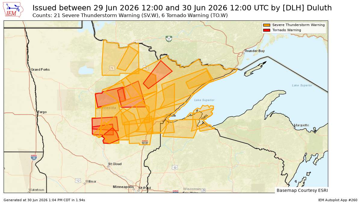
27 Warnings in a Day: Northland Severe Weather Recap & What’s Next
On Monday, June 29, 2026, the National Weather Service in Duluth, Minnesota, issued a total of 27 warnings, including 21 for severe thunderstorms and 6 for tornadoes, across northeast Minnesota and northwest Wisconsin. It was certainly a busy day for severe weather in the area. Note: Several additional storm reports…
-

Local Storm Reports: Hail, Wind Damage & Heavy Rain – June 29, 2026
3 PM: Hail 1.00″ (Quarter size). Wrenshall, MN (Carlton County) 2:57 PM: Thunderstorm Wind Gust 57 mph. 4 NE Herbster, WI (Bayfield County) 2:55 PM: Rain 1.95″. 5 NE Castle Danger, MN (Lake County) 2:36 PM: Hail 0.50″. 5 NW Barnum, MN (Carlton County) 2:34 PM: Hail 1.75″ (Golf Ball…
-
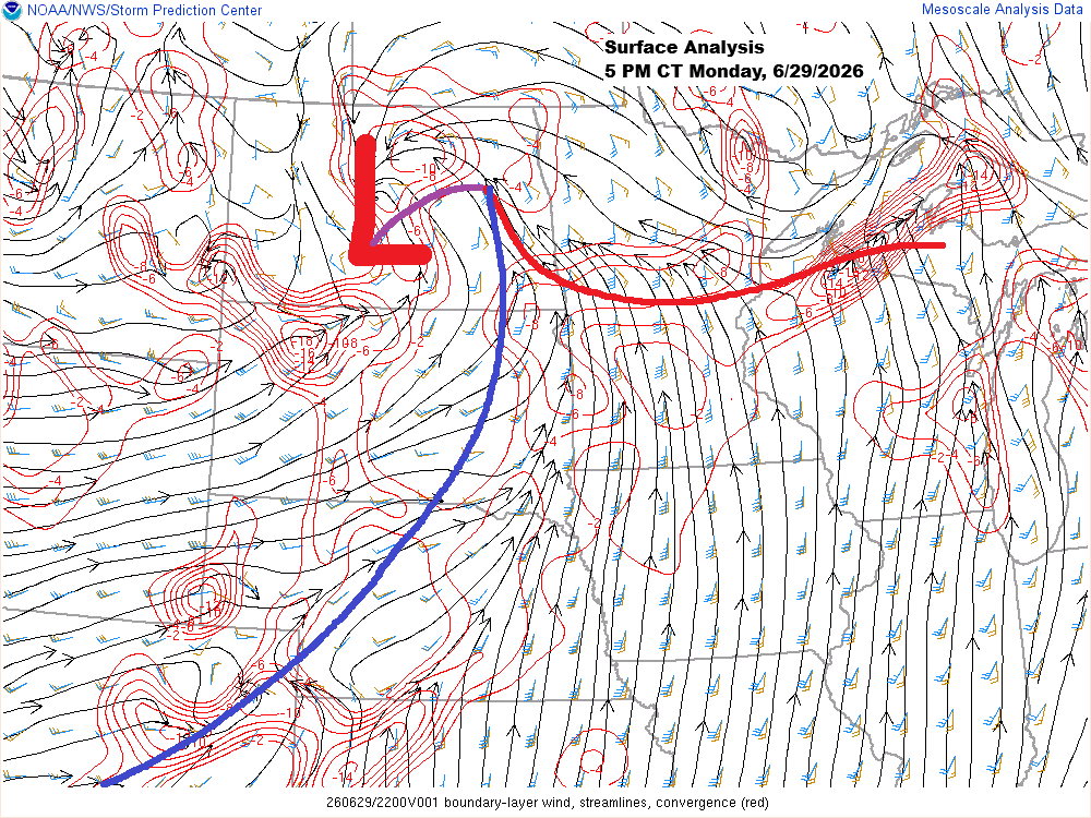
Northland Severe Storms Tonight: Large Hail, Damaging Wind Risk
This afternoon, a low-pressure system over central North Dakota has a warm front stretching east-southeast through central Minnesota into northern Wisconsin, while a cold front extends southwest from the low across the eastern Dakotas. South of the warm front, temperatures climbed into the upper 80s and low 90s today, while…
-

Severe Thunderstorm Watch for Central & Northern Minnesota Today
This morning, a small but intense supercell and bow echo raced northeast from southern South Dakota into west-central Minnesota. As a result, a severe thunderstorm watch is in effect downstream of the storm until 4 PM today, covering northern and central Minnesota (highlighted in yellow on the map). The main…
-
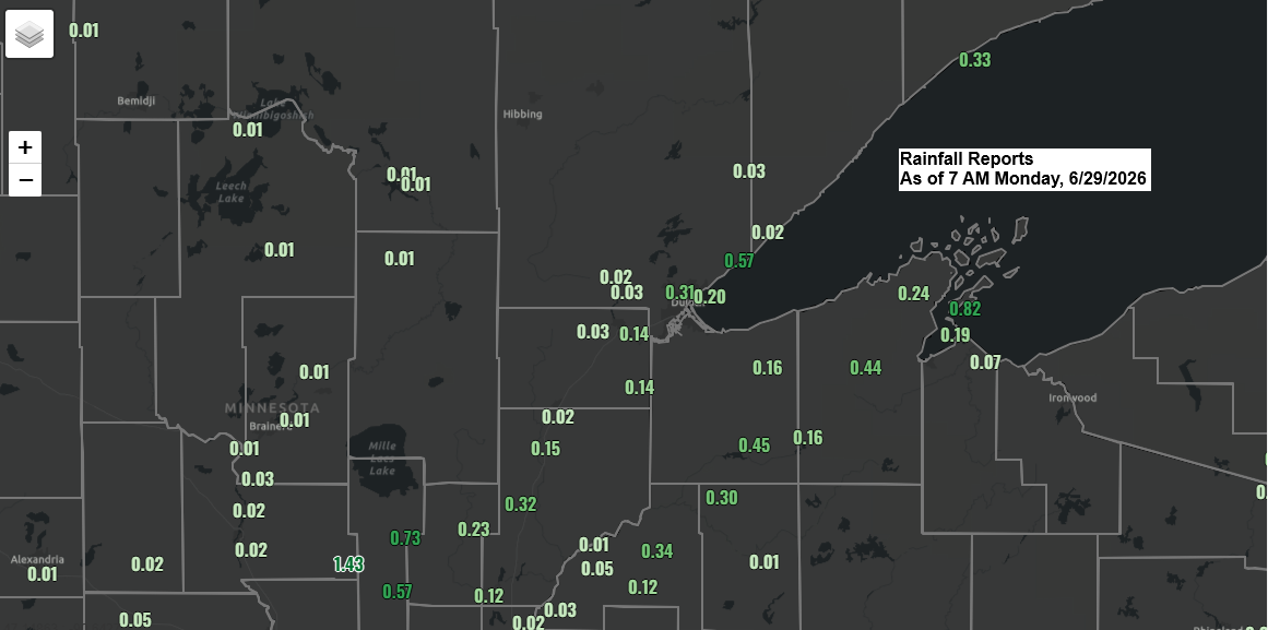
Overnight Northland Thunderstorms, Rain Totals & Evening Risk
Overnight and early this morning, scattered downpours and thunderstorms swept through parts of northeast Minnesota and northwest Wisconsin before moving out over Lake Superior and northern Lake Michigan. Some of those storms had cloud tops reaching around 50,000 feet, which is pretty impressive for this time of day. With elevated…
-

Plains Storm Line May Race Into the Northland Monday, Bringing an Isolated Wind and Hail Risk
New trends are starting to emerge in the model guidance from Sunday evening for Monday. There’s a chance a line of thunderstorms could form over western Nebraska or western South Dakota overnight, then race northeast, possibly impacting parts of north-central and northeast Minnesota from mid to late Monday morning into…
-
Northland Forecast: Muggy Monday, Storm Chances & Late‑June Snow Out West
A strong southerly low-level jet will keep pushing plenty of moisture north into our area tonight. This afternoon’s surface map shows two boundaries: one behaving more like a moisture gradient front, with dew points climbing into the 70s to the south and sitting in the 50s and low 60s to…