Category: Minnesota Fishing Opener
-
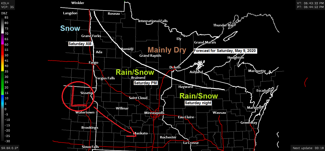
Some rain and snow possible Saturday mainly south of Duluth
-Some rain and snow is possible Saturday into Saturday night mainly affecting southern portions of the Northland. This area of precipitation should stay south of Duluth and Superior, but there is some uncertainty on how far north the precipitation will reach as the latest NAM run (18z) shifted this band…
-
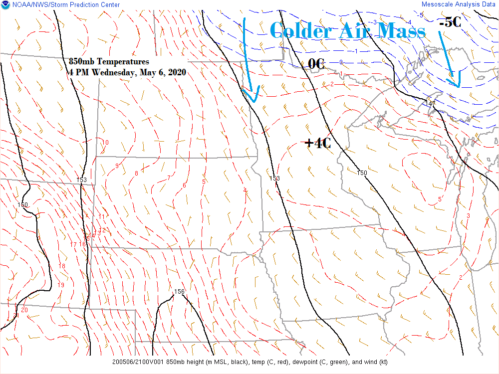
Mainly dry with below normal temperatures through the middle of next week
-Today (Wednesday) was likely the last time we see 60 degree temperatures in Duluth until maybe late next week at the earliest, and 60s are right where we should be this time of the year. -Cooling trend begins Thursday with highs across the Northland in the 40s and 50s. Winds…
-
Seasonable temps for Wednesday; turning colder late this week into early next week
-Wednesday looks like a pretty nice spring day across the Northland with highs in the middle 50s to lower 60s along with quite a bit of sunshine. A lake breeze (ENE wind) is possible near Lake Superior on Wednesday which could keep temperatures in the 40s if said lake breeze…
-
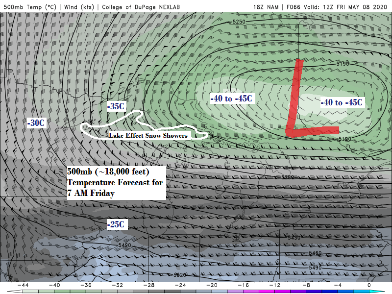
Cool Tuesday, a little rain possible far west areas of the Northland; seasonable temps for Wednesday; colder late this week with possible flurries
Lake effect snow showers on May 4th? Yes, radar was showing some lake effect snow early Monday morning along the North Shore of Lake Superior, roughly from Two Harbors to Silver Bay. Spring 2020! -Only far western portions of the Northland may see some rain on Tuesday, say from around…
-

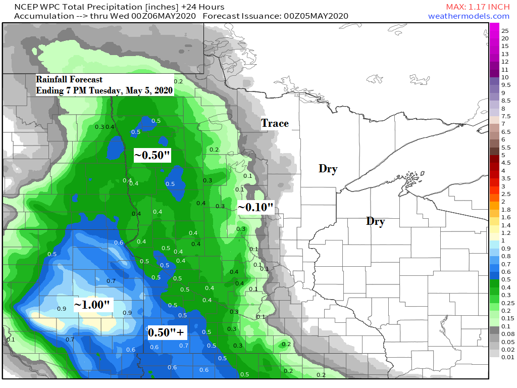
A cool week ahead; some rain possible Tuesday mainly west/south areas of the Northland
-Monday’s weather across the Northland will feature below normal temperatures, but dry weather with highs in the 40s near Lake Superior and in the 50s to around 60 degrees for inland locations. Winds will be out of the east at 5 to 15 mph. -The system I’ve been watching for…
-
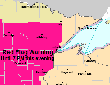
Critical Fire Weather Conditions continue this evening; cooler Sunday; rain and possibly some snow/mixed precip late Monday-Tuesday
Extreme (red) to High Fire Danger (yellow) covers all of Minnesota through this evening. Note: The fire situation is rated as explosive in the extreme category. Source: https://www.dnr.state.mn.us/ -Red Flag Warning continues until 7 PM this evening for portions of north-central, northeast and east-central Minnesota (hot pink area on map)…