Tag: Lake Superior
-
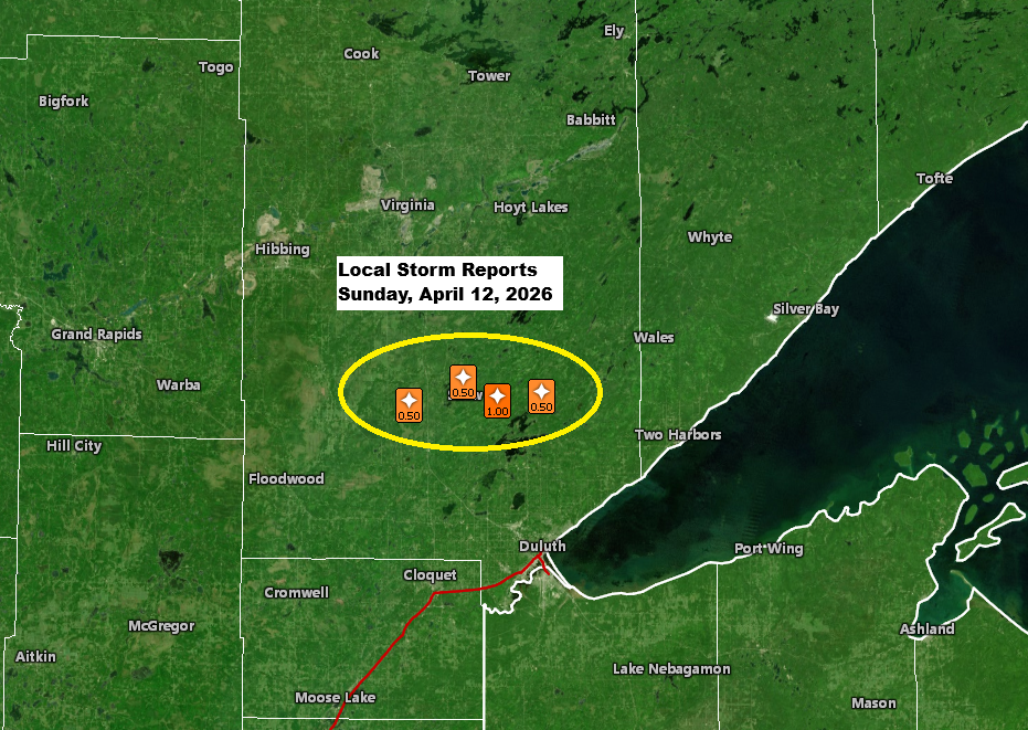
Local storm, rainfall, and temperature reports.
Late this afternoon, a single strong thunderstorm popped up near the warm front stretched across northeast Minnesota. This cell first appeared around 4:30 PM today near Hill City, Minnesota, before moving east-northeast. The storm hit peak intensity between about 6:00 and 6:45 PM, with cloud tops reaching around 40,000 feet…
-
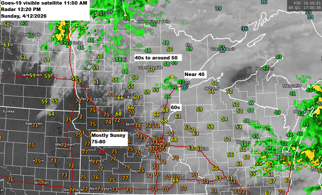
12 PM Weather Update for 4/12/2026: There’s a low chance of isolated strong to severe thunderstorms developing late this afternoon into the early evening.
Early this afternoon finds an area of low pressure over eastern North Dakota near Fargo with a warm front draped southeast through central Minnesota into central Wisconsin. For the rest of the day, the low will drift east-northeast, pushing the warm front farther north, while a cold front sweeps southeast…
-

Weekend weather for the Northland: Expect occasional rain with a few thunderstorms in the mix.
Dry weather will stick around in the Northland tonight and through most of Saturday, but the chance for occasional rain will increase later in the day and continue into Sunday night. This rain will be caused by a northward-lifting warm front, which is forecast to be over southern Kansas around…
-
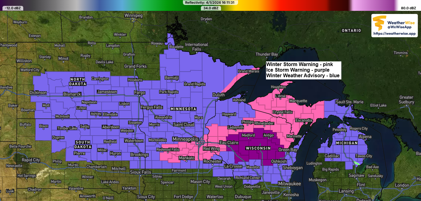
Winter Storm Update – Friday, April 3, 2026, 6:00 PM
Another winter storm is set to impact the Northland through Saturday. Much like Thursday’s storm, it will bring a mix of snow, sleet, and freezing rain. Freezing rain is most likely in northwest Wisconsin and far eastern Minnesota, with the chance for significant icing from late tonight through mid-morning Saturday.…
-
Winter Storm Update – 5:00 PM, Thursday, April 2, 2026
One winter storm is ongoing in the Northland tonight, with another expected Friday night into Saturday. Note: As of 4 PM today, the National Weather Service in Duluth, Minnesota reported 2.1 inches of snow, with an additional 2 to 4 inches expected by late tonight, which falls within my forecasted…
-
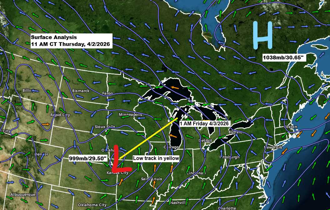
Winter Storm Update – 12:00 PM, Thursday, April 2, 2026
A low pressure system of about 999mb/29.50 inches is positioned over far southwest Iowa and will move northeast, passing near Green Bay, Wisconsin by tonight. To the northeast, there is a strong arctic high of 1038mb/30.65 inches located over Quebec, Canada, which is sending colder air into the Northland with…
-
Winter Storm Update: Revised Snowfall Forecast as of 5 PM, Wednesday, April 1, 2026.
A messy winter storm will hit the Northland tonight and last through Thursday evening, with the heaviest precipitation expected from Thursday afternoon until around mid-evening Thursday. Duluth area: Snow will start to develop tonight, with up to an inch of accumulation possible by 8 AM Thursday. Snow will continue through…