Tag: Proctor Speedway
-
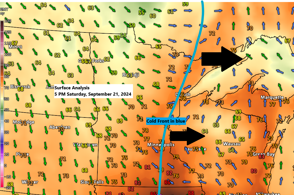
Cold Front Moves Through Northland: Impact on Weather
5:37 PM Saturday, September 21, 2024 This afternoon, a cold front is moving eastward across the Northland. As of 5 PM, the front stretches from northeastern to eastern Minnesota. Behind this front, temperatures are cooler and more typical for late September, in the 60s, while ahead of the front, temperatures…
-
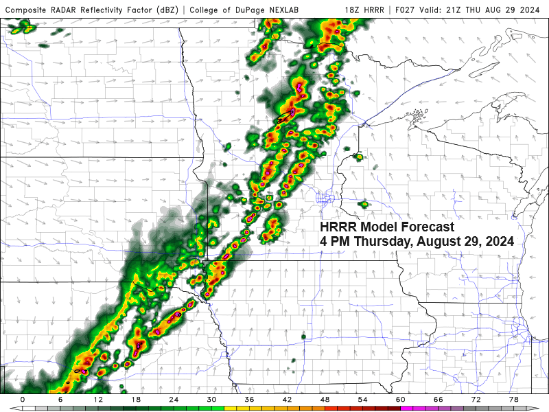
Northeast Minnesota and Northwest Wisconsin Weather Forecast: Rain and Thunderstorms Expected on Thursday
5:20 PM Wednesday, August 28, 2024 Rain is expected to return to northeast Minnesota and northwest Wisconsin on Thursday due to a strong cold front and an upper-level trough moving eastward from the northern Plains.
-

Cooler temperatures ahead; intermittent showers and thunderstorms are forecasted for tonight and Tuesday, with a return of rain chances by Thursday.
5:56 PM Monday, August 26, 2024 Much of the Northland has experienced a hot Monday. Take a look at the heat index temperatures from 4 PM today.
-
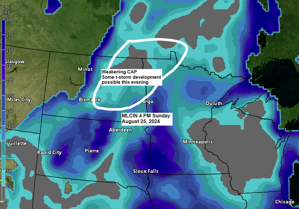
Northland Weather Forecast: Thunderstorms and Severe Weather Risk
6:17 PM Sunday, August 25, 2024 Thank you, jday08, for subscribing to my blog; your support is greatly appreciated! I’ve reached 3 paid subscribers now, and I’m hopeful that this number will keep growing. A big thank you to everyone who has subscribed thus far. Signs of a weakening cap…
-

There’s a potential for a few strong to severe thunderstorms early next week. Expect warm and humid conditions over the next few days, with cooler temperatures closer to Lake Superior.
6:08 PM Friday, August 23, 2024 Over the coming days, humidity is expected to increase, with dew points predominantly in the 60s throughout northeast Minnesota and northwest Wisconsin. However, certain regions in the Northland might see dew points reach the 70s on Sunday and Monday, creating a rather tropical sensation,…
-
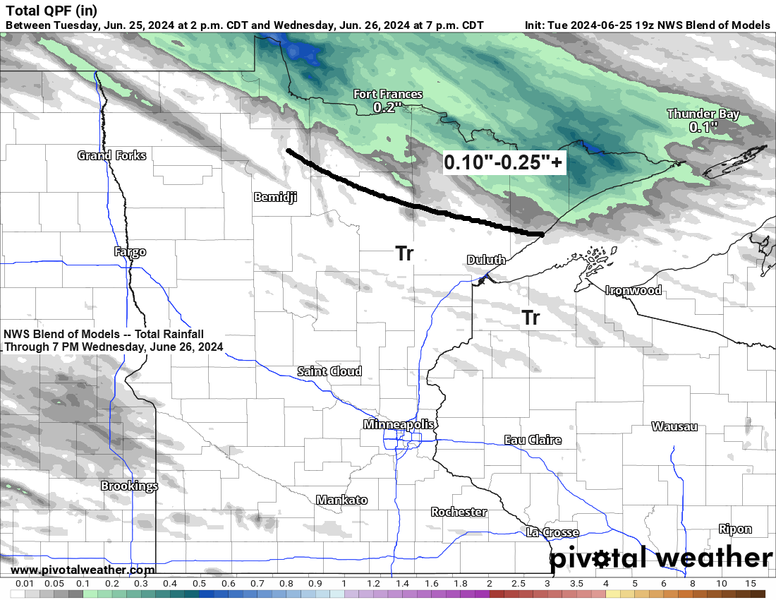
Turning cooler the next few days; Scattered showers late tonight-Wednesday; More rain chances Friday-Saturday and again early next week
6:47 PM Tuesday, June 25, 2024 Generally, the active weather pattern we’ve experienced for weeks shows little sign of changing in the near future. An incoming cold front and an upper-level wave are expected to move southeast across the Northland tonight. This system is anticipated to bring rain showers primarily…
-
Update on the system for late this week, less rain for the Northland?
Seeing quite a few changes in some of the computer models today regarding a late week system and its timing for the Northland, and whether or not it will even affect our area, and if it does how much rain will we get? –The biggest change I’ve seen is with…