Tag: record highs
-
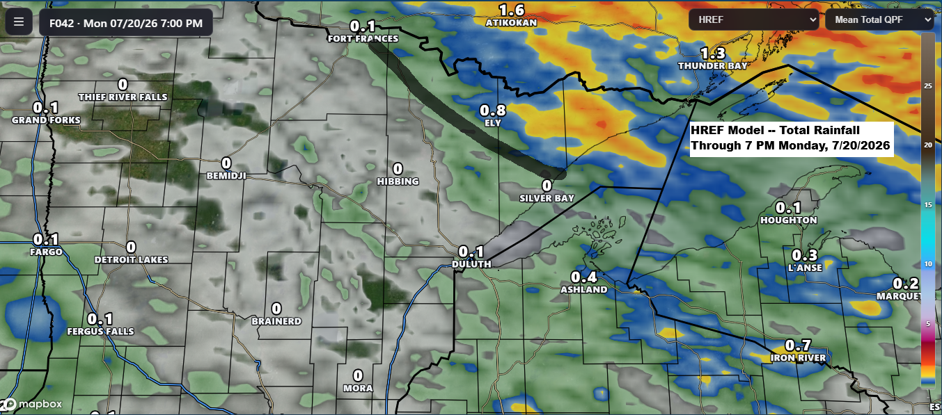
A warm Sunday is in store across the Northland before scattered showers arrive tonight and continue into Monday.
Scattered rain is on the way for the Northland as a strong low-pressure system moves east today from Saskatchewan and into Ontario by Monday. A warm front and cold front tied to this system will sweep through the Northland on Monday. Ahead of this system, south winds will draw moisture…
-
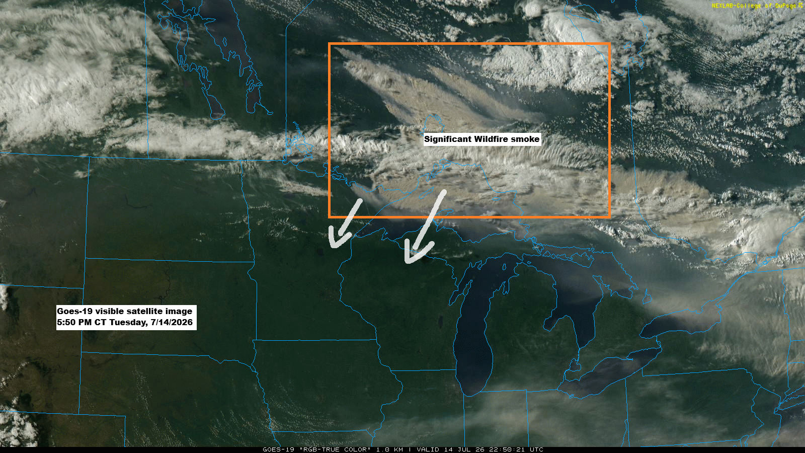
Wildfire Smoke Engulfs Northland: Air Quality Alert Through Friday
GOES-19 satellite images show thick plumes of wildfire smoke drifting from parts of Ontario into far northeast Minnesota and over Lake Superior this afternoon, mixing with some clouds. The smoke is expected to move southwest across the Northland, with air quality likely to worsen overnight into Friday morning. The smoke…
-
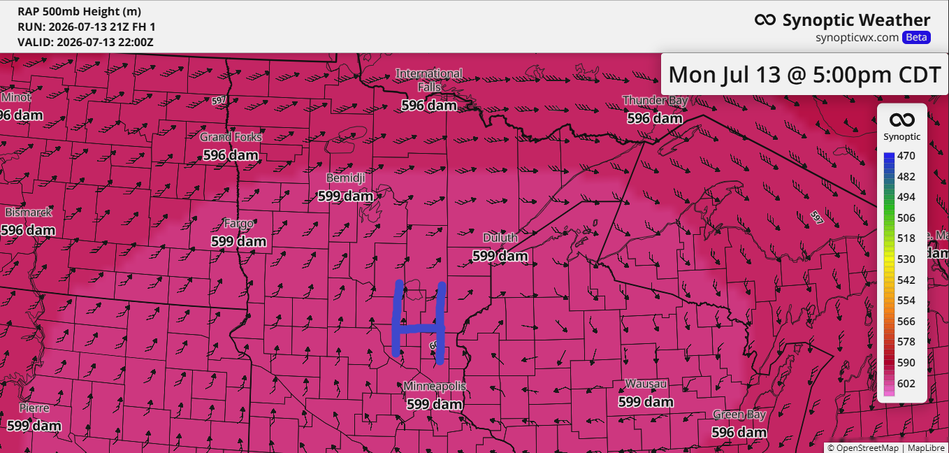
Northland Heat Wave, BWCA Fire Growth and Smoke Risk This Week
Today’s blog will take a bit longer to read, about five minutes, as there’s plenty of weather to cover, including fires and heat across the Northland. As expected, the ridge over the upper Midwest has reached near-historic levels for this far north, with the RAP model indicating 500mb heights hitting…
-
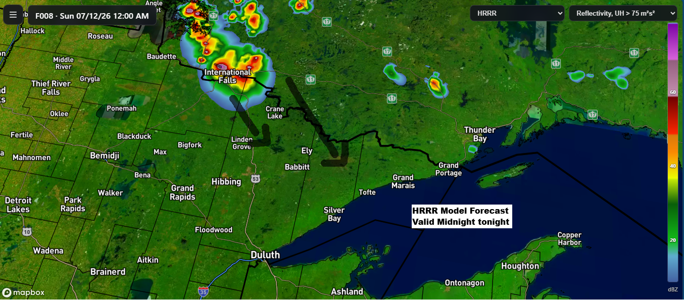
Low Overnight Storm Chances Tonight, Then a Remarkable 597–600 dam Ridge Builds Into the Northland Early Next Week
While chances are low, some model runs today suggest showers and thunderstorms could form over far northern Minnesota or southern Ontario tonight. If they do develop, they’d likely track southeast early Sunday morning. There’s plenty of instability and moisture in the air to support storms but rising heights from a…
-
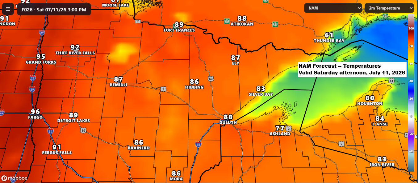
Major Heat Wave Builds Sunday–Monday, With International Falls Possibly Nearing 100° for the First Time Since 1923
According to the data I’ve seen, the last time International Falls, Minnesota reached at least 100 degrees was July 22, 1923. Now, there’s a chance it could get close to 100 degrees again this Sunday and Monday. High temperatures are expected to be in the 80s to low 90s on…
-
Birch Bay Fire Update and Upcoming Weather Trends
Rain chances will remain highest west of the Northland tonight and throughout most of Wednesday. By Wednesday night, the western parts of the region might get some showers or a few thunderstorms. However, any rain making its way toward northeast Minnesota and the Twin Ports by early Thursday morning will…
-
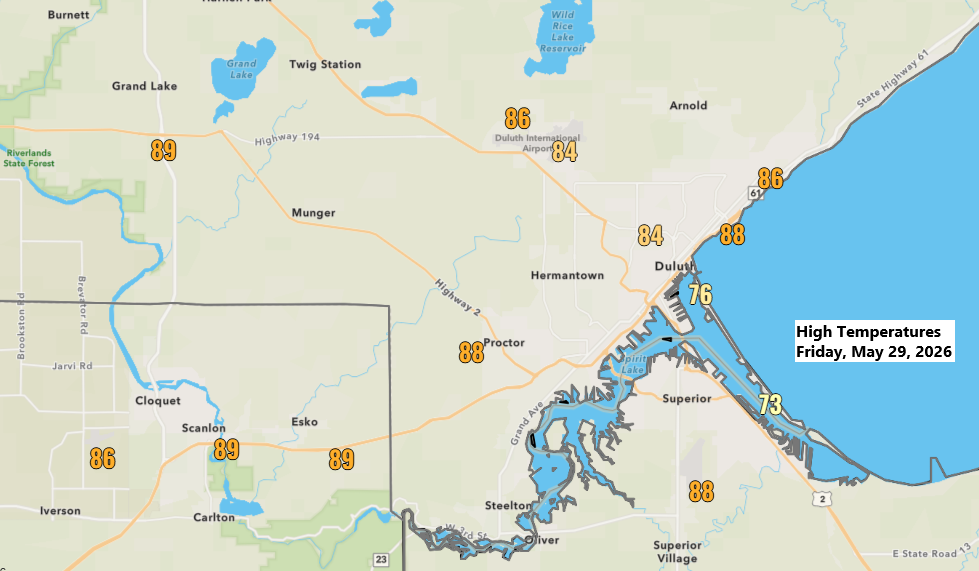
May 29 Temperatures Soar
Much of the Northland experienced a hot late spring day, with temperatures climbing well into the 80s and even reaching the lower 90s in some areas this afternoon. Even though it was a warm day, only Hibbing tied their daily record high for May 29th with a temperature of 88…