Tag: sleet
-
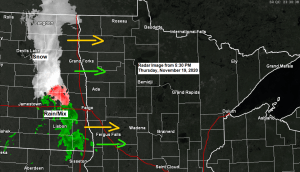
A wintry mix possible late tonight; few snow showers and cooler Friday; watching snow chances late Saturday night-Sunday
A mixture of precipitation types ranging from snow to rain to sleet and possibly even a bit of freezing rain is expected to move quickly through northeast Minnesota and northwest Wisconsin later this evening into early Friday morning. Although precipitation amounts should remain light tonight, there could be enough snow/sleet…
-
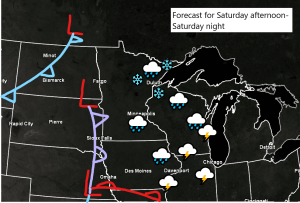
Mild Thursday; turning a little cooler (near normal temps) this weekend; a couple chances for light precipitation thru Sunday
We have three shots for some precipitation over the next few days. The first chance comes Thursday morning when we could see a few rain showers mainly across northern Minnesota, and then will see another chance for some showers across most of the Northland Thursday night, and these showers could…
-
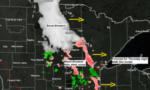
Some light rain, snow and patchy sleet on the way late Saturday afternoon into Sunday morning
Tonight and most of Saturday morning look dry across the Northland, but chances for some rain, snow and possibly some patchy sleet will increase as we go through Saturday afternoon and into Saturday evening, and the chances for precipitation will linger right into Sunday morning. A few areas of low…
-
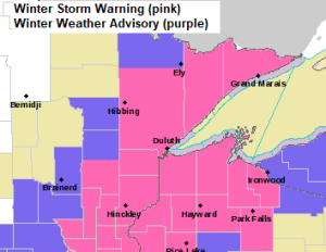
Winter Storm to impact much of the Northland tonight
5:23 PM Tuesday – There’s been some changes to the winter weather headlines this afternoon as the National Weather Service in Duluth has upgraded some of the winter weather advisory to a winter storm warning. Tonight’s storm will bring accumulating snow to much of northeast and east-central Minnesota and northwest…
-
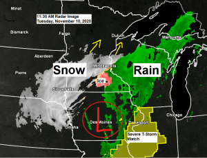
Snow, sleet and freezing rain on the way; winter storm warnings and advisories in effect for much of the Northland
11:40 AM Tuesday – Will see the snow and freezing rain currently across south-central Minnesota late this morning continue to lift N-NE through early this evening. Note: Looks like the bulk of the precipitation with this storm will remain southeast of a line from around Walker to Bigfork to International…
-
March 27, 2015 Weather Report – Warming up a bit this weekend; Watching late Saturday Night-Sunday AM rain/wintry mix threat; 1st t-storms of the season could arrive middle of next week!
/Issued 7:01 PM CDT, Friday, March 27, 2015/ Precipitation totals of up to one quarter inch are possible across the Northland late Saturday Night-Sunday Morning per 18z RGEM. Source, TropicalTidbits.com Note: Some of this precipitation could fall as snow or sleet in parts of the area. Potential for widespread half…