Tag: storm potential
-
Winter/Spring Storm arrives Sunday (Updated 3/22) Preliminary Snowfall Forecast
5:23 PM Friday, March 22, 2024 A messy spring storm is forecast to impact the Northland late this weekend/early next week. This storm will likely bring snow and wind to the Northland Sunday into Monday followed by some rain, snow and areas of freezing rain Monday night into Tuesday. Some…
-

Storm Potential April 4-5 (updated)
5:58 PM Saturday, April 1, 2023 A powerful winter/spring storm could hit the Northland Tuesday into Wednesday. Storm track continues to be uncertain, and this will determine where the greatest snow accumulations will setup in the Northland, and also on what areas could see the snow change to freezing rain,…
-
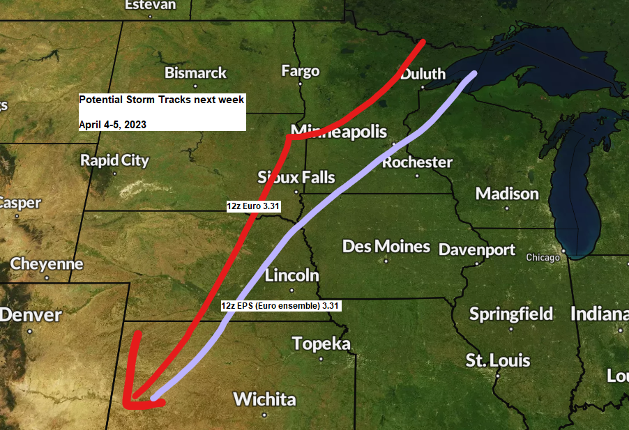
Storm Potential Next Week (April 4-5)
6:29 PM Friday, March 31, 2023 A significant storm could impact the Northland next week, from Tuesday into Wednesday April 4-5. The exact track of this storm is still uncertain, but computer models are in pretty good agreement on a system affecting the Northland around the middle of next week.…
-
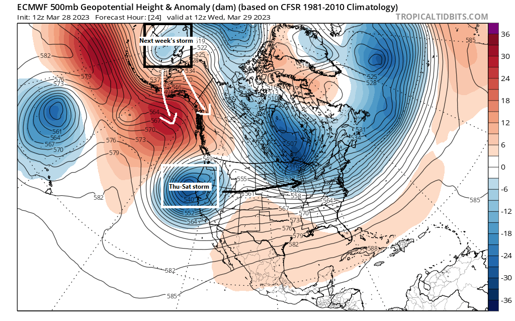
Active pattern into next week; Very cold tonight with snow showers; Accumulating snow/wintry mix Thursday afternoon-early Friday; Shot at 50 degrees Sunday; More snow/rain/wintry mix chances next week
6:40 PM Tuesday, March 28, 2023 Here we go again. -Active times ahead with several systems possibly impacting the Northland through next week. -Snow showers come to an end later tonight with a cold but mostly sunny Wednesday ahead. -Snow or a mix of snow, sleet and freezing rain on…
-
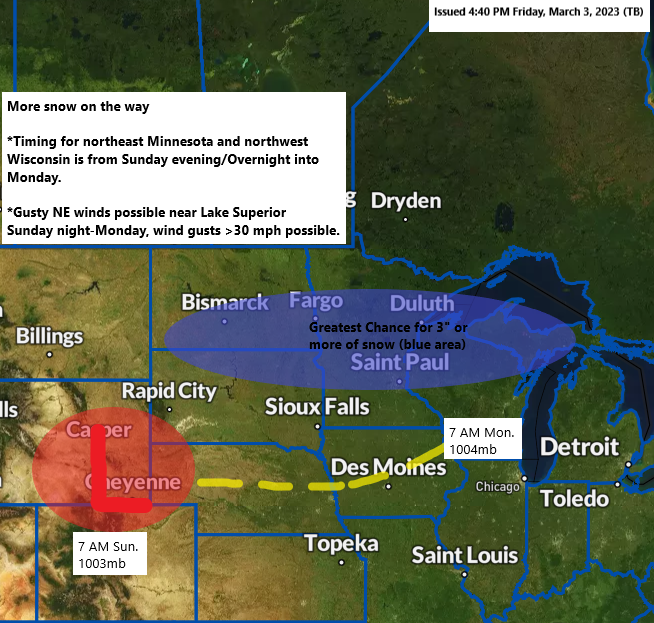
Accumulating Snow possible Sunday evening-Monday; Gusty NE winds near Lake Superior with some blowing snow Sunday night-Monday
6:16 PM Friday, March 3, 2023 Currently it looks like will see some snow spread northeast into parts of the Northland starting Sunday evening (timing of this could change) 18z NAM 3km model radar forecast valid from 3 PM Sunday to Midnight Sunday night. Northeast winds will increase near Lake…
-
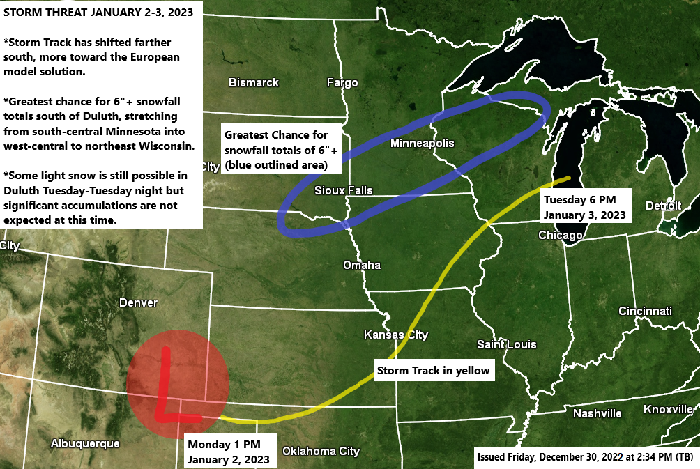
A little light snow, freezing drizzle and patchy fog possible Saturday; Winter Storm Threat early next week (Highest snow totals south of Duluth) Long Range Forecast for January 2023
5:58 PM Friday, December 30, 2022 After a cooler day today (highs closer to normal for this time of year) will see temperatures warm back up this weekend with highs in the mid 20s to low-mid 30s Saturday and Sunday. Areas of fog are possible late tonight through Sunday morning,…
-
Some snow and a wintry mix tonight followed by breezy and cooler weather Friday; Model mayhem for the early to middle of next week
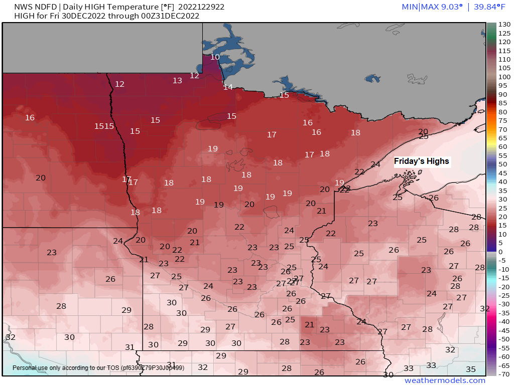
5:28 PM Thursday, December 29, 2022 Temperatures will fall back toward more seasonal levels on Friday with highs in the mid 10s to low to mid 20s in northeast Minnesota and northwest Wisconsin. It also looks blustery as northwest winds increase with gusts of up to 15 to 25 mph…